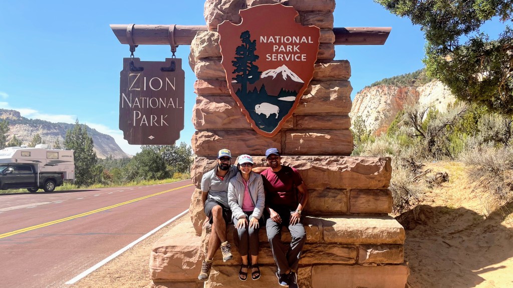
Cut by Virgin River, Zion Canyon is one of the most visited places in the United States. The thing that makes this place unique is that you look at this canyon from the bottom. Most of the canyons like Grand Canyon or Bryce Canyon is viewed from top, but here you drive at the bottom with thousands of feet high rocky ramparts standing on either side of the road. Folklore says that an early mormon settler was enchanted by this place and compared it with ‘’city of god” aka Zion, and thus the name stuck thereafter.
Geology of Zion Canyon
Grand Canyon, Zion Canyon and Bryce Canyon – each one is dramatically different but when united, they tell a common story. A story of earth’s history – a history so well-preserved in the layers of rocks that as you flip the pages of each chapter it can take you as back as 600 million years. Nowhere on the earth is this much of earth’s history so well-preserved. Together, these three form what geologists call – Grand Staircase. Grand Canyon is at the bottom, Zion is in the middle and Bryce is at the top. The bottom layer of rock at Bryce Canyon is the top layer at Zion, and the bottom layer at Zion is the top layer at the Grand Canyon.
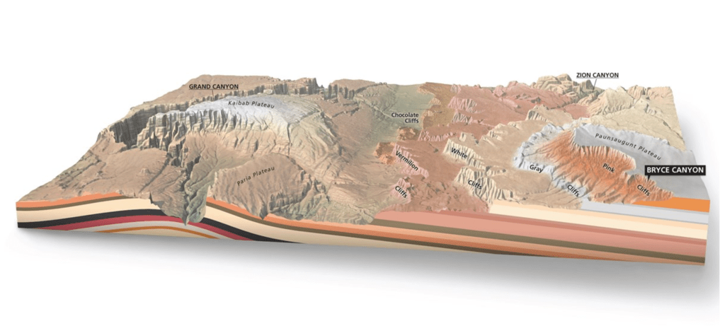
Zion National Park’s geologic history can be broken down into four main parts:
- Sedimentation – Zion was a relatively flat basin about 240 million years ago. As sand, gravel, and mud eroded from surrounding mountains, streams carried these materials into the basin and deposited them in layers. The basin sank under the weight of the sediment so that the top surface always remained at the sea levels. With changing climate, the depositional environment changed from shallow sea to coastal plains to desert. And the process of sedimentation continued.
- Lithification – As mineral laden water filtered through the sediments, iron oxide, calcium carbonate and silica acted as cementing agents. Accompanied by pressure from overlying layers, these sediments turned into stones. Ancient seabeds became limestone, mud and clay became mudstones and shale, and desert sand became sandstone. Each layer originated from a distinct source and so differs in thickness, mineral content, color, and eroded appearance.
- Uplift – Due to forces of earth’s inner core, Zion’s elevation rose from near sea level to as high as 10,000 feet above sea level, forming what we know today as Colorado Plateau.
- Erosion – This uplift gave streams a great cutting force in their descent to the sea. A fast-moving stream carries more sediment and larger boulders than a slow-moving river. These streams began eroding and cutting into the rock layers, forming deep and narrow canyons.
The source of this knowledge is Geology – Zion National Park (U.S. National Park Service) (nps.gov).
Day 3: Angels Landing hike at Zion, Sep 20th 2021
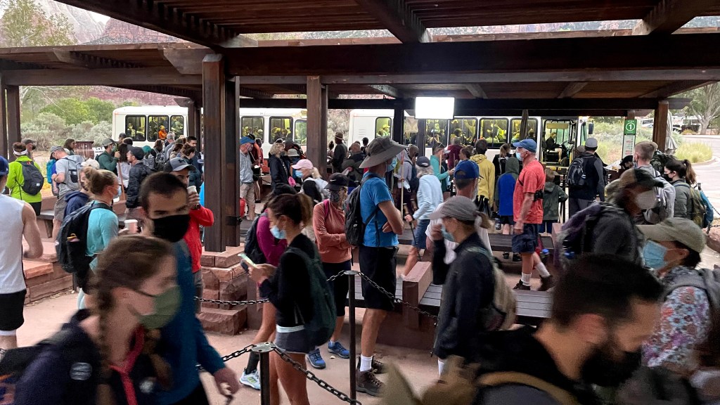
The day started early with my alarm ringing at 4.30 AM in the morning. We got freshened up and left the house at 5.30. Our goal was to reach Zion National Park visitor center by 6.30 AM to secure a parking spot. There is no private vehicle allowed inside Zion National Park beyond the visitor center unless you are staying at Zion lodge. All tourists must use the free shuttle system at the park, which by the way is quite frequent and efficient. Prior research had told me that parking spots get filled up quite fast. If someone misses that, then a lot of time could get wasted hunting for a parking spot at Springdale and then taking a shuttle from there to the visitor center. We were right on time and got a parking spot. Even at that early hour, about 50-60% of the spots were already filled. When we went to the shuttle pick up area, there were about 250 people in queue waiting for the first shuttle to arrive at 7 AM. We had read that the crowd at Zion could get overwhelming, but this much – at 6.30 in the morning and that too on a weekday – was simply unexpected.
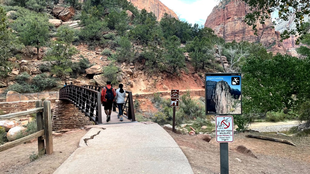
We had earlier planned to do the hike at The Narrows that day. For that we had to pick up rental shoes from Zion Outfitters, near the visitor center. But looking at the crowd, we decided to pick up the rentals in the evening and do The Narrows the next day. We wanted to save 30 minutes and avoid the further rush. With that in mind, we switched the order and decided to do Angel’s Landing hike that day.
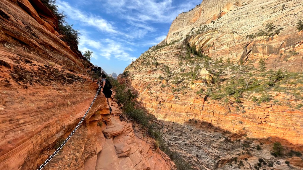
Angel’s Landing is a popular 5-mile roundtrip hike that rewards the adventurers with a beautiful view of Zion canyon from an altitude of about 1600 feet. You have to take the shuttle from the visitor center and disembark at The Grotto trailhead. First 2 miles of the hike is decent gradual incline, but then it leads to Walter Wiggles which is a set of 21 switchbacks which takes you to Scout Lookout. From here, it’s a 0.8 mile steep and strenuous climb on a narrow cliff. Meena and Ravita decided to stop at Scout Lookout as the climb was genuinely treacherous. I decided to continue ahead.
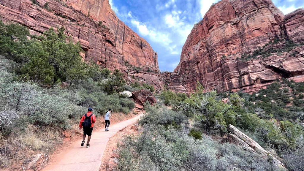
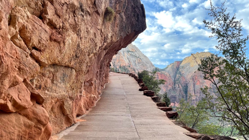
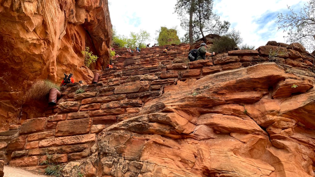

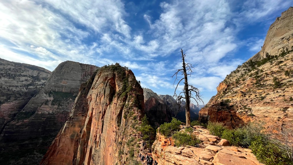
There were chains bolted into the cliff to provide secure handholds to the people climbing up. Even though it was such a strenuous climb, there was no dearth of adventurers. People were queued up on the trail hanging along the cliffs by holding the bolted chains. It was a scary sight, but I backed myself up and continued upwards. In hindsight, I think that the heavy traffic on the trail was actually a blessing in disguise. Firstly, it kept my mind away from the height that I was scaling up on such a narrow tortuous path, and secondly, it gave me a free breather every now and then as fellow hikers passed by. It took me about 45 minutes to reach the summit. But the view from the top was truly rewarding. You get to witness the history of earth trapped in the layers of rocks. The layering is so distinct that it can be counted on fingers and one can easily conclude how many times this place was inundated by sea. The sight of massive, red-colored cliffs towering above Virgin river on both the sides with tiny white dots of shuttles running on a paved road parallel to it was simply stunning. Angel’s Landing hike is mentally challenging due to steep cliffs and sheer drop-offs, but it certainly rewards you aptly with its unparalleled views.
I had my lunch there while immersing myself in this natural marvel. After about half an hour there I sped down all the way back to the trailhead. The steep decline while returning came in handy and I literally ran on my way back. My goal was to not make Meena and Ravita wait much longer, and I succeeded. It was noon and quite sunny. We decided to call it a day and reserve our energy for the next day’s hike at The Narrows.
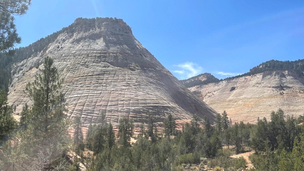
On our way back, we stopped at Checkerboard Mesa. Standing at 6670 feet, it derives its name from the checkerboard appearance. The horizontal lines are due to cross-bedding of ancient sand dune while the vertical lines are cracks due to fracturing of sandstone in winter.


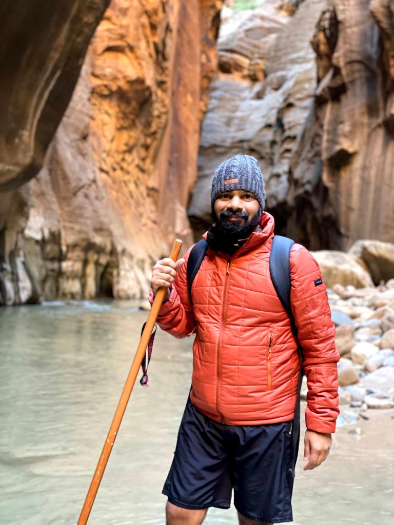
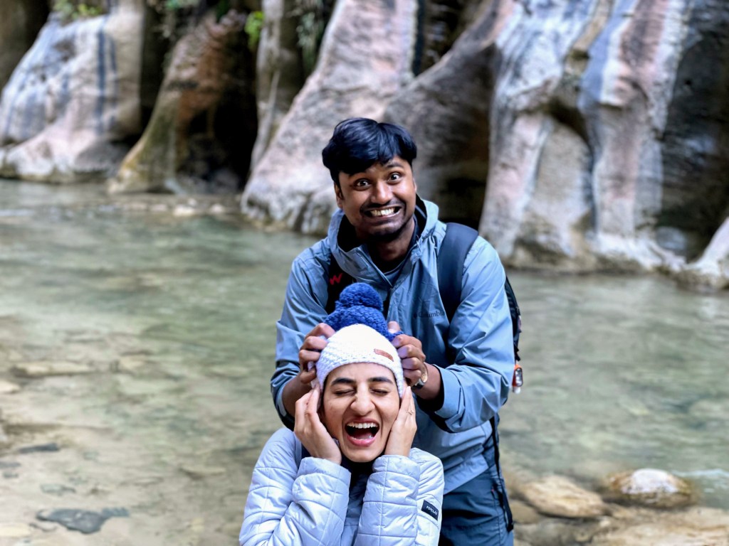
Day 4: The narrows at Zion, Sep 21st 2021
The Narrows, as the name suggests, is the narrowest section of Zion where the canyon constricts to as much as just 20 feet in width. For taking a hike in The Narrows, you have to get down from the shuttle at Temple of Sinawava followed by a 1 mile walk on paved wheelchair accessible Riverside Walk. At the end of this paved trail, you can see The Narrows and the Virgin river. To continue moving further you have to get your feet wet and walk upstream the river. Thankfully, we were prepared. We had rented a summer package from Zion Outfitters which included a pair of Adidas Terrex Hydro Lace shoes, neoprene socks and walking stick. The water generally remained knee deep for a 6’ person like me except at some stretches where it did reach my thighs. The temperature on that day was about 100° F, but The Narrows is so deep and narrow that sunlight cannot reach the bottom of the canyon. As a result, the place was comparatively much cooler than any other place in the park.
It was an entirely unique experience to walk in knee-deep water with a thousand feet vertical sandstone walls towering on both sides. It felt as if I was Indiana Jones searching for some hidden treasure in the remotest part of the planet.
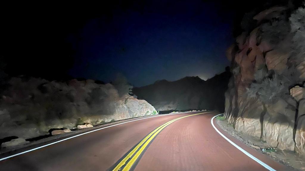
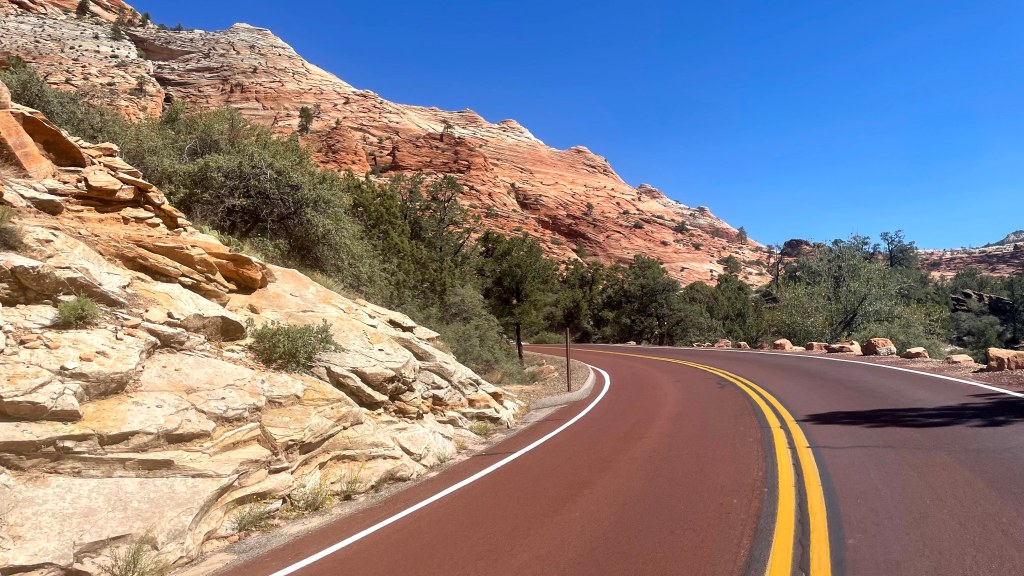
By the way it was at The Narrows that I slipped and sprained my left wrist. When I retuned back to Redmond, my radiologist said otherwise – it was a fracture. Should I have been more careful with those waterproof boots? Definitely! Do I regret doing the hike at The Narrows? Hell no! In fact, it is one of the most unique and among the best hikes I have done so far. As I am writing this with a cast on my left hand, my smile is wider than grimace of the pain. A smile because of the sheer delight you get when driving through Zion. The well-paved, red-colored curvy roads ahead of you flanked by similar, red-colored sandstone walls on both sides. And to break the monotony, you get to see pale buff-colored limestone rocks and green trees like pine, juniper and sagebrush. What an amazing place!