In heart of Canadian Rockies, we find a conglomeration of 4 adjacent national parks – Banff, Jasper, Yoho and Kootenay, with Banff being the cornerstone of these. Banff National Park is Canada’s oldest national park. It was set up as a 26 sq. km Banff Hot Spring Reserve in 1885 near present day Cave and Basin historic site. In 1887, it expanded to 674 sq. km and renamed Rocky Mountains Park. This was the 3rd national park in North America after Yellowstone and Mackinac National Parks in US. Canadian Pacific Railway (CPR) built Banff Springs Hotel and Lake Louise Chateau to increase tourism and rail passengers. In 1930, the park area was expanded to about 6700 sq. km and renamed again to Banff National Park after the closest CPR station, Banff, which in itself was named after Banffshire in Scotland.
A bit about Rockies
Rocky Mountains stretches for almost 3000 miles almost in a straight line from northern British Columbia in Canada to New Mexico in US. More than 100 million years ago there existed an ocean here. About 70 million years ago, the ocean retreated as Rockies began to rise due to tectonic forces. When dense oceanic tectonic plate subducted beneath the lighter continental tectonic plate at the western edge, the American tectonic plates buckled due to stress leading to formation of mountains.
But how come these mountains formed 500 to 1000 miles inland, in the middle of the continent? They should have been closer to the ocean, just like Andes in South America and Cascades in Northwest. Geologists believe the Rockies formed so inland because the crust was very fragile at this location. When the tectonic plate compressed, it crumbled more near the weak zone which buckled and rose to form present day Rockies.
Canadian Rockies is the Canadian segment of Rocky Mountains. These are starkly different from their American counterpart. The Canadian Rockies are largely made up of layered sedimentary rocks as compared to metamorphic and igneous rocks which form the American Rockies. Much of the Canadian Rockies is dotted with magnificent glaciers, rushing streams, turquoise lakes and wind-swept meadows. At the time of formation, Rockies were as high as 24000 feet in height, but were gradually eroded significantly, first by water and then by glaciers. This section of Rockies is much more jagged due to glaciers. The glaciers are a tongue of larger icefields. When these glaciers retreat, they leave a U-shaped valley and a bowl of the lake behind.
I learn a lot from this video – Climb The Majestic Rockies | How the Earth Was Made (S2, E5) | Full Episode | History (youtube.com)
Icefield vs glacier
When you are in Banff, you will hear or read these two terms quite often. But they are not the same, or interchangeable. Think of icefields as parent of glaciers. Icefields are vast swaths of ice formed through accumulation and compression of snow over thousands of years. Icefields are larger than alpine glaciers but smaller than ice sheets. Their topography is determined by the shape of surrounding landforms. Glaciers are run-offs from the icefields that flow down the mountain due to gravity. That’s why glaciers are called river of ice. Another way to picturize this is to consider your palm as an icefield and the fingers as the gravity-propelled glaciers.
Itinerary
| Date | Activity | Google maps link |
| Day 1, Aug 28th, 2024 | Drive from Seattle to Golden | Day 1 map |
| Day 2, Aug 29th, 2024 | Banff National Park | Day 2 map |
| Day 3, Aug 30th, 2024 | Lake Louise & Lake Moraine | Day 3 map |
| Day 4, Aug 31st, 2024 | Yoho National Park | Day 4 map |
| Day 5, Sep 1st, 2024 | Icefield parkway | Day 5 map |
| Day 6, Sep 2nd, 2024 | Drive back from Golden to Seattle | Day 6 map |
Day 1, Aug 28th 2024: Drive from Seattle to Golden
This day was just about driving. We had picked the town of Golden to be our home for the next few days. Staying at any of the lodges at Banff or Lake Louise is going to make a hole in your pocket. Golden is a 1-hour drive from Lake Louise and 1.5 hours’ drive from Banff, and much cheaper. We booked an Airbnb here which gave us the flexibility of cooking our food and packing our lunches, which is very much required when you are hiking in the Rockies. If you don’t mind waking up a bit early every day to account for the driving time, Golden is a perfect location for staying during your Banff trip when driving from Seattle side. If you are flying, then Calgary is an option.
On our way to Golden, we took pitstops at Bridal Veil Falls near Hope, Kamloops and Revelstoke. By the time we reached Golden, it was 8 PM in the night. We cooked our dinner and slept early.
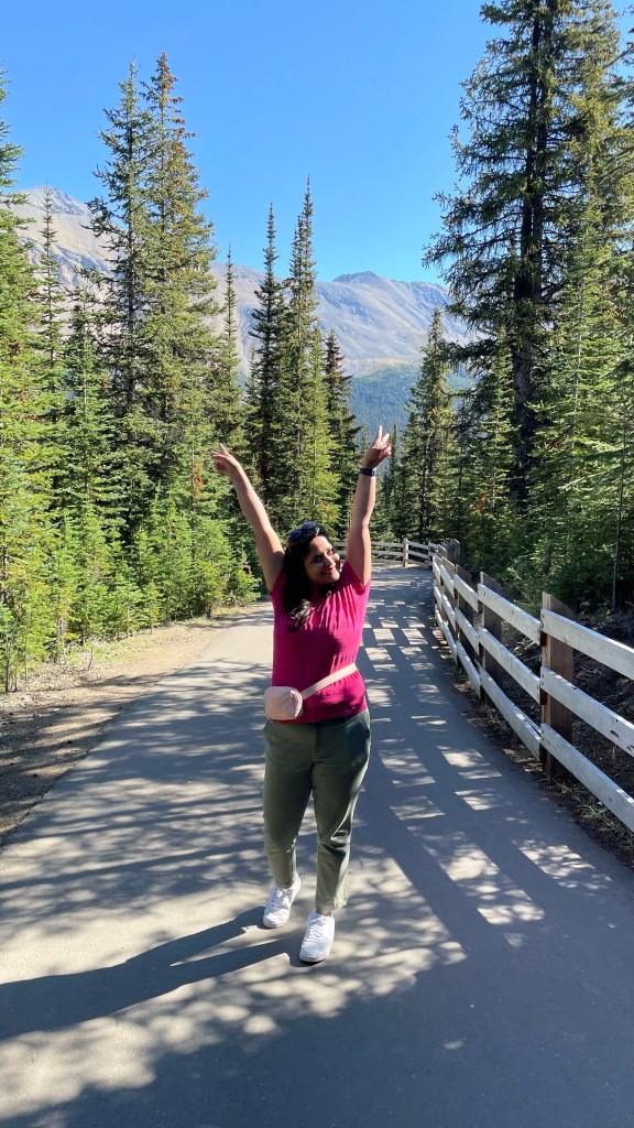
Day 2, Aug 29th 2024: Banff National Park
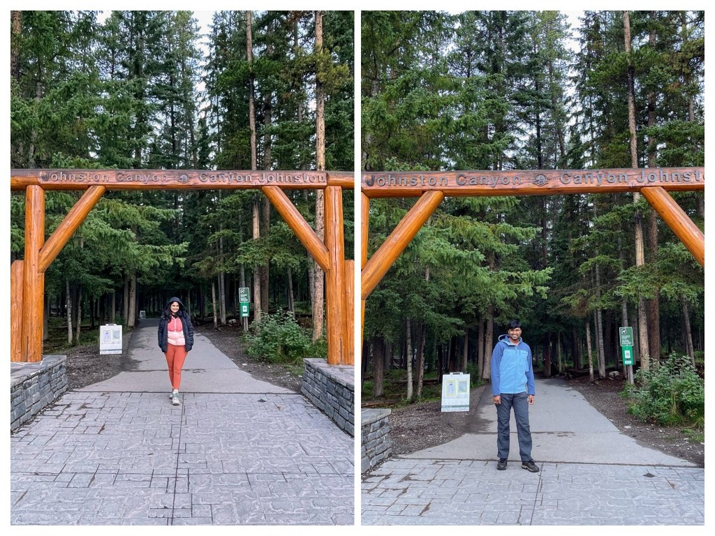
Johnston canyon
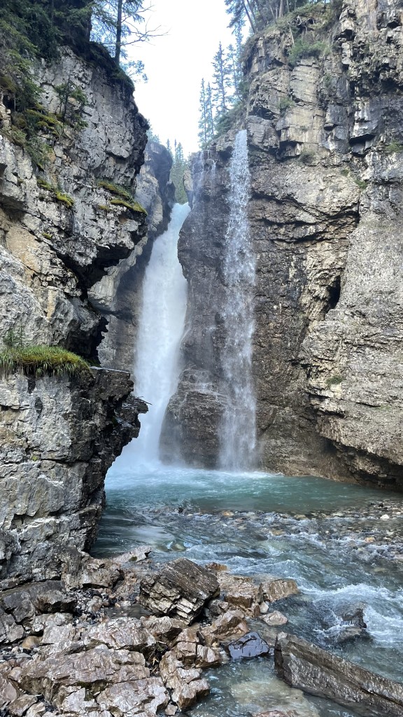
Johnston Creek, a tributary of Bow River, has cut through the limestone rocks for thousands of years to form sheer canyon walls of what we call Johnston Canyon. There is a popular trail that runs along the walls of the canyon leading to the meadows of Johnston valley. The initial part of the hike is on elevated metal walkways bolted to the sides of the canyon walls with Johnston creek flowing underneath. The latter part of the trail goes through rugged lush green pine forest. There are mainly 2 hikes here. Hike to Lower Falls is 1.2 km one way. If you continue 1.3 km further, you reach Upper Falls. We hiked till Upper Falls which was 5 km round trip. If you have time, you can hike up to Ink Pots which is 11 km round trip.
As Johnston Creek erodes the rocks, it has formed plunge pools. Plunge pools are created by backward erosion. Cascading water on the rocks erodes the formation’s base where the water impacts. As a result, plunge pools recede upstream. Dry Falls in Eastern Washington that I visited a few months back is another example of plunge pool. Lower Falls and Upper Falls are two plunge pools created by Johnston Creek. There is a small cave at Lower Falls from where you can get a much closer view of water falling down. The force is so high that you can easily get drenched if you stay long enough.
Johnston Canyon is a very popular spot. Many hikers throng the place to enjoy this unique view. So, reach early to secure a parking spot for your car. We reached there by around 6.30 in the morning. When we left around 11, there weren’t any parking spot available.

Bow Valley Parkway
Bow valley parkway (also called Highway 1A) is a 48 km scenic winding road that runs between Lake Louise and Banff. Thanks to Canadian Pacific Railway, Banff became a popular vacation destination for Europeans. So, this road was built in 1920 with the purpose of vehicle sightseeing in mind. There are plenty of hikes, wildlife viewing and roadside pullouts along Bow valley parkway. One such pullout where we stopped at was Backswamp which gave a beautiful view of winding Bow River.

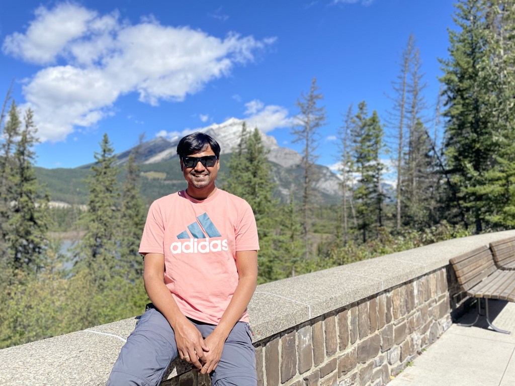
Banff downtown
Flanked on all sides by snow-covered rugged mountains, Banff downtown is hands down the most beautiful downtown I have seen. With Mount Rundle looming over it, the entire area is vibrant and lively with numerous local cafes, restaurants, art galleries and museums. You can stroll on the streets for hours immersing yourself in the stunning view of mountains and local vibe.
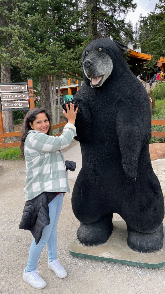
We started with a customary pic at Banff signboard. Then we went to Banff Museum which is a taxidermist heaven. Many animal skins are preserved and kept for display in a lifelike state. Most notable ae lifelike grizzly bear and bison kept at the museum. It can be an optional place to visit if there is time. We spent about an hour at the museum and then went to Cave and Basin.
Cave and Basin is the national historic site of Canada located at the site of thermal hot springs around which Banff National Park was established. For thousands of years, indigenous tribes used to come here. The water never froze despite the harsh winter of Canadian Rockies. They treated it as holy because they believed the spring water had healing power. It first gained attention of modern world when Canadian Pacific Railway workers Willian McCardell and Frank McCabe discovered this in 1883 and laid claim to this site. In 1885, government of Canada took over and reserved 26 sq km. This led to the genesis of Banff National Park and subsequently Canada’s national park system.
Note: Parking is difficult in downtown. Bow Avenue has free parking, but it is difficult to find one. Be prepared to park along the roadside and pay 6 CAD per hour.


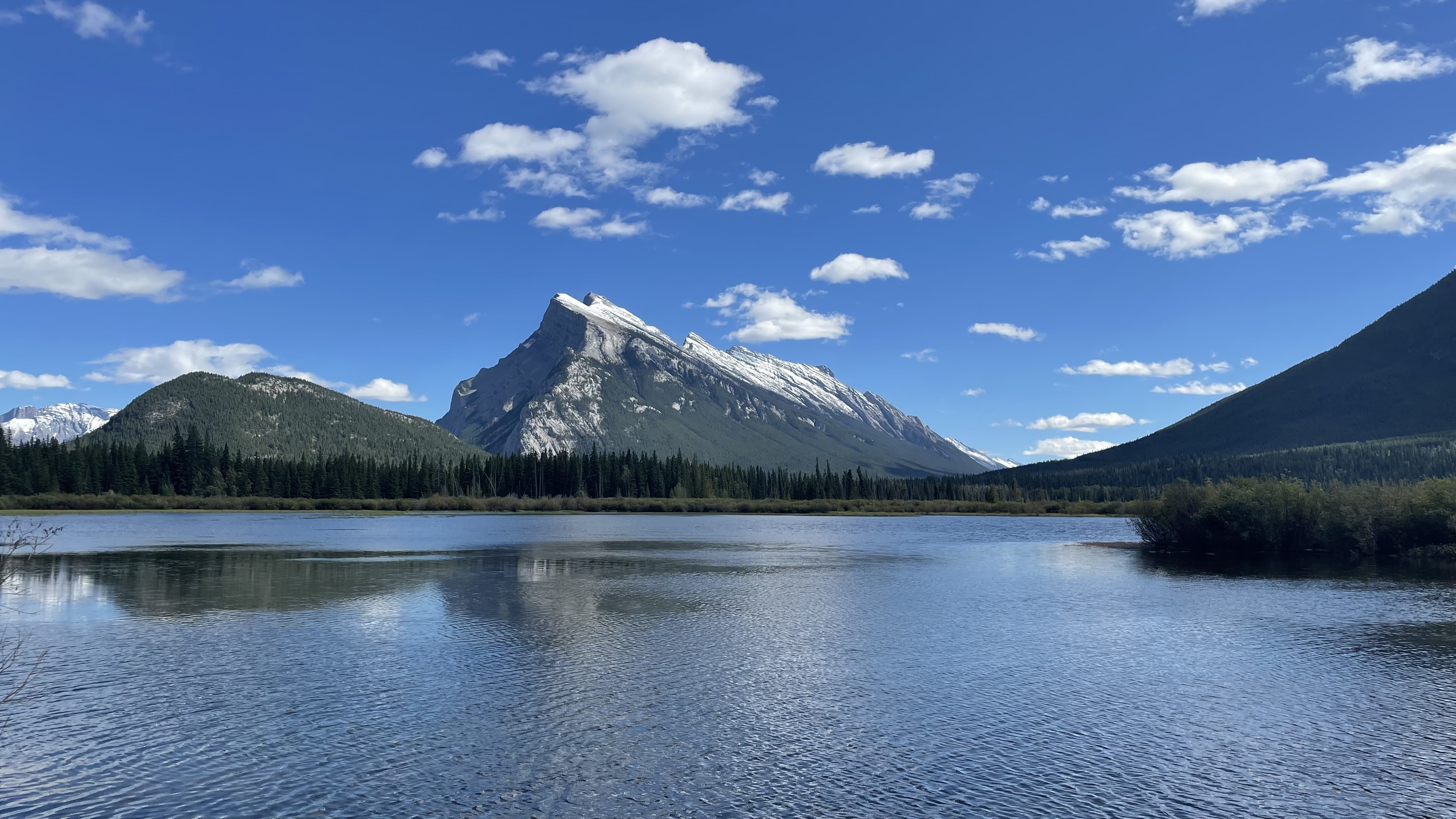
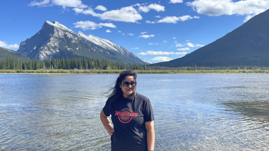
Vermillion Lake
Sitting in the backdrop of Mount Rundle and carefully ensnaring its reflection in its calm water, Vermillion Lake is the perfect place to end your day with. Away for glare of crowd, you can sit on the wooden dock and enjoy the sun set in front of you. The low elevation offers the optimum temperature and rich silt soil provides enough nutrients to make this place biologically diverse and extremely productive for plants and animals.
By this time, we were tired as we had woken up early. So, we headed back to Golden around 3.30 PM.

Day 3, Aug 30th 2024: Lake Louise and Lake Moraine
Lake Louise is a world-famous glacial lake. It has been well known to indigenous people for hundreds of years much before the arrival of Canadian Pacific Railways (CPR). Thomas Wilson was the first non-indigenous person to visit the lake in 1882. He named the lake “Emerald Lake” due to its color. Later it was renamed to Lake Louise after Prince Louise, 4th daughter of Queen Victoria.
Booking tickets to Lake Louise & Moraine
Tourists from across the world visit these two lakes. There is a horde of tour operators which run a day tour to these two. However, the cheapest way to visit them is by reserving Park Canada shuttle for CAD 11 per person. The tricky thing is that it is usually booked way in advance. You will have to try your luck with “last minute reservations” which opens just 48 hours before the day of visit and usually gets booked in minutes. That’s how popular these two lakes are. We tried to book this on 27th Aug morning for visiting on 29th but failed. On 28th Aug morning, we tried again. This time both me and Shalini tried to book 1 ticket each, and this succeeded. It seems booking 2 tickets from one account has a lower chance to go through. This ticket includes the ticket to Lake Connector shuttle which runs between Lake Louise and Lake Moraine.
We had booked the shuttle for 7.30 AM in the morning. We parked our car at the Lake Louise Park & Ride and took the bus that was standing. By 7.30 we were at Lake Louise.
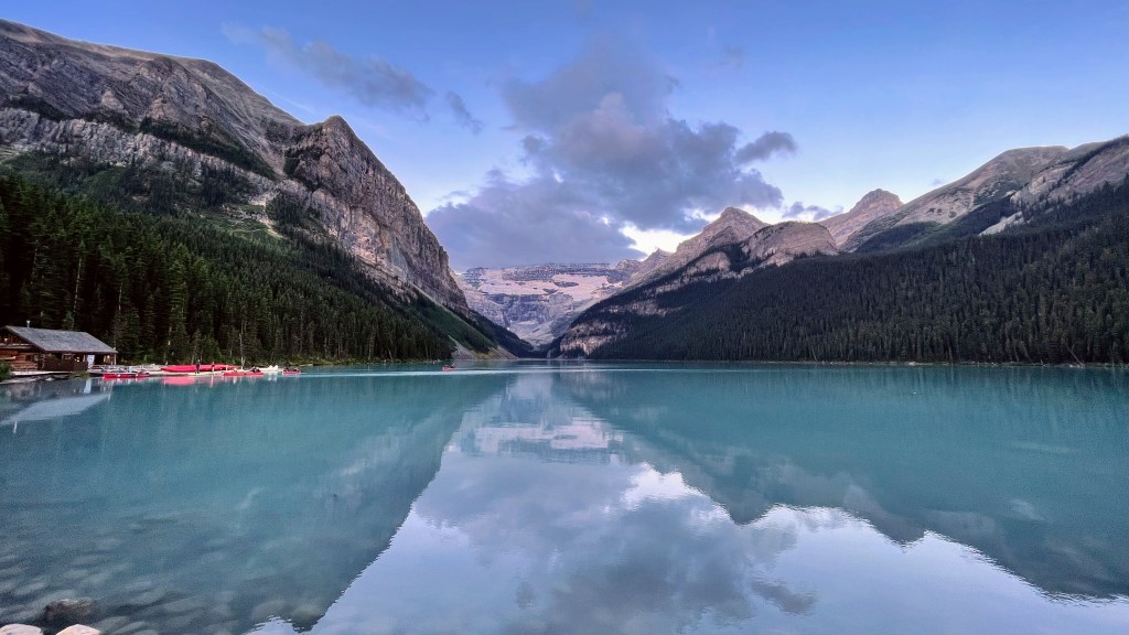
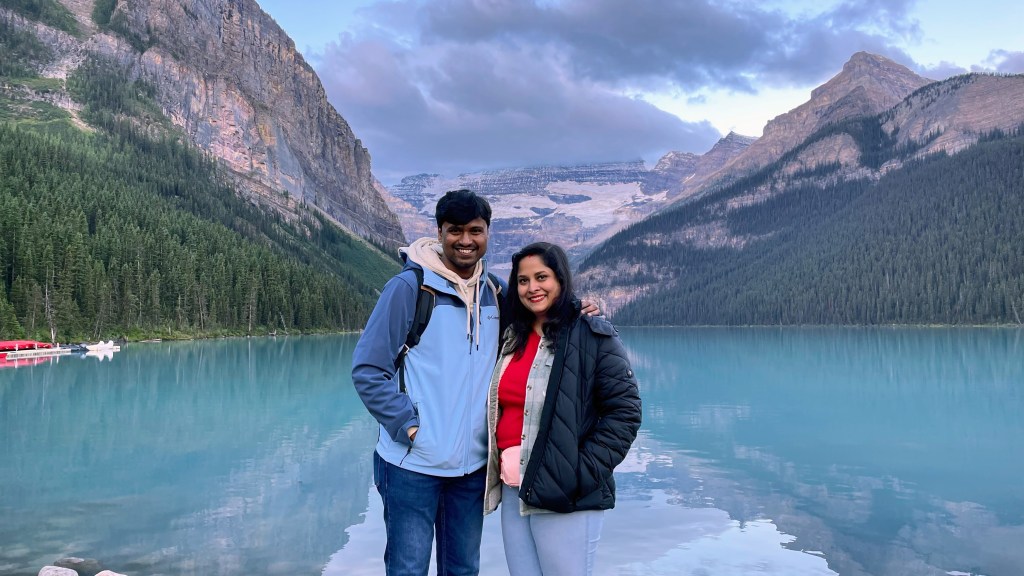
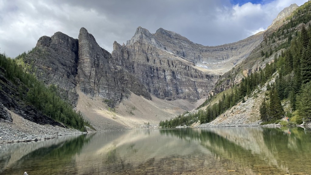
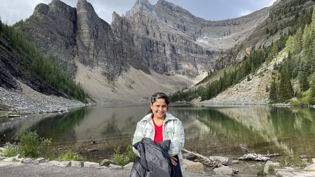
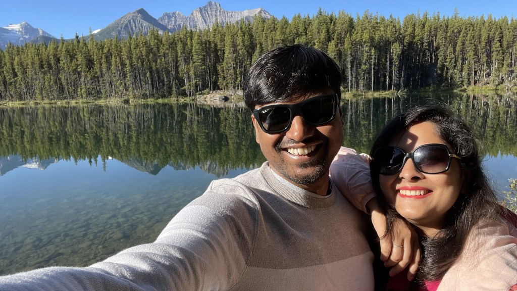
Lake Louise is simply magical. Grey alpine mountains from three sides, white thick river of ice flowing from mountain top, green tree line canvasing the base of those mountains and among all these is cradled a pool of turquoise water. Mt. Fairview and Mt. St. Piran flank the two sides of Lake Louise while Mt. Victoria is at the center which is the home of 6 glaciers that feeds the lake. Shrouded in the early morning mist, there was a mystical aura around Lake Louise. Not many tourists had come till then, so it was relatively calm still. One couldn’t get enough of this view. We took a lot of pictures for the next 30 minutes, and why not, we were at one of the most beautiful places in this world.
Like other glacial lakes, the blue color is due to rock flour. Glaciers move constantly and thus grind the rock underneath into fine powder called rock flour. The meltwater from glacier brings this rock flour into the glacial lake which remains suspended in its water column. When sunlight falls on the rock flour, they absorb all color and reflect blue-green color. This is why Lake Louise is blue in color.
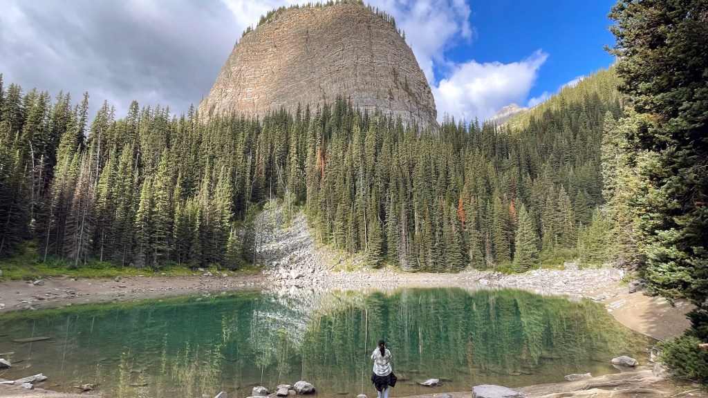
Then we embarked on Lake Agness Teahouse hike at around 8.30 AM. It is a 7.2km roundtrip hike that took us to a teahouse which is situated on the shores of Lake Agnes. The teahouse was built in 1901 by CPR as a refuge to the hikers and has been serving tea since 1905. It is only accessible on foot or horseback. The teahouse staff carry fresh supplies every morning while the dry goods like flour, sugar etc. are flown in through helicopter. This teahouse is open only between June and October. I was hoping that we would get a top view of Lake Louise from here, but we didn’t. This was a bit disappointing though.
By the time we were back at Lake Louise after the hike, it was full of people. There was hardly a place to take pictures. Thank God, we were done before this. So, plan to visit early to have a good time and pictures at Lake Louise.
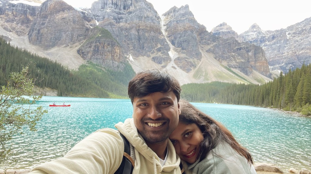
From Lake Louise, we took the Lake Connector shuttle to Lake Moraine. This was another hell of a beauty. Like Lake Louise, its water was also blue due to rock flour suspended in its water. I was interested in canoeing but dropped the plan as we were tired. We ate our packed lunch in front of the serene waters of Lake Moraine. It was also surrounded by glaciers which fed the lake.
We were done at Lake Moraine around 2 PM. We took the shuttle back to park & ride and headed back to Golden. It was a tiring day but totally worth it. I had mixed feelings today. I was very glad to immerse myself in the beauty of these two unique lakes. But just looking at moraines along the side of these lake reminded me of receding glaciers that once would have touched the lakes.


Day 4, Aug 31st 2024: Yoho National Park
Shalini was not feeling well today, so we kept it a very light day. We chilled at our Airbnb and planned only a couple of places at nearby Yoho National Park.
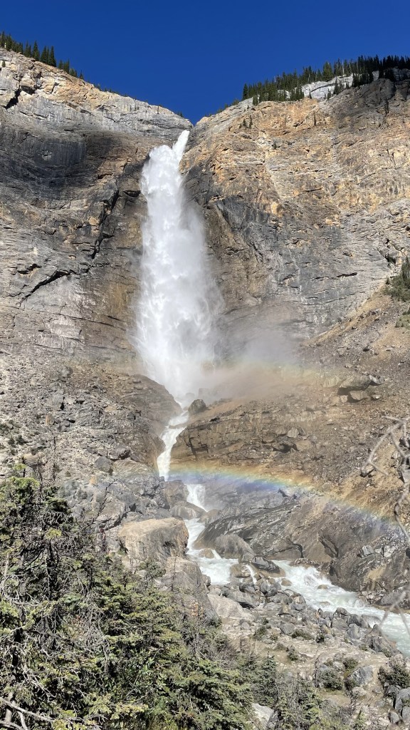
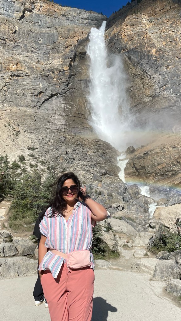
Takakkow Falls
Yoho national park was inhabited by Ktunaxa, Blackfoot and Cree First Nations. First Nations is a term used to identify indigenous people of Canada who lived here for thousands of years before Europeans arrived. The word ‘Yoho’ is an expression in Cree that means ‘awe and wonder’. The word ‘Takakkow’ translated to ‘wonderful’ in Cree language.
After you park the car, you will have to walk for about 1.5km to reach the falls. At the height of 370 meters and a single drop of about 250 meters, this is one of the tallest waterfalls of Canada. Takakkow Falls is meltwater from the Daly glacier which is part of Waputik Icefield. You can walk up close to the foot of the waterfall. As we crossed the bridge built over Yoho River, we felt the power of water. The mist from the falling water can be felt much before. When we reached the foot of the waterfall, we felt the need for a rain jacket. The day was bright and sunny and mist from the falls created the perfect condition for a beautiful rainbow to emerge. It was magical and reminisced me of Niagara Falls.
The Yoho Valley Road that you take to reach Takakkow Falls is a number of switchbacks and with beautiful sights all through. It was a fun drive.

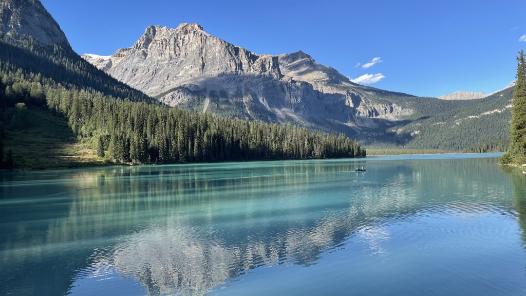
Emerald Lake
Cradled between the towering peaks of the President Range and forested banks, this looks like a grand amphitheater. True to its name, the water is pristine emerald color fed by the nearby glacier. The reason for color is the same rock flour that gives the color to Lake Louise and Lake Moraine. There is a small bridge where most visitors congregate and take beautiful pics. But you can escape the crowd by taking a walk around the shore of the lake. I felt that Emerald is truly underrated. It is equally beautiful.
Natural bridge
Just before Emerald Lake there is a left fork off the road that leads to this spot. The powerful force of Kicking Horse River has eroded the bottom portion of the rocks forming a natural bridge, hence the name.

Day 5, Sep 1st 2024: Icefields Parkway
Icefields Parkway (or Highway 93) is a 232 km winding road along the continental divide between Lake Louise and Jasper National Park. Regarded as one of the most beautiful drives in the world, this highway navigates through the mighty peaks of Rocky Mountains, jaw dropping glaciers, vast sweeping valley and few of the most picturesque lakes.
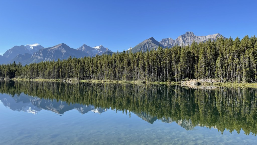
Herbert Lake
We started with Herbert Lake. It is right at the beginning of Icefields Parkway near Lake Louise. No hiking is required to access the lake. It was quick 5 minute stop of Herbert Lake.
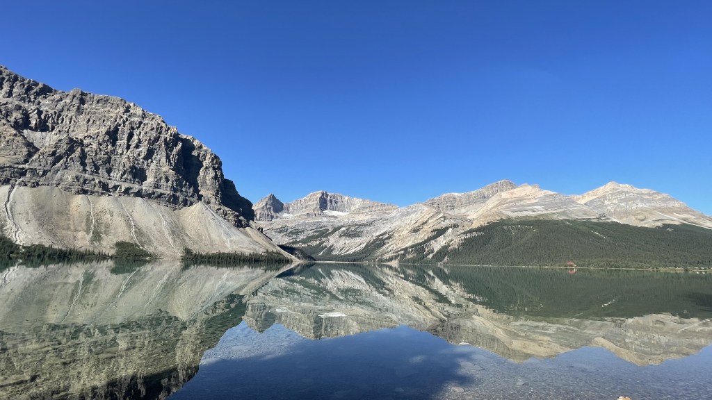
Bow Lake
Not very far away from Herbert Lake is Bow Lake. ‘Bow Lake viewpoint’ in Google Maps takes you to a pull-off lookout point. But I felt Bow Lake Lodge gives you a much better view of the entire scenery. From shore, one can see Bow glacier which is the source of this lake as well as Bow River which flows all along Banff and Calgary. The water here was so clear and calm that we got a perfect reflection of the surrounding mountains. You can see Bow and Crowfoot glaciers at a distance.


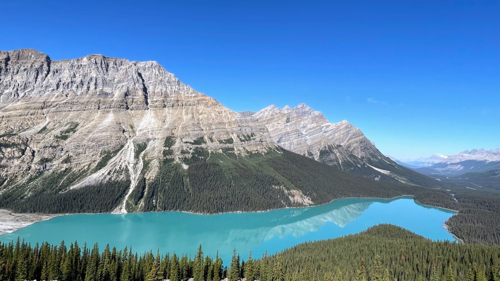
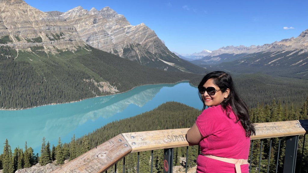
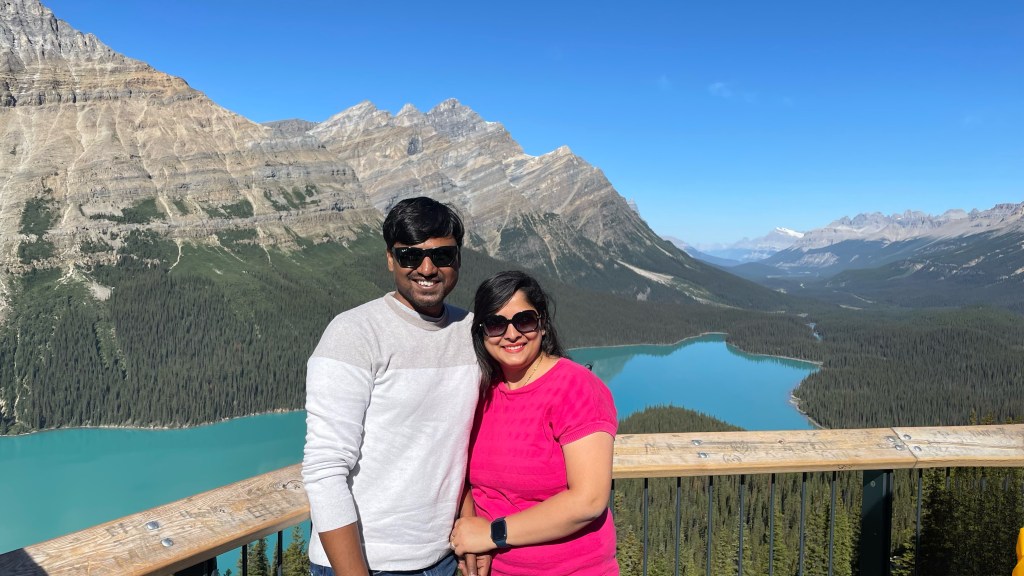
Peyto Lake
From Bow Lake, we headed further to Peyto Lake which is yet another glacier-fed lake in Banff national park. There are 2 parking spots for Peyto Lake – the lower and an upper one. The upper parking spot is closer to the viewpoint and does not need a hike. But the parking at the upper viewpoint is limited to buses and trailers. You will have to park the car at the lower parking lot. From here there is a short but steep hike to the viewpoint. But it is difficult to find a parking here. So, try to come here as early as possible. Many songs of the movie Koi Mil Gaya including its title track and Haila Haila has been shot at Peyto Lake, Bow Lake and Emerald Lake.
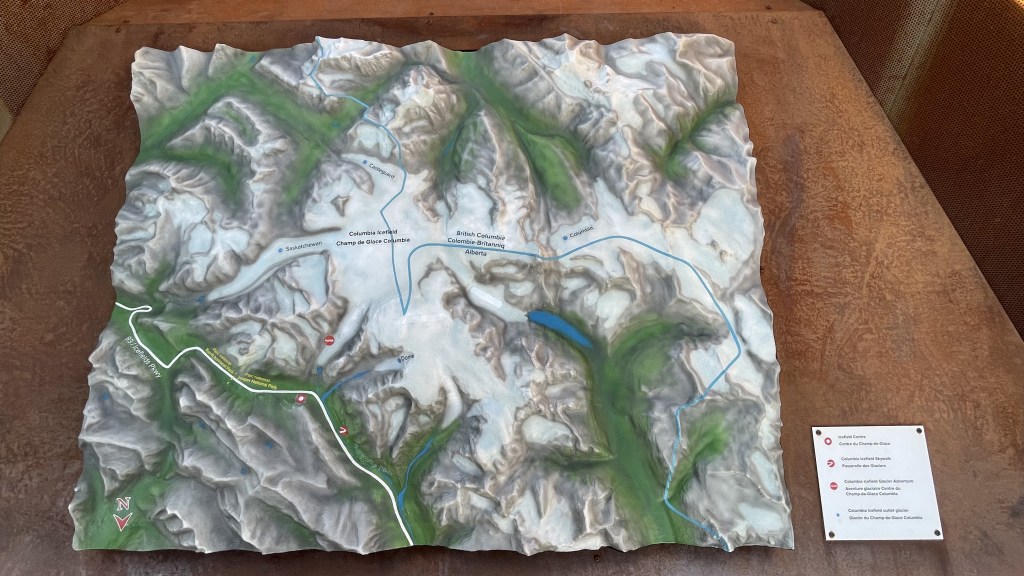
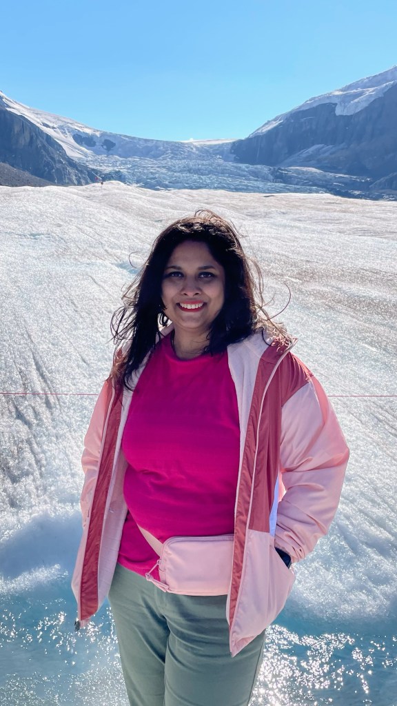
Columbia Icefield Glacier Adventure
After making a few pitstops at Waterfowl Lake and The Big Bend, we arrived at Columbia Icefield Glacier Adventure Center around 2.30 PM to enjoy a tour of Athabasca glacier.
There are 3 tour operators who provide a glacier walk on Athabasca Glacier – Columbia Icefields Center, Icewalks Tours and Rockaboo Mountain Adventures. Icewalks and Rockaboo provide a more private experience in smaller group size with a good amount of hiking involved. Columbia Icefields Center is more touristy. They have a fleet of 21 Ice Explorers which are monster trucks that take tourists right on the Athabasca glacier.
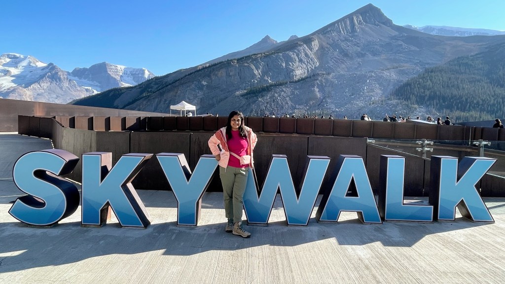
We had booked Icefield Adventure which offers a tour on the Athabasca glacier as well as a Columbia Icefield Skywalk overlooking Sunwapta valley. It is a combo. You can’t book just the Athabasca glacier tour. The tour departs at Columbia Icefield Glacier Adventure. The skywalk is about 6 km north of Columbia Icefield Glacier Adventure Center. But it is not possible for you to drive to skywalk and do icefield adventure later. The trip must start at the center through their bus.
We had booked 3.30 PM tour. We reached Columbia Icefield Center at 1.45 PM. We checked in at 2.30 and roamed around the building to capture some beautiful views of the Athabasca glacier from their rooftop. If you have online reservations, you just have to walk up to the gate at your designated time and take the bus. But if you haven’t, then you will have to get in the queue to purchase tickets on the spot.
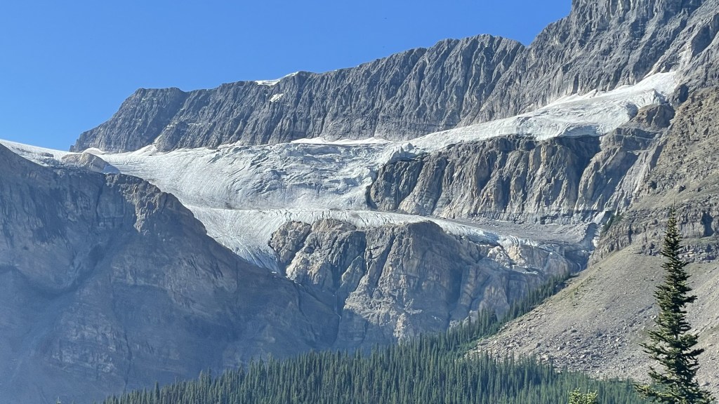
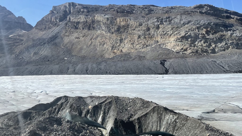
First, we hopped on a regular bus that took us to the first checkpoint. From there we got into one of those monster trucks and drove us to the Athabasca glacier. These ice explorers are true engineering marvels. They can seat about 50 people inside and travel on extreme off-road terrain including steep moraines. I remember the driver told us that the slope grade was 36 degrees and possibly the steepest drive in a vehicle in the entire world. The ice explorer landed us right on Athabasca glacier. This was my second glacier-walk, the first was in Iceland was back in 2019. A small section at the foot of the Athabasca glacier was cordoned off for the tourists. We spent some 20 minutes there appreciating the beauty of this place. These glaciers won’t survive for long, so I definitely consider myself lucky to have wherewithal to see these. It was definitely once in a lifetime opportunity.


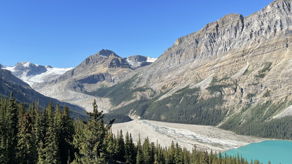
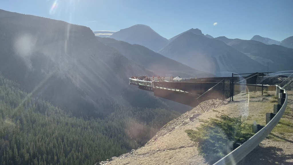
We hopped back on the ice explorer and headed back to the first checkpoint. We boarded a regular bus to continue our tour to the Skywalk. As mentioned before, Skywalk is about 6 km north of Glacier Adventure Center. It does not provide the view of Athabasca glacier, instead it offers the views of Sunwapta valley. My heart skipped a beat when I put my foot on the glass bottomed bridge for the first time. The glass walkway is about 35 meters protruding from the cliff about 300 meters above the Sunwapta valley. Sunwapta Valley is a unique place where 2 types of erosion have happened. First massive glaciers carved a giant U-shaped valley. Then Sunwapta River, fed by meltwaters from glaciers carved its own V-shaped path at the bottom of U-shaped glacial valley. The water of Sunwapta River has a lot of rock flour, so it is not fit for drinking. Rather, another lake nearby Ripple Lake which is fed by geo-thermal spring is used for that purpose. Ripple Lake does not even freeze during the harsh winter of the Rockies.
From the Skywalk, we could see Mount Snow Dome which is a unique triple continental divide. The meltwater from Dome glacier on top of Snow Dome flows in 3 directions: (a) through Athabasca river to Arctic ocean, (b) through Columbia river to Pacific ocean, and (c) through North Saskatchewan river to Hudson Bay. Another such hydrological apex in North America is Triple Divide Peak in Glacial National Park, Montana.
Overall, this icefield adventure was too commercialized for my taste. The time we spent on the glacier was just 20 minutes, with 50 more people. Somehow, I felt the thrill was missing. Everything was just too easy. Additionally, I am not sure of the environment friendliness of this experience when you run such massive vehicles on such fragile natural wonders.
Note – Book a tour at 3.30 PM or afterwards. You will get discounted prices. Second, make reservations online, preferably in advance. Booking at the center is expensive and you may not get the off-peak rates there.


Day 6, Sep 2nd 2024: Drive back from Golden to Seattle
Same as day 1, this was mostly driving taking the same pitstops at Revelstoke, Kamloops and Hope.
Banff is undoubtedly one of the most beautiful places I have been to. It boasts of mountains so high that tree lines couldn’t reach there, conifers so lush that entire valleys are replete with them, lakes with water so blue that it looks extra-terrestrial, glaciers so thick that they have survived even after hundreds of years of climate pillage caused by human beings. We frequently stopped on the roadside and enamored those enthralling views but still couldn’t get enough of it. When I think about Banff National Park, I reminisce those jagged mountain tops topped with glaciers. At the same time, I also reminisce those moraines on the lake shores weeping for the glaciers that were no longer present…
