Day 10, July 2nd – Ice fall trek on Matanuska and then to Hatcher’s Pass
Driving Through the Matanuska Valley
Our morning began with a beautiful drive through the wide and sweeping Matanuska River Valley, a corridor carved over thousands of years by the icy push of the glacier itself. On both sides rose mountains unlike each other—some stark black, some glowing completely white. At first it felt random, but the more we drove, the more it made sense. The black, bare slopes were the ones facing the sun. They warmed up faster and shed their winter coat early. The snow-covered slopes were the shy, north-facing ones that rarely see direct sunlight and remain frozen far into summer.

Within the first 30 miles approaching MICA’s tour office, the landscape unfolded dramatically. To our left stretched the great Matanuska Glacier, a 27-mile-long frozen river of blue and white, curling deep into the Chugach Mountains. Above it towered Mt. Marcus Baker, the mighty peak that feeds this glacier. At one point, we even spotted a hanging glacier suspended from a cliff—silent, shimmering, and completely otherworldly.
The Curious Land Ownership Around Matanuska
Before starting our trek, we learned something unusual about Matanuska Glacier—the glacier is mostly public, but the only drivable access to it is private. The road that takes you from the highway to the glacier’s toe crosses land homesteaded decades ago by the Kimball family under Homestead Acts. Today, this patchwork of land is partly owned by a private operator, Matanuska Glacier Park LLC (operated by a person named Bill Stevenson), and partly by Cook Inlet Region, Inc. (CIRI), a Native corporation that received land under the Alaska Native Claims Settlement Act. In short: glacier + some surrounding land = public; but the practical road, bridge, and immediate “toe of glacier” access = private land controlled by Glacier Park LLC and partly by CIRI.
Because of this, all visitors—no matter which tour they book—must pay a glacier access fee, which goes to the private landowners who maintain the road, bridge, and immediate entry area. It’s one of those surprising quirks of Alaska, where wild landscapes often carry layers of history, law, tradition, and settlement beneath their surface.
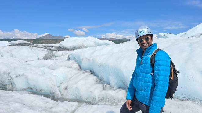
Icefall trek with MICA guides
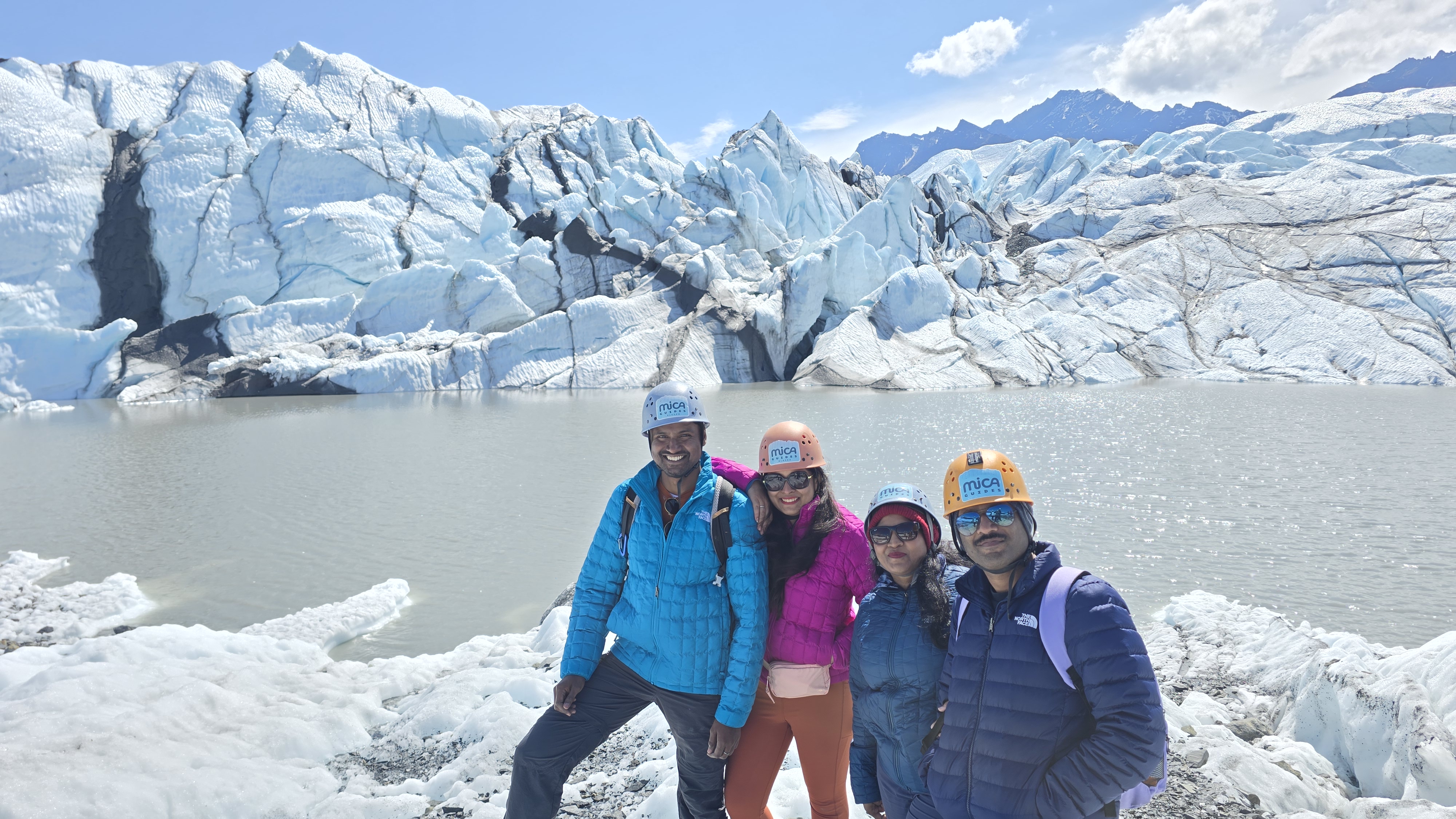
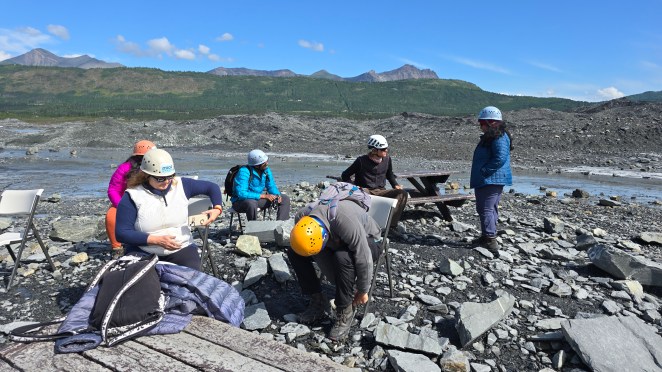
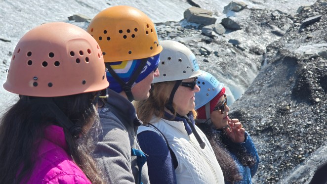
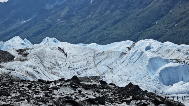
We reached MICA’s office around 10:30 AM for our Icefall Trek, a tour that promised both excitement and education. After a short briefing, we met our guide, Sam, who handed us sturdy boots and crampons. MICA prefers visitors not to use their own boots—the glacier ice is fragile and sharp, and well-broken-in boots help reduce micro-damage to the ice.
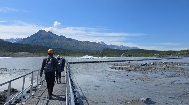
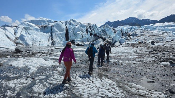
Sam then drove us about 15 minutes down a rugged, bumpy dirt road to the trailhead (yes, the same road managed and maintained by private parties). From there, we crossed a narrow metal bridge built over a glacial outwash plain—fast, silty meltwater braided in beautiful patterns. At the edge of the glacier, picnic benches were set up for putting on crampons. From here, the real adventure began.
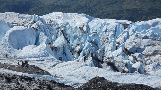
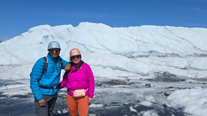
The surface looked muddy and rocky at first. But Sam reminded us: “What you see as dirt is actually the glacier protecting itself.” This debris—moraine—comes from the mountains the glacier scrapes, and it acts like a thin blanket that slows melting. But just a few steps in, the true ice revealed itself: glowing blue, ridged, grooved, and alive.
Crevasse vs. moulin
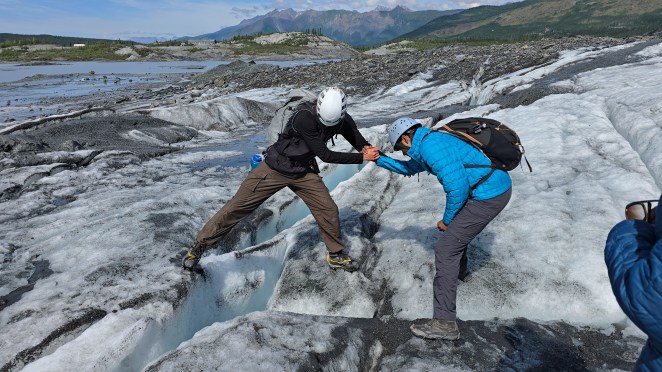
As we climbed deeper into the glacier, we saw enormous crevasses—deep cracks formed when the glacier moves unevenly. These cracks eventually channel water downward, becoming swirling shafts called moulins. Meltwater rushes vertically down moulins, winds carve horizontal tunnels, and together, they can form entire ice caves hidden beneath the solid surface.
Dirt cones
As we moved further, we saw dirt cones—strange ice mounds capped with dark sediment. They form the base of moulins when a pile of dirt protects the ice beneath it from melting. The clean ice around melts faster, leaving these cone-shaped features standing like tiny volcanoes on the glacier’s surface.

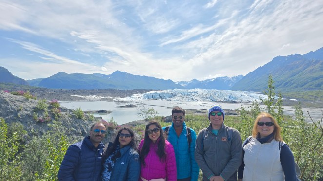


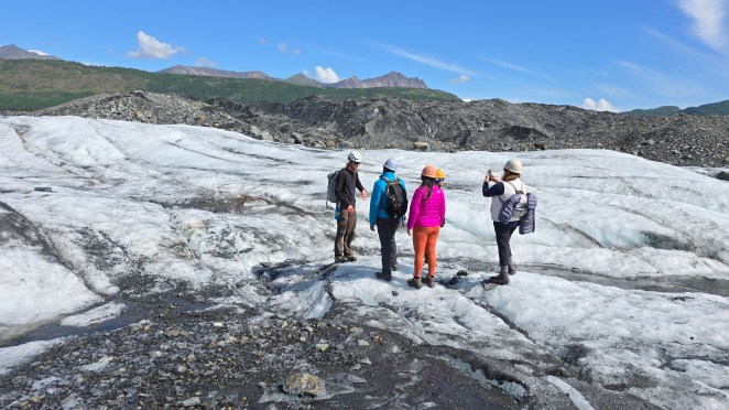


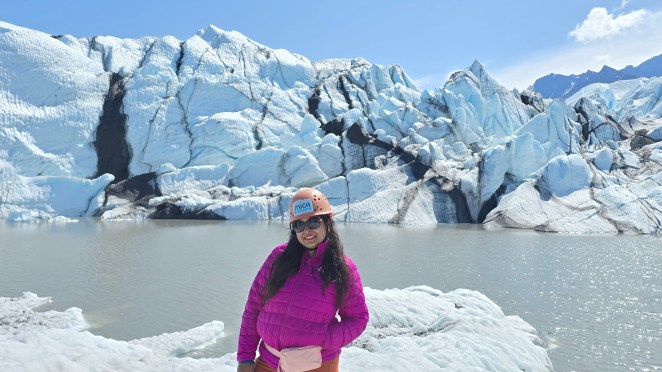
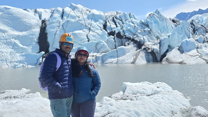
By around 1 PM, we reached the core of Matanuska Glacier, where the ice was pure, thick, and deeply patterned. Here, we saw the famous black horizontal and vertical streaks. Those black streaks on Matanuska Glacier are bands of rock and sediment called moraines, made of mixed debris (from fine silt to large boulders) that the glacier has scraped off the valley walls and bedrock and then transported within and on top of the moving ice. As the glacier flows, debris falling from surrounding mountains builds up along its sides to form lateral moraines, and where separate ice streams once merged their side debris was squeezed into the center to form vein‑like medial moraines; ongoing melting then exposes and sharpens these debris-rich zones so they stand out as horizontal and vertical dark ribbons against the bright blue‑white ice.
One thing we did miss. Our guide didn’t take us further deep within those glacier peaks. We could see other tour groups going further deep into the glacier wonderland. I asked Sam about this. He said we were running short of time. I felt it was unsatisfactory response. Probably, I wouldn’t come here again, so that additional experience would have meant a lot for me.
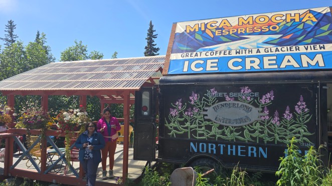
By 2 PM, we were back at the trailhead, boots wet and hearts full. Before leaving, we treated ourselves to ice cream at a tiny shop beside MICA’s office.

Hatcher’s pass
From Matanuska, we drove toward Palmer, filling both gas and free drinking water—something you can find easily across Alaska. Golden light followed us as we headed toward our evening destination: the rolling highlands of Hatcher’s Pass. Hatcher’s Pass is a high mountain gap in the Talkeetna Mountains, famous for its sweeping green meadows, striking grey peaks, and a landscape that looks like a painting coming to life. As glaciers retreated over centuries, the bare rocks were slowly colonized by mosses and lichens—small, patient life-forms that created the first thin soil. Today, these are giving way to shrubs, wildflowers, and new vegetation. It feels like watching the beginning of a forest being born.
RVs are allowed to drive right up to the Independence Mine State Historical Park, one of Alaska’s most evocative gold-mining sites. Over 150,000 ounces of gold was recovered from this mine between 1936-1943. At its peak, it employed 200 workers here. In the early 1900s, hundreds of miners lived here in wooden structures nestled between the mountains.
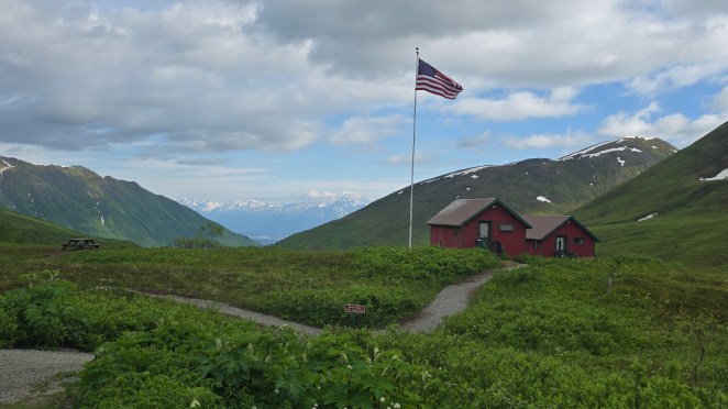
Down from the old mine complex but nestled just below Hatcher Pass’s alpine corridor sits the Hatcher Pass Lodge — a small cluster of rustic red cabins that many travelers now associate with Hatcher Pass itself. The story goes that a former U.S. Army soldier, Karl “Hap” Wurlitzer, dreamed of creating a remote adventure lodge in the Talkeetna Mountains. In 1963 he homesteaded 10 acres near Hatcher Pass and by 1967 began building what would become the lodge. The cabins were gradually expanded from that point onward.
There are multiple hiking trails here. We didn’t hike that day as Shalini was not feeling well.
A few minutes downhill from the mine lies a dry campground that looks like a simple parking lot—but it’s actually an RV campsite. You just drop cash in an envelope and settle in for the night. We parked, stepped outside, and breathed in the quiet. All around us were rolling green meadows, dappled with grey rock, glowing softly in the evening light. The mountains seemed halfway between wild stone and new life.
It was peaceful. It was simple. It was Alaska at its purest.