Day 5, June 27th – Flying Over Denali
Mt. Denali flightseeing tour
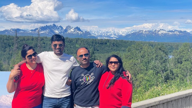
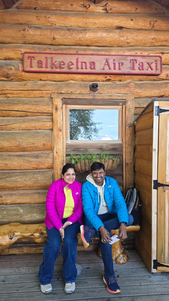
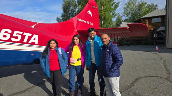
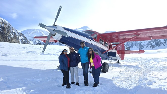
Waking up on Day 5 felt surreal. Our RV sat quietly in the parking lot of Talkeetna Air Taxi, the very company that would fly us into the heart of the Alaska Range. Boondocking here turned out to be one of our smartest decisions—no rushing, no driving, no stress. All we had to do was step out of the RV and check in. By 8 AM, we were inside their warm wooden office, signing papers for our glacier landing tour. At $420 per person, it felt expensive, but this was Alaska—these are memories that last a lifetime. The staff handed us Gore-Tex boots and over-flaps, and the excitement slowly wrapped around us. Butterflies fluttered in my stomach. We were a group of eight today. The other four weren’t tourists—they were mountain climbers, heading out to attempt the summit of Denali. They loaded their ropes, tents, and metal gear into the same plane.
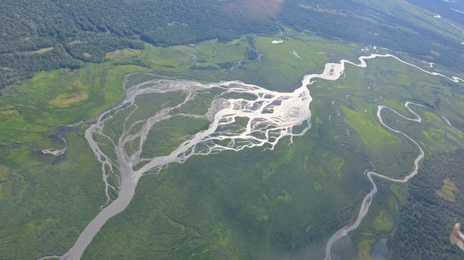
“Talkeetna” in Athabascan means “where rivers meet.” And the moment our plane lifted off the runway, that name made perfect sense. Below us stretched the wide, green Susitna Valley, which is shaped by ancient glacial flow and by the three powerful rivers that sculpt it even today—the Talkeetna, Susitna, and Chulitna Rivers. From above, their confluence looked like three silver threads weaving themselves into one giant ribbon of water. This valley also forms a natural divide: the Talkeetna Mountains on one side, and far beyond them, rising like giants, the Alaskan Range. A broad, flat corridor separates the two ranges, created by retreating glaciers thousands of years ago. It is through this very valley that pilots approach Mt. Denali, making it one of the most scenic flights in North America.

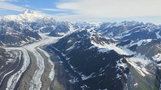
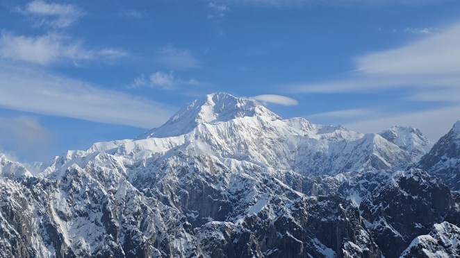
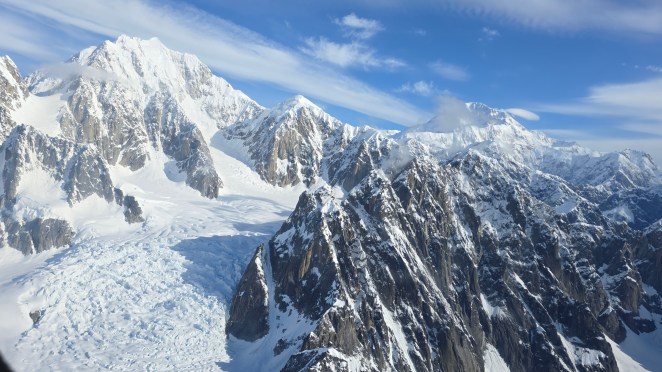
As the plane climbed, the small rolling hills gave way to the towering ramparts of the Alaska Range. This is where we saw Denali itself—America’s highest peak at 20,310 ft—rising dramatically from its base, which lies much closer to sea level compared to most big mountains. Beside Denali, we saw its sister peaks: Mt. Foraker (17,400 ft) and Mt. Hunter (14,573 ft). Together, these three mountains form a massive wall of snow and rock that dominates the skyline.
Our pilot pointed out the giant Ruth Glacier below, flowing like a frozen river through a deep canyon. We also saw the Kahiltna Glacier, the longest glacier in the Alaska Range and also the main climbing route Base Camp for Denali climbers. Both glaciers sit on Denali’s south side. Landing are almost always done on the Ruth Glacier or Kahiltna Glacier, depending on weather and the specific tour variant. These landing zones are flat, wind-sheltered sections where small ski-equipped planes can safely touch down. I was surprised by looking at the color of Ruth glacier. From above, it looked grey, striped bands of dirt, rather than clean white. But when I researched, I learnt that it isn’t pollution—it’s natural. As glaciers move, they grind rocks beneath them into fine powder called glacial silt. Avalanches also drop soil and debris onto the ice. Wind then spreads this grit across the glacier’s surface, giving it a dusty, dirty look from the air.
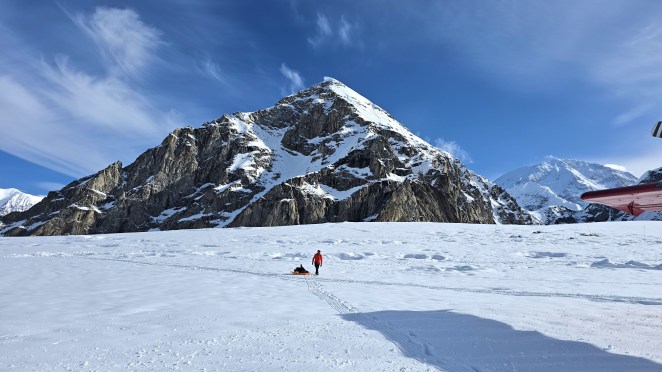
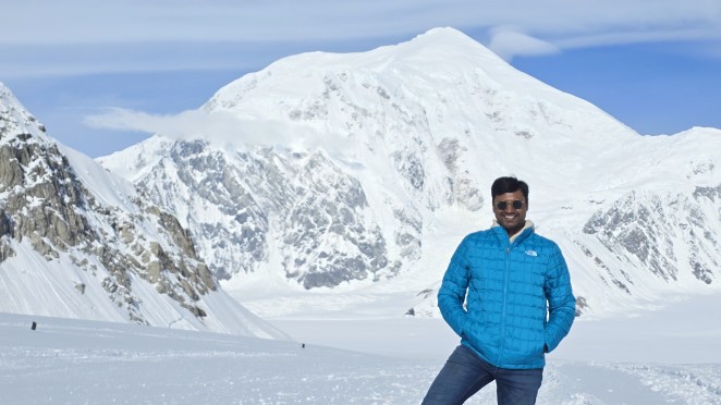
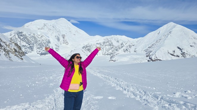
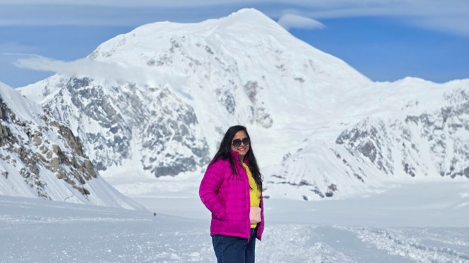
Our plane landed on the Great Gorge of the Ruth Glacier. This gorge is considered one of the deepest in the world, with nearly 3,700 feet of ice beneath the surface. Stepping out of the plane was overwhelming—an endless world of white between jagged peaks, silence, and ancient ice. This wasn’t a painting, it was real. After we stepped out of the plane, the first thing we saw was a group of mountain climbers unloading their gear. They moved with quiet purpose, dragging heavy ropes, packs, and ice tools on sleds toward a small cluster of tents buried in the snow. We stood there completely mesmerized, turning slowly in every direction because every angle looked like a painting. Naturally, the cameras came out instantly. We clicked photo after photo, trying to capture the impossible beauty around us. We spent about 20 awe-filled minutes soaking it all in before finally climbing back into the plane.
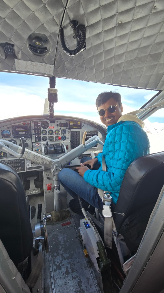
While returning, I requested the pilot to sit right next to him, and he agreed. As the flight skied off the icy runway, I noticed something interesting. Through my own eyes, the airplane propeller looked like a blur, almost invisible. But on the camera screen, it appeared moving slowly. I was able to see each blade which was not the case when seen through the naked eyes. It definitely destroyed my videos and images, but I learnt something interesting about frame rate and shutter speed of cameras – Here’s Why Helicopter Blades Can Look Strange On Video.


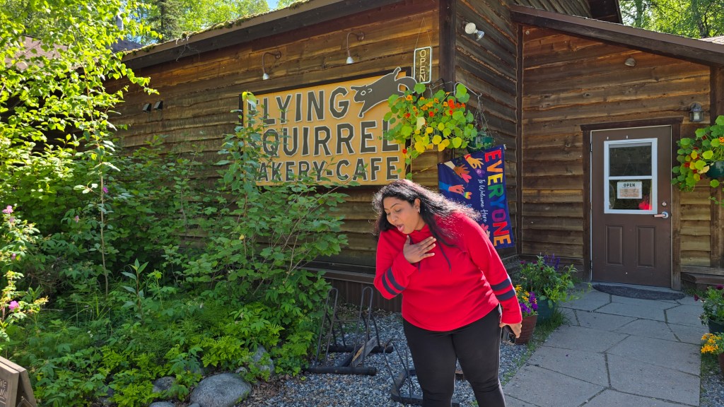
Back at Talkeetna by 10 AM, we headed to the Flying Squirrel Café. Their sandwiches, sadly, didn’t impress—raw salmon in a sandwich was not our taste. So we returned to our trusted favorite: Talkeetna Spinach Bread, warm and delicious as always. By 12 PM, we said goodbye to the charming little town and were back on Highway 3, heading toward Denali National Park.
Denali National Park: The Crown Jewel of Alaska
As we merged back on highway 3, we drove north towards Denali National Park. Around 1:30 PM, we stopped at Denali Viewpoint South and an hour later at Denali Viewpoint North, for breathtaking views of the Alaska Range. The landscape here felt endless, like the mountains were marching toward the sky.
We reached the Denali Visitor Center by 4:30 PM. It was easily one of the best visitor centers we had ever seen. Wide wooden halls, friendly rangers, and exhibits explaining the park’s vastness. Denali National Park covers 6 million acres, an enormous wilderness of tundra, taiga forest, braided rivers, glaciers, and mountains. Geologically, the Alaska Range here is still rising—Denali itself grows a few millimeters every year due to tectonic uplift from the Pacific Plate pushing under North American plate. It was protected in 1917 to preserve wildlife, especially Dall sheep. Today, it stands as one of the last truly wild landscapes in America. We watched a short film in the visitor center’s theater—a beautiful reminder of how special this land is.
We drove our RV up to 15 miles into the park up to Savage River. Beyond that, only the Denali bus system can take you deeper—up to 42 miles—so that the wilderness stays untouched. By 7 PM, we reached Riley Campground. A very important note: you must stop at the Mercantile first to get your camping permit. The campground is no-hookup, but Mercantile has paid showers, restrooms, and water-sewer dump points.
Dinner was warm egg curry and chapati, perfect after a long day. The night ended with a competitive game of Phase 10 and laughter under the soft midnight Alaskan light.
Mt. Denali or Mt. McKinley?
Mt. Denali was known to Alaska Natives for millennia as Denali (“The High One”) versus its colonial-era renaming to Mount McKinley. After decades of discussion, the U.S. officially restored its original Native name in 2015, honoring cultural heritage and land identity, but Trump administration changed it back to Mt. McKinley in 2025. While this drama continues, most people still refer to it as its true native name.