
Geology of Grand Canyon
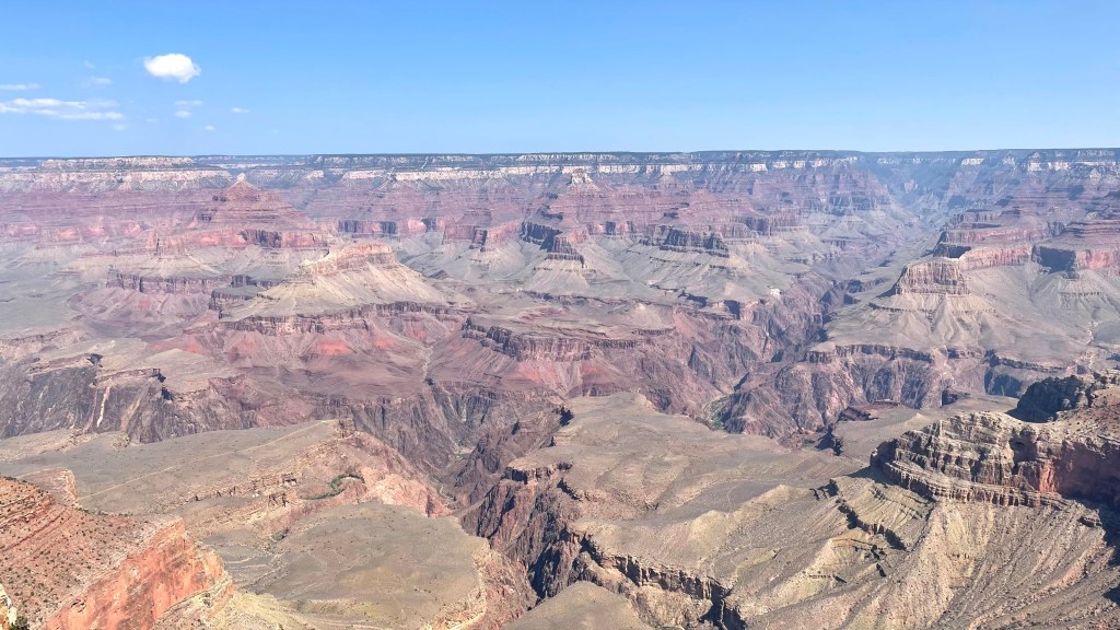
Nearly 2 billion years ago, mountains as high as Mt. Everest stood at the place where the canyon is now. These mountains gradually eroded over next 1.5 billion years. Paleontologists have found fossils of sea creatures as old as 500 million years old, thus revealing that this place was inundated sea at that time. In fact, multiple layers of rocks at Grand Canyon tells that this place was submerged in sea, not once but at least 8 times. There are clear distinct layers of rocks, often of different colors, depicting different types of sediments deposited by the sea. Some sediment was sand that solidified to become buff-colored sandstone, some was mud that hardened to become darker shale, while the calcified remains of the marine organisms were crushed into light-colored limestone. Yet the dominant color here is red. That comes from iron locked within all the rocks. Over millions of years, iron rusted into a distinctive red hue. Last time this part of Arizona was under sea at least 80 million years ago.
The limestone layer at the top of the canyon is 225 million years old. As you descend further into the abyss, you keep going further backwards in time. The dark granite rock layers, also called Vishnu basement rocks, at the bottom of the Grand Canyon are about 2 billion years old, half the age of the earth itself. The distinctive uplift between 70 and 30 million years ago that formed the Colorado Plateau caused the sea to drain back towards northeast. Generally, uplifting is combined with tilting of rock layers. But not here. Here it’s like the entire landscape moved 1 mile above sea level in an elevator due to the forces of mother nature.
It is believed that Lake Bidahochi lied east of the present-day Grand Canyon. Colorado river started from Rocky Mountains and flowed west all the way till Lake Bidahochi. As the lake spilled over and flowed further west, it started cutting the Colorado Plateau which we see today as the Grand Canyon. Colorado river cut this 1-mile-deep canyon in 5.5 million years, which by geological measures, is mere blink of an eye. The primary cutting tool is not water, but the silt, rocks, and pebbles it carried. Steepness of riverbed caused the river to carve this canyon so quickly.
But why is the Grand Canyon so wide?
The forces of gravity and erosion cut this deep canyon, but what makes it so wide? It is 18 miles wide at its widest point near South Rim. The answer, yet again, lies in the layers of rocks. Limestone layer is hard but beneath it sits the softer shale. These solidified mud wither in rain or by Colorado river. As a result, the rocks above it also fall causing landslides which can be seen happening even today. Colorado river by its sheer force carries away all the debris cleaning up the space and giving room for new landslides further widening the canyon.
Additionally, the tributaries of Colorado river also played a part here. As the river cut deeper, the gradient of tributary streams become steeper as they rush to the river’s edge. These tributaries branching off and cutting the canyon walls grew the rims further apart. Look at the Grand Canyon on Google Maps with terrain filter. This landscape created by tributaries is quite evident.
What gives stepped-pyramid kind of look to the Grand Canyon?
Each rock layer erodes in its own manner. Shales erode to slopes, while harder sandstones and limestones tend to form cliffs. The extremely hard metamorphic rocks at the bottom of the canyon produce the steep-walled and narrow inner gorge as these rocks are more resistant to erosion than the softer sedimentary rocks above.
This is a very good documentary from where I learnt majority of this stuff – The Grand Canyon Explained | How the Earth Was Made (S2, E1) | Full Documentary | History – YouTube.
The Grand Canyon is like a book with each chapter elaborating seas coming in and going out leaving thousands of fossils as ink marks on its mesmerizing pages. There are canyons deeper and wider than the Grand canyon, but it is certainly the grandest.
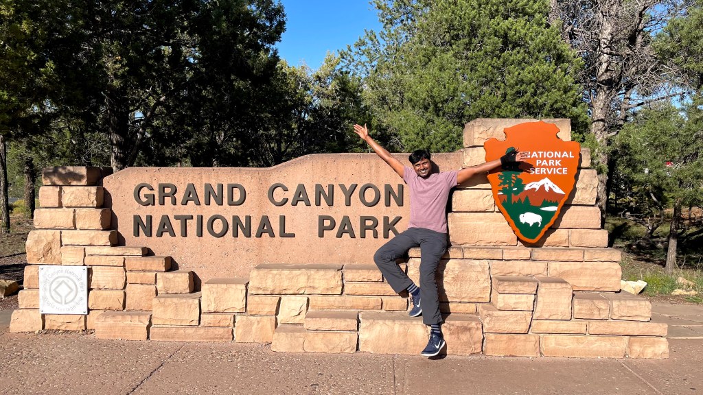
Day 7: Grand Canyon, Sep 24th 2021
For the next couple of days, we took shelter in Williams, a sleepy town in Arizona which is just 1 hour drive from the south entrance of Grand Canyon National Park.
Earlier, our plan was to do the Bright Angel hike. But it was a 12-mile hike, and we were tired with so many back-to-back hikes. So, we decided to keep it light and do short and easy ones. We parked our car at the visitor center and boarded the shuttle. Like Zion and Bryce, Grand Canyon National Park also runs complimentary shuttles for its tourists. The shuttle system has 3 different routes depicted by different colors on the map – orange, blue and red. We took the eastbound orange shuttle to reach South Kaibab trailhead where we did a 1.7 miles hike to Ooh Aah point. This ‘halfway’ point to Cedar Ridge is a beautiful hike in itself. The vista of Grand Canyon opens up at this point for the first time in the trail and you get to see the beautiful layers of rocks revealing the age and history of earth.
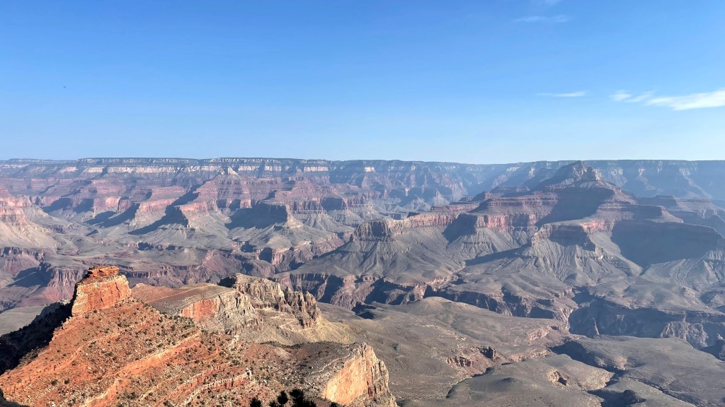
After Ooh Aah point, we went to Yaki point. This was a better point than the previous one for two reasons. First, it genuinely had a more unobstructed view of the canyon and secondly, there was literally no one here. We had ample amount of alone time to enjoy the view and click numerous pics. At Yaki point, we boarded the orange shuttle and moved westwards back towards the visitor center. We continued westwards till Mather Point. This was the first location where we got a glimpse of Colorado river in the canyon. From there, we went to Yavapai Point and Geology Museum. This point has an amazing info center where the history and geology of the Grand Canyon has been explained in a very interactive way. I learnt a great deal about canyon formation here. By the time we were done here it was noon, and we were hungry. We took the shuttle back to the visitor center, picked up our car and drove to Market Plaza which is a food court inside Grand Canyon National Park. We got a sandwich and fried chicken from the plaza and had our lunch in the car.

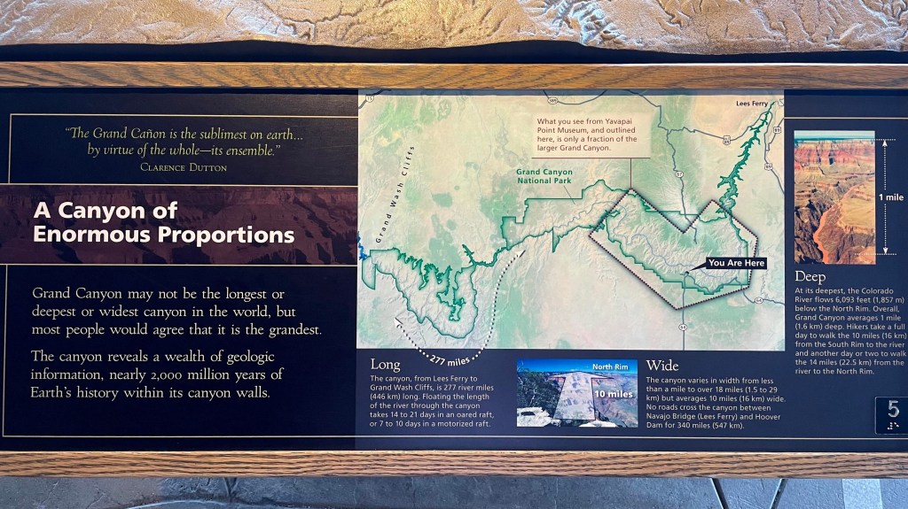
Now was the time for the scenic Desert View drive. This 23-miles scenic drive begins at the junction of SR 64 and South Entrance Road of Grand Canyon, and then runs eastwards along the south rim all the way till the Desert View watchtower which is near the east entrance of the canyon.
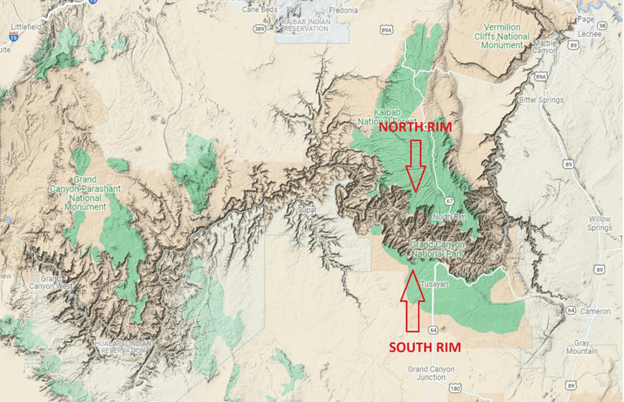
Although we were driving eastwards, but we were still on the south rim of the canyon. This thought was confusing me. This is where Meena came to the rescue and gave me a good insight into what north rim and south rim really means. The entire canyon can be considered a river with two banks, the one on the northern side is called North Rim and the one on the southern side is called South Rim. Desert View drive is along the southern bank of the Colorado river when it cut the canyon.
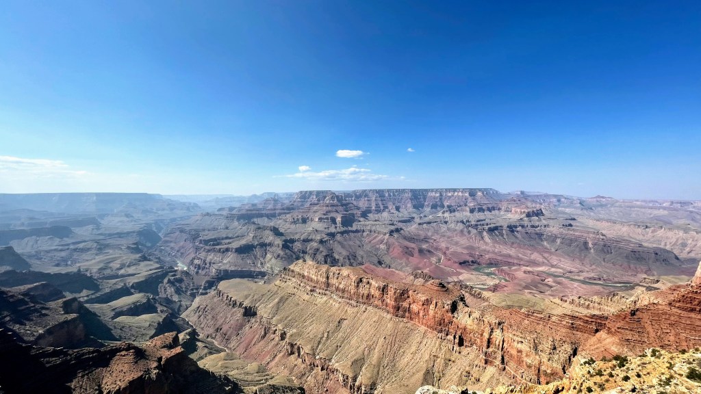
On the Desert View drive, we stopped at Grandview point, Moran Point, Lipan point, Navajo point and finally at Desert View watchtower. And without a doubt, we got the best view of the canyon on this route. Moran Point is named after an artist Thomas Moran whose vibrantly colored paintings brought the Grand Canyon to life in the era of black and white photographs. At Lipan Point, you can see Hance Rapid. From the viewpoint, it looks calm but Hance Rapid is one of the most dangerous rapids in Grand Canyon as Colorado river falls to the height of three-story building. At Lipan Point, you can also see Vishnu basement layer which is literally the rock bottom. This granite layer is the oldest and bottommost layer of the Grand Canyon. Colorado river, slowly and steadily, took 5 million years to cut the rock layers at Grand Canyon. But that’s it. It can uncover no further, river has hit the bottom of the continent. As we drove further east, we reached Navajo point and then to Desert View watchtower. This stone tower designed in 1932 by architect Mary Colter gives a 360° view of canyon from above the ground level. Only the ground level retail location was open to the public. The observation deck at the top of the tower was closed due to COVID. It was around 2.30 PM and quite hot. So, we treated ourselves with ice cream at a café here before starting our return journey.

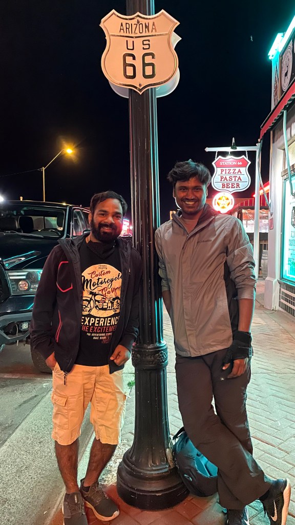
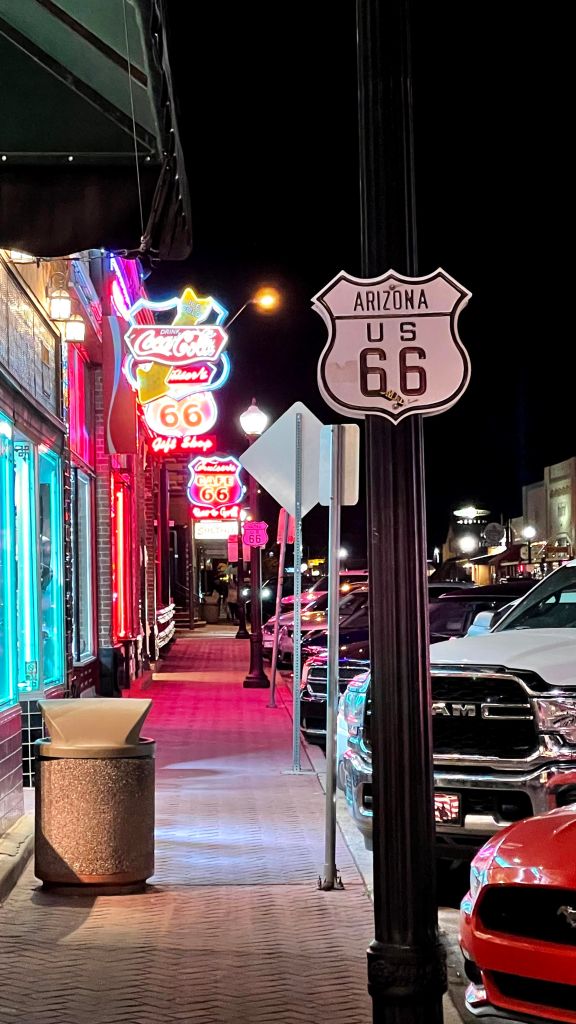
Our Airbnb was located next to historic Route 66. Route 66 was one of the United States first continuous stretches of paved highway and served as a major path for those who migrated west. Also called “The Mother Road”, it stretched about 2500 miles from Chicago to Los Angeles. But the passage of the Federal Highway Act 1956 sounded the death knell for this old road as gradually segments of this route were replaced with faster superhighways. Its final demise was the completion of the Interstate Highway System. Williams was the last town on historic Route 66 to be bypassed by the freeway. I-40 replaced the last surviving segments on Oct 13th, 1984. Yes, the same Williams where we were staying. Lately, there has been an effort to rejuvenate the legacy of Route 66. Many preservation groups are trying to save and even landmark the old motels and neon signs along the road. You can see “Historic Route 66” markers erected along this route to remind the newer generation of a bygone era. By the way, this is also the theme of the famous animated movie Cars. Do watch it if you get a chance.

Day 8, Sep 25th 2021
Although this day was earmarked for the Grand Canyon, there wasn’t much left for sightseeing there. So, we decided to do something different. We took a proper rest that day and had a good, relaxed breakfast. Then, we headed to Bearizona. It is a wildlife park featuring a drive-through area where you can see animals living in their natural habitat. We saw many bears with dramatically close proximity. Till now, I had seen wolves howling only on TV, but that is now a thing of the past. Thanks to Bearizona, we saw 4-5 arctic wolves howling in unison here. This wildlife park also has a walk-through area where we saw a black jaguar, another first. I think the $35 entry ticket was towards a higher end, but I don’t mind spending if I see or learn something new.
In the afternoon that day we headed to Grand Canyon Caverns. The story of the Grand Canyon Caverns started some 350 million years ago when this place was covered by ocean. As tiny sea animals lived and died, their shells and skeletons fell to the ocean floor creating a fine, oozy mud, very rich in lime deposits. This layer lithified to form the limestone bedrock which forms the base of caverns. Over the next millions of years, forces within the earth pushed this ocean floor up forming the mountain tops. Yes, the caverns are 5000 feet above sea level. These upheavals fractured the crust where rainwater seeped in marking the beginning of Grand Canyon Caverns. Mild acidic rainfall over thousands of years dissolved away softer limestone forming passageways and cavities which were eventually filled with water. As climatic conditions changed, the water table receded leaving the caverns empty. Today, the only way to enter the Caverns is with a guide and through the use of an elevator that takes you 210 feet below the earth’s surface, a 21-story building! During the Cuban missile crisis this place was a designated bomb shelter for about 2000 people.

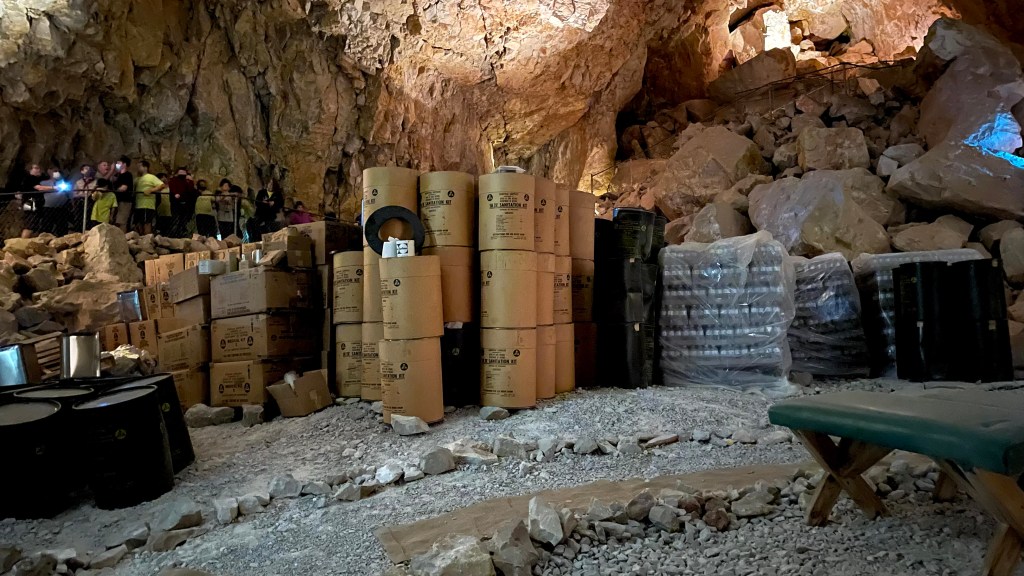
This place was surprisingly good. Full marks to Meena for its discovery and nudging us to prioritize over the Grand Canyon. If there is one thing that has been a constant theme throughout this trip, it is that water is a dramatically powerful force. And it got reinforced at Grand Canyon Cavities as well.
While returning from the Grand Canyon Caverns, we avoided I-40 and took route 66. It runs parallel to I-40 for a small stretch before merging with it.


Day 9, Sep 26th 2021
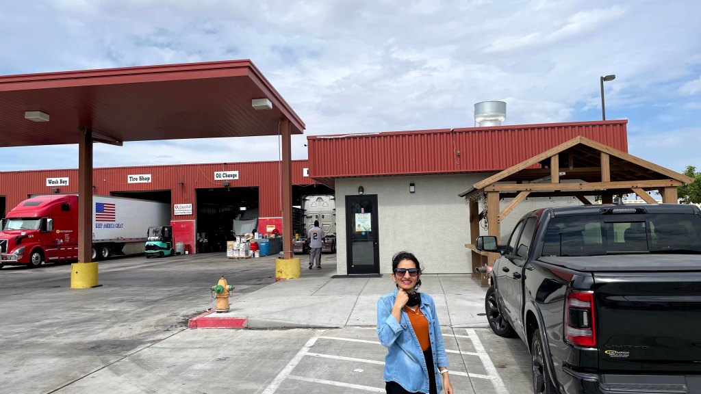
Meena had a pleasant surprise in his scuttle for the last day of our trip. On our way back to Vegas, he found a Punjabi dhaba for our lunch stop. Located just off the exit 59 on I-40, this was a typical Punjabi dhaba where all truck drivers, mostly Punjabis, were stopping for a car wash and picking up their lunch. No bells and whistles – fixed menu, order your food at a counter, pick it up and eat at a couple of benches placed outside. I had chicken curry and roti while Meena and Ravita had paratha, roti, dal and sabzi. No doubt the food was tasty, but it was the nostalgia it evoked that struck me.
सबा से करते हैं ग़ुर्बत-नसीब ज़िक्र-ए-वतन
तो चश्म-ए-सुब्ह में आँसू उभरने लगते हैं
~फ़ैज़
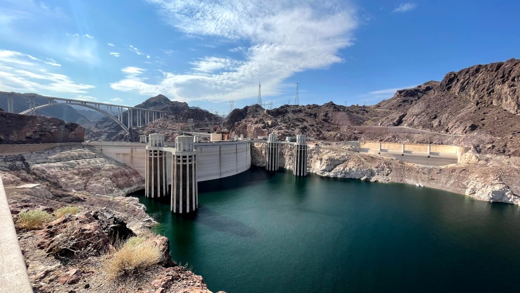
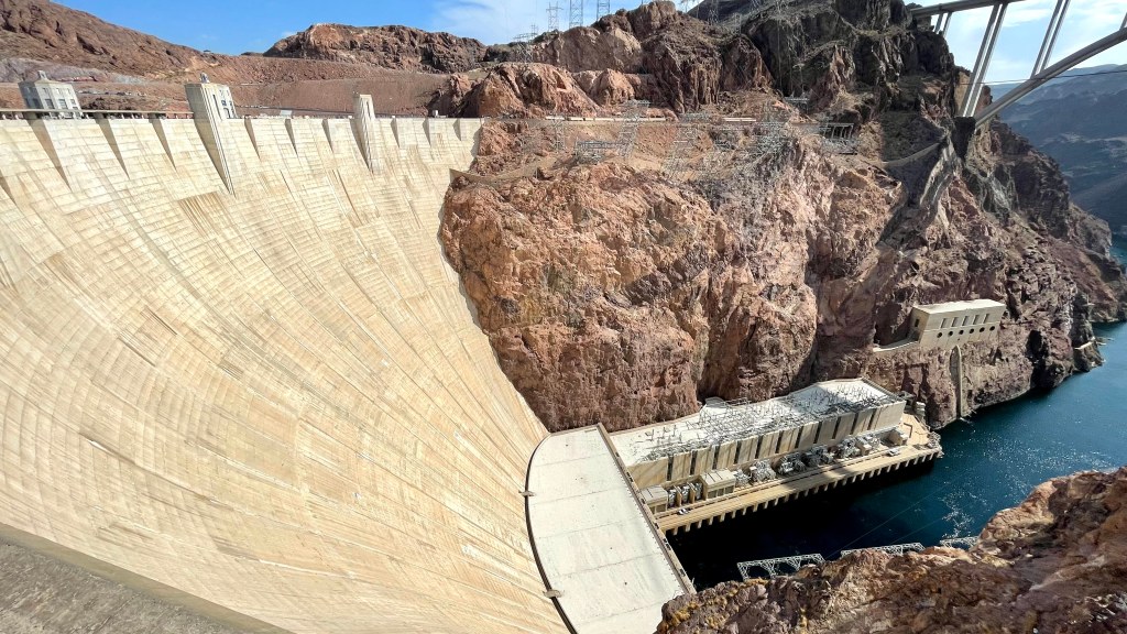
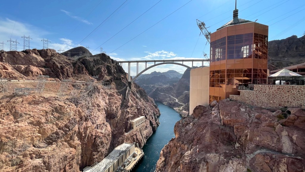
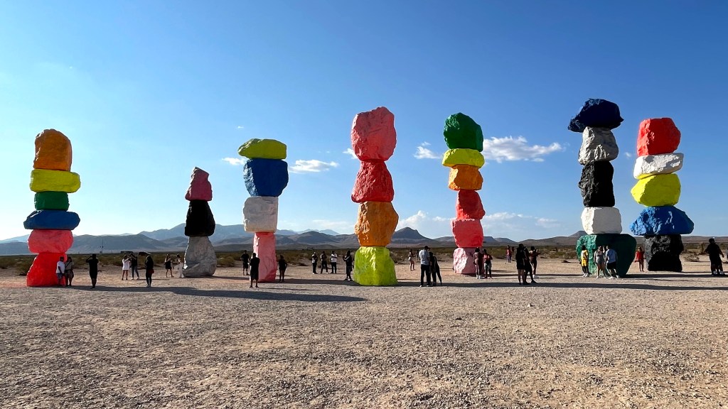
One pro tip – if you are on a road trip, never eat like a pig. For about an hour I had to fight my drowsy eyes before I found a Starbucks to get the much-needed caffeine. As we neared closer to Vegas, the temperature soared up. Hoover dam was on our way so we decided to take a break there. Created in 1935, it lies on the western edge of Grand Canyon where Colorado river is impounded to form Lake Mead. This majestic dam serves the water and electricity needs of a big chunk of population in California, Nevada, and Arizona. We wanted to stay longer but it was just way too hot. We clicked a few pictures and continued onwards towards Vegas. By 4.30 PM, we were in Vegas. Our flight was at 9 PM, so we had enough time. We took a 30-minute detour to catch a glimpse of the Seven Magic Mountains. This artwork by Ugo Rondinone is a collection of seven totems, each of which is formed by fluorescently colored stones stacked on top of each other. What an utterly overrated place! Anyway, by 5.30 PM, we returned the car and headed to the airport to wait for some time before boarding our flight.

Final thoughts
No, the souvenir of this trip was not the fractured wrist due to a fall at The Narrows, it was the innumerable memories that I brought back. As I am writing this with a cast over my left hand, I can only think of fluorescent neon signboards of Vegas, driving through the red sandstone cliffs of Zion, delicate poetry in the pink stones of Bryce, mesmerizing dance of sunlight in the swirling orange passageways of Antelope, miraculously bending green waters of Colorado river at Horseshoe bend and multi-colored rock layers at Grand Canyon unraveling the pages of earth’s history. This trip reinforced how puny we human beings are in the grand scheme of things.

Wow …you have given such a detailed explanation about the canyon formation. Enjoyed reading it. I have blogged on the canyon…but more on the travel tips
do check it out…https://travel-along.in/
LikeLike