
Geology of Big Sur
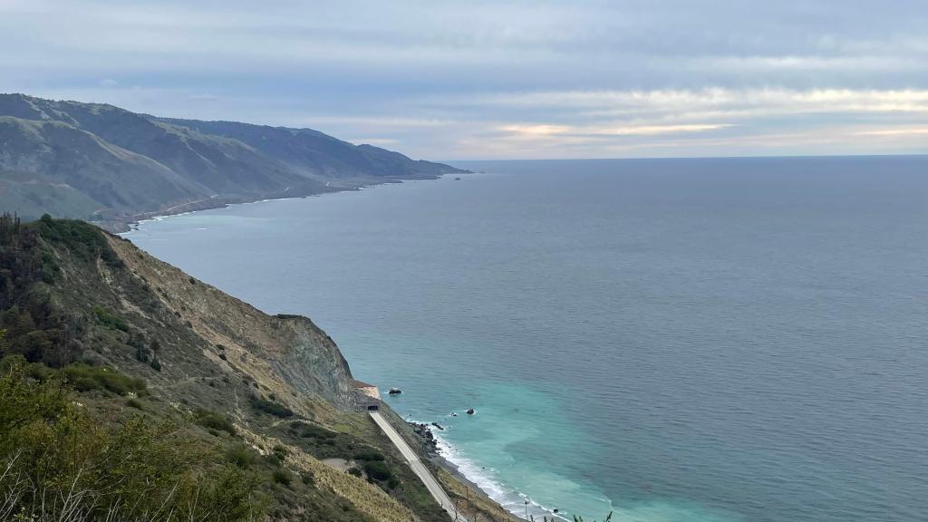
Towards the south of Carmel, there is a vast untamed landscape where mountains come to the sea. Every time you look south of Carmel Bay, there is a wall that appears suddenly. It is dark, forbidding and mysterious. Probably because of this very same reason the early Spanish settlers called this land el pais grande del sur– the big country of the south – or just shortened to el sur grande – the big south. The headlands of Saint Lucia Mountain Range rise as high as 5000 feet directly from the shoreline. Big Sur’s Cone Peak at elevation of 5100 feet is just 3 miles from the ocean and is the tallest coastal mountain in contiguous United States. With Highway 1 running along the coast, it is undoubtedly one of the best drives in the world.
Big Sur has a debatable boundary. A widely accepted view is that it extends from Malpaso Canyon in the north to Ragged Point in the south. In the Big Sur region, the uplift is dramatic. As you go further north or south, the landscape is flattened out. It is still jagged, but largely flat. For example, La Jolla Cove to the south or Point Lobos to the north, they have rugged coastlines but the mountains recede away from the sea and the area is largely flat.
Big Sur is known for its varied coastline and the unique combination of rocks that make up its terrain. Specifically, while there are many sedimentary rocks that are typical in coastal areas, Big Sur also includes many metamorphic and igneous rocks, which are usually located near volcanoes, that are seemingly haphazardly mixed in with the sedimentary rocks. But why is it so?
There are three different types of plate interactions: transform, divergent, and convergent boundaries. Transform boundaries happen when two plates slide past each other. A divergent boundary is one where two plates move away from each other, and new crust rises from beneath to fill the gap. A convergent boundary is one in which two plates are moving towards each other.
Millions of years ago, there was an oceanic plate called Farallon plate between Pacific and North American plates. About 30 million years ago, Farallon plate started subducting beneath North American plate. Remember, oceanic plates are denser than continental plates, so this makes sense. This subduction ground up lots of oceanic rocks on the continental plate. As Farallon plate inched deeper and deeper underneath North American plate, it sparked volcanic eruptions inland. The convergence of tectonic plates created enough heat and pressure leading to the creation of metamorphic rocks like marble, slate, schist and so on. The resulting volcanic eruptions led to the formation of igneous rocks. These volcanoes were also the beginnings of the Sierra Nevada Mountains. Eventually, Farallon plate was completely subducted under North American plate, and it started touching Pacific plate. Pacific and North American plates became a transform boundary. This transform boundary created a number of faults, most notably San Andreas fault and San Gregorio faults. San Gregorio fault is of importance here. It doesn’t just slide sideways but it has a differential uplift as well. And this has led to the rise of Big Sur. It is like putting your hands on a tablecloth and moving them in opposite direction. This movement creates wrinkles in tablecloth. In case of San Gregorio fault, those wrinkles are big – the Saint Lucia Mountain range.
I have learnt most of above details from this video which is a very good source of info on geology of Big Sur – Geology of the Big Sur Coast: A Dynamic Landscape – YouTube.
Day 5: San Diego to Palm Spring, Dec 18th 2021
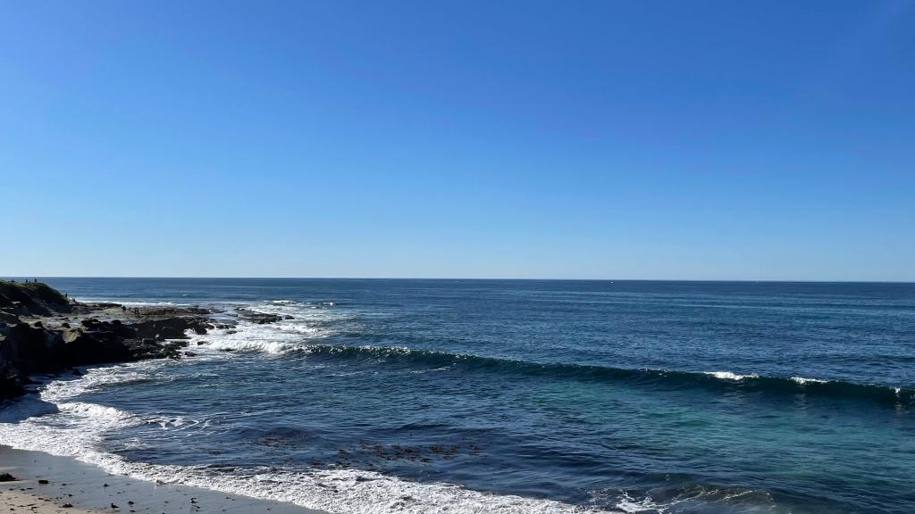
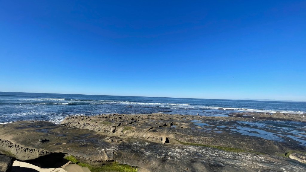
The sky was clear, wind was calm, and the sun was bestowing its warmth. A perfect day to enjoy the beach. So, we headed towards Crystal Pier after checking out of the hotel. This pier was slightly different. It had cute little vacation cabins right on the pier itself. They took “staying near ocean” to another level here 😀 . Plenty of surfers were enjoying a beautiful weekend riding the waves and crashing into them. Just pausing for a while watching them surf was so calming and entertaining. After about an hour, we drove towards La Jolla Cove. As the name suggests, it was a small cove with a beach that was surrounded by cliffs. California sea lions can be found in the waters of the cove and hauling out, temporarily leaving the water to rest on its beaches, cliffs, and bluffs. Besides sea lions, sea gulls were also present at this place in abundance. I had read that scuba diving and snorkeling are popular activities at La Jolla Cove, but we didn’t have time or booking to do that.
After La Jolla Cove, we headed to Mission Basilica San Diego de Alcala. This was California’s first mission established on July 16th, 1769. It was relocated from Presidio hill to the current location in August 1774 to be closer to the native American population, a better source of water and more fertile land. This mission also marks the southern tip of El Camino Real. El Camino Real, aka The Royal Road or The King’s Highway, is a 600-mile commemorative route connecting the 21 Spanish missions in California. It stretches from Mission San Diego de Alcalá in San Diego down south all of the way up to the trail’s northern terminus at Mission San Francisco Solano in Sonoma, just north of San Francisco Bay. San Diego Mission is the mother of the other missions that were established during the time of Spanish ocupation.


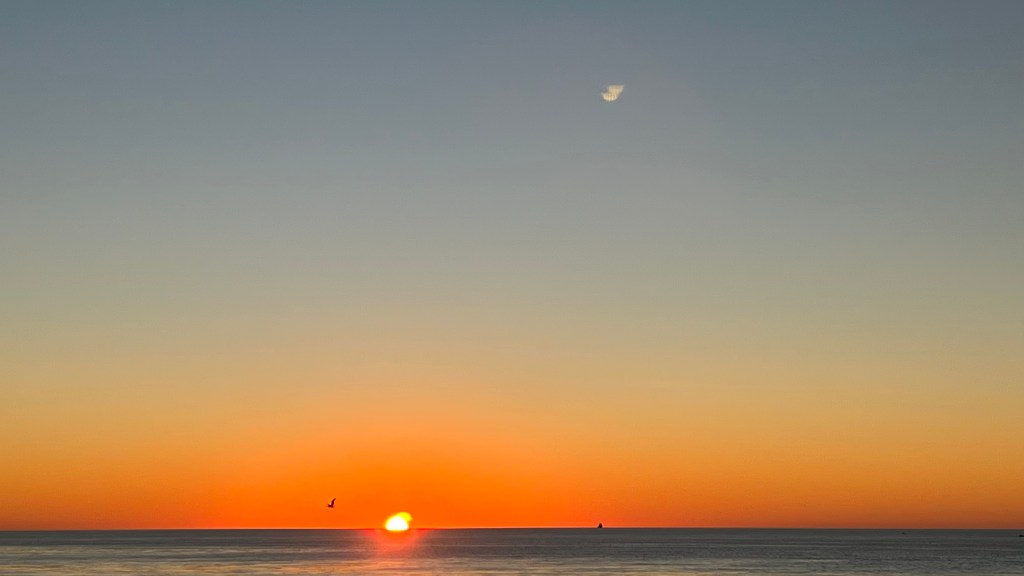
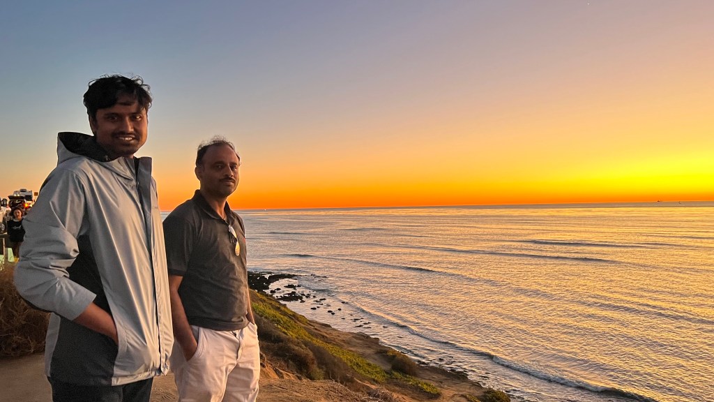
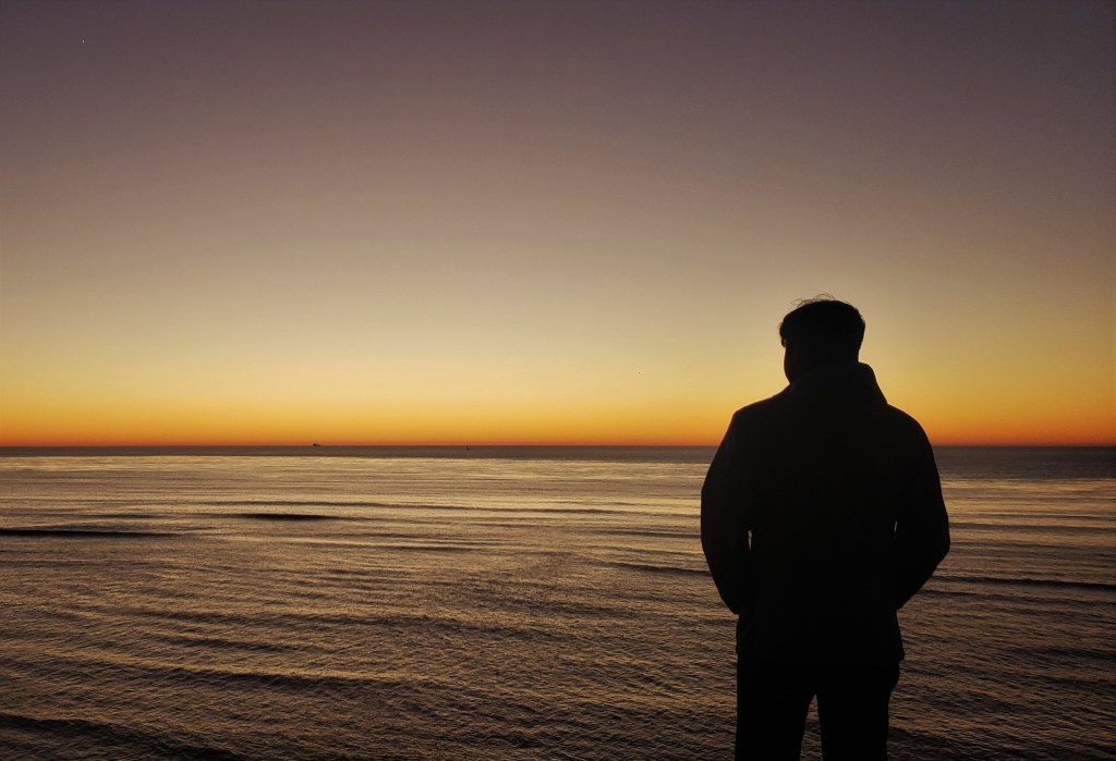
Balboa Park was nearby. Although we didn’t have a lot of time to explore the park completely, we still decided to go around the park a bit. We went to Spanish Village Art Center inside Balboa Park. It has a nice open courtyard where locals sell paintings, arts & crafts. We sat at one of the stone benches here and had our late lunch. By this time, it was already 4.15 PM. Sunset that day was supposed to happen at 4.46 PM. Our earlier plan was to go Malibu beach and watch the sunset there, but it wasn’t feasible given the traffic at that time. So, we rushed to Sunset Cliffs cave which was 30 minutes’ drive from there. We were right on time as sun had started going down the horizon. We literally chased the sun that day. As soon as we reached there, Jyothi and Raj got down of the car so that at least they can see the beautiful view. By the time, I parked the car it was 5 PM and sun was completely below the horizon. However, I still got to witness a bright orange dusk blanketing an infinite ocean with a couple of tiny surfers sauntering around. What a view it was!
As it got dark, we got onto I-15 and headed to our next destination – Palm Springs.

Day 6: Palm Springs to Santa Maria via LA, Dec 19th 2021
Palm Springs is a desert resort city within the Colorado Desert’s Coachella Valley. It’s a popular get away for Hollywood stars and other celebrities from the hustle bustle of LA.
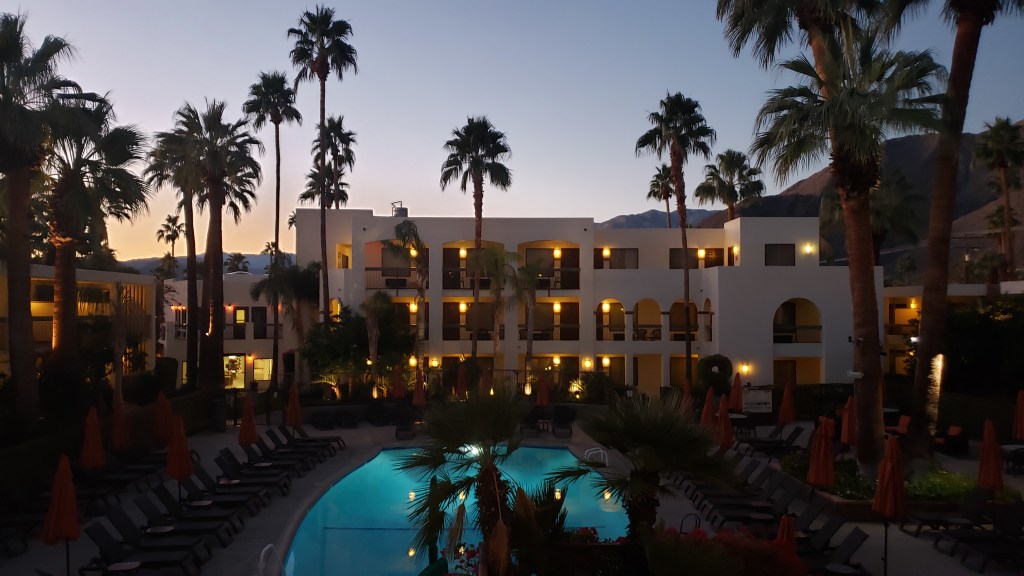
Our hotel, Palm Mountain Resort and Spa, was located adjacent to Palm Canyon Drive which is the heart of Palm Springs. This street was beautifully lined with majestic palm trees and was continuously lit in a wrapping of sparkling lights. It was dotted with abundance of art galleries, pubs, restaurants and all types of shops.
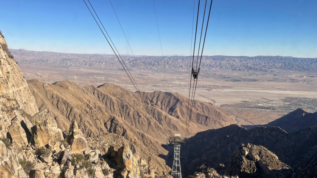
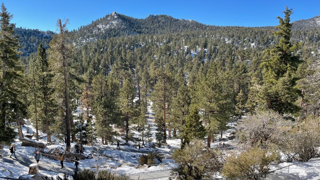
No trip of Palm Springs is complete without riding the famous Palm Springs Aerial Tramway. An engineering marvel, it is the world’s largest rotating tram cars transporting the tourists from Valley Station at 2643 feet to Mountain Station at 8516 feet. This 15-minute enthralling ride passes through five unique life zones, from Mexican Sonoran Desert to alpine wilderness. The tram was pretty big with a capacity of about 80 passengers and rotated 360 degrees twice per trip. At the top was an incredible view of Mt. San Jacinto State Park with plenty of trails taking the hikers away into the alpine wilderness, a breathtaking contrast to the rocky gorges and barren desert lands down below. The tram runs every 15-30 minutes, depending upon the season. Plenty of seats are available. We didn’t have a reservation, but easily got the ticket at the Valley Station. We took 9.30 AM tram for going up and then came down in an hour.
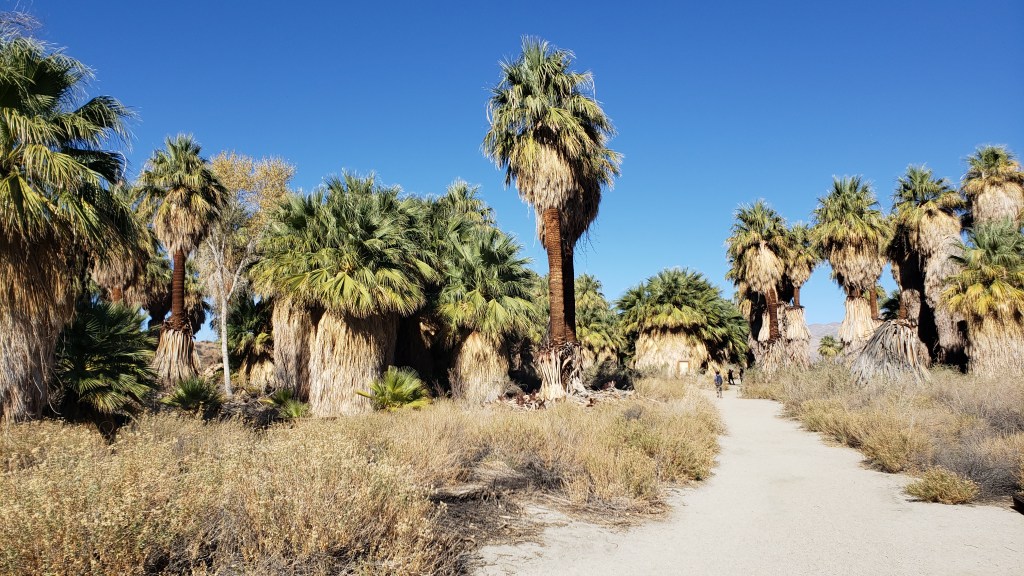
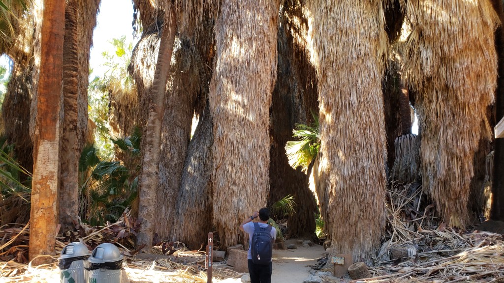
From there, we drove about 20 miles east on I-10 E towards Coachella Valley Nature Preserve. This 17000-acre protected area is home to the spectacular Thousand Palm Oasis which is fed by water seeping out of the San Andreas Fault. The preserve has several hiking trails. Initially, I was not sure about this hike but when we reached the trailhead, I was stumped by the view. In the middle of the desert and nothingness, there were thousands of palm trees bunched together forming this oasis. Who would say no to a unique hike under the shades of palm trees? We did 1.5 miles McCallum trail. There were patches where we had to walk on sand under the sun, but it was largely comfortable. A welcome workout to compensate for the morning intake of 3 pancakes, scrambled eggs and sausages.


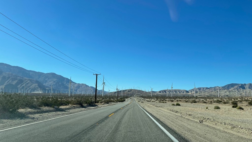
We, then, turned 180 degree and got onto I-10 W to head towards LA. Just outside the city, stretched along I-10 and SR 111, you can see thousands of windmills rotating gently harnessing the energy of winds in the due process. When we reached LA, we stopped at Union Station and Olvera Street before heading to Venice Beach to see the sunset, second in a row. Compared to previous day, we were a few minutes early and got the parking on time. This day I was able to see sun getting engulfed by the ocean leaving behind an orange smudge all over the sky and a tranquil mind in its wake. Venice beach was the best beach I saw throughout the trip – clean and happening – with Santa Monica pier being just a stone’s throw from here.
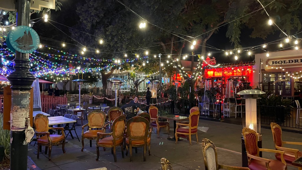
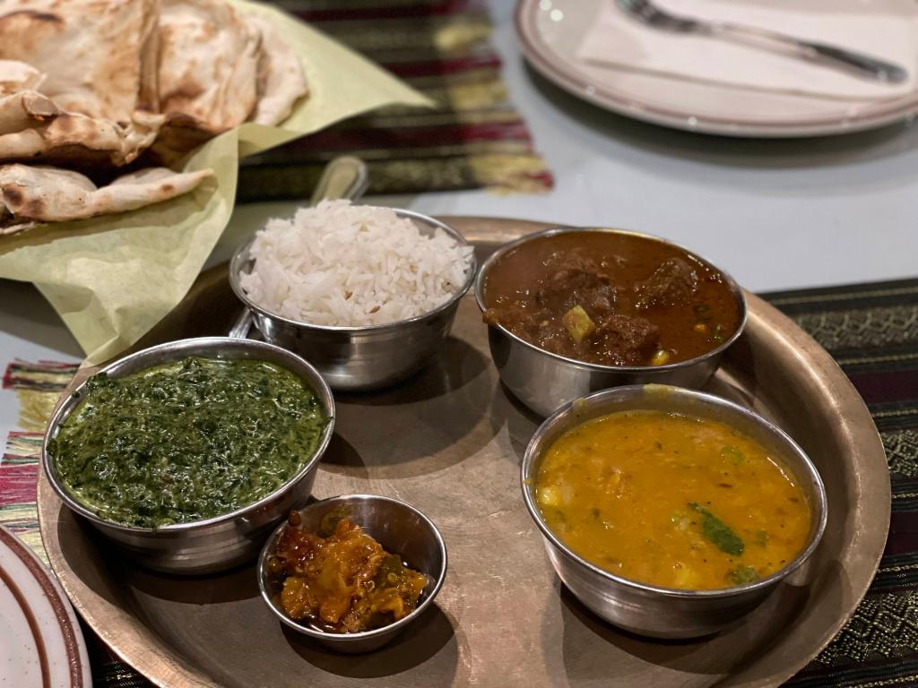
Now the day was almost wrapped up and it was getting dark. So, we headed towards Santa Maria via Santa Barbara. We stopped at Santa Barbara for 2 reasons. First, to drive on its pier. Yes, you can actually take your car and drive on its Pier Santa Barbara. Second, to have our dinner. Santa Barbara has better and a greater number of restaurants than Santa Maria. We had our dinner at a Nepali restaurant Himalayan Kitchen. Jyothi and I had non-veg thali, while Raj had chicken fried rice. The thali was so good and fulfilling that it necessitated a short walk after the dinner. We had roamed around Santa Barbara on Day 2 but most of the shops and restaurants were closed around noon. It was a completely different story on this day. All the Christmas lights had sprung to life with chairs and patio umbrellas of restaurants out on the street, smiling waiters standing outside with menus in their hands and people enjoying food and beer on the streets with flame heaters by their side to ward off the evening chill. Did I even visit this place before?


Day 7: Santa Maria to San Jose, Dec 20th 2021
This day was all about driving in Highway 1 and taking pit stops in between for pics and restrooms. We started with Pismo Beach which was near our hotel in Santa Maria. Instead of taking the regular Highway 1, we drove on Ocean Blvd Road for some time which runs much closer to the ocean than Highway 1. On the way, we found very nice and picturesque Dinosaur Caves Park and Vista Del Mar Beach. Near Dinosaur Caves Park there was a spot with a cove kind-of formation with houses constructed along the edges of the cliffs. It looked pretty and precarious at the same time. Moving further, we got away from Highway 1 for a bit and hit the scenic Moonstone Beach Dr to reach Moonstone Beach. Not very far away from there was the road that takes you up the hillock to the Hearst Castle. But the diversion was marked ‘No entry’ as the castle was temporarily closed. Just a 10-minutes’ drive from there was Elephant Seal Vista Point. Elephant seals are slightly different from the regular harbor seals. Adult males have an elongated trunk-like snouts, hence the name. Elephant seals spend 80% of their time in sea but come ashore at different time of the year to give birth, mate, molt and rest. There were many elephant seals resting and fighting at this spot. Driving further we reached Ragged Point. It is a headland located at the southern end of Big Sur. Headland is a coastal landform, a point of land usually high and often with a sheer drop into the sea. It can also be called a sea cliff. This was a good spot for restrooms and taking some rest. We spent about half an hour here.
Just after Limekiln State Park, there is a small diversion towards right that takes you up a hillock to New Camaldoli Hermitage. The drive up the hill was narrow and curvy, but the coastal view from the top was amazing. We got additional brownie points as there were many picnic benches along the roadside, which is where we stopped and had our lunch.
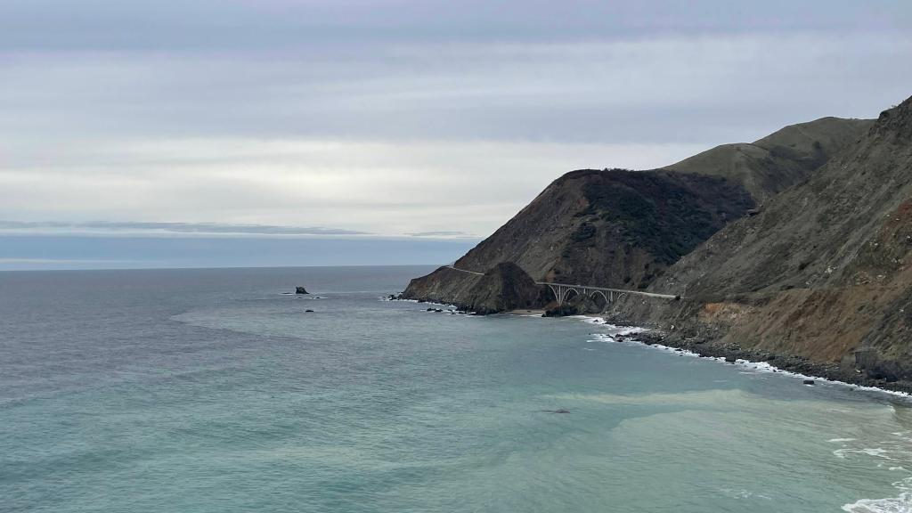
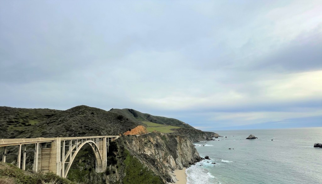
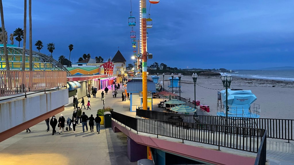
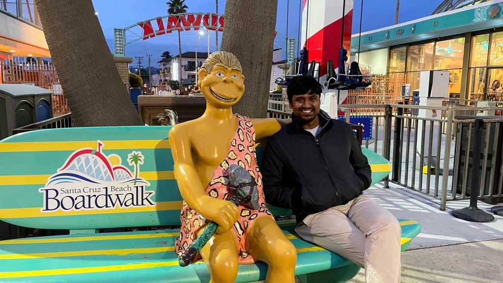
As we drove further, we stopped at Big Creek Bridge, Point Sur Lighthouse and the famous Bixby Creek Bridge. By 5 PM, we were at Santa Cruz Beach Boardwalk. This place is much bigger and happening than boardwalks at Santa Barbara or Santa Monica. There are many rides, restaurants, indoor game centers and shopping centers. Actually, it is not a boardwalk in its true sense. Santa Cruz Beach Boardwalk is an oceanfront amusement park. Although rides were closing and everything was winding down, it gave a good sense how charming this place could be at its regular hours.
Around 5.30 PM, we headed to our hotel in San Jose. But the day was not over yet. I had plan to meet Abhishek and Shukla, while Raj and Jyothi had plan to meet their friend Yogesh. So, I dropped Raj at Yogesh’s place and went to Pacific Pourhouse Ocean Bar to catch up with my old buddies. Even when the bar closed at 9.30 PM, we stood outside and talked for another one and a half hours till 11 PM. It was good 3 hours filled with nostalgia and laughter.


Day 8: Fly back from San Jose to Seattle, Dec 21st 2021
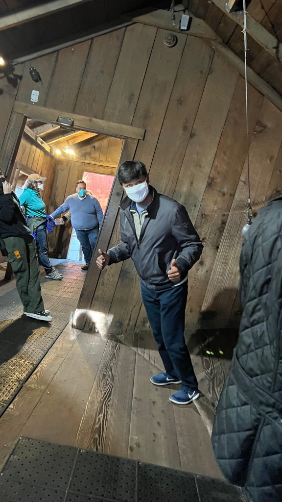
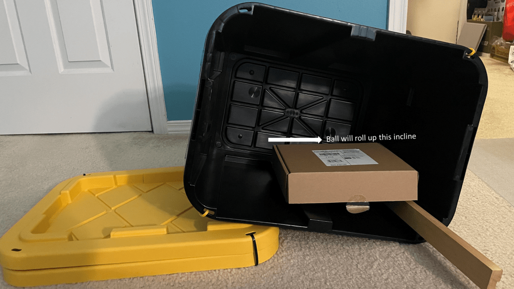
This was a relatively quiet day. Our flight was at 5.30 PM in the evening. Jyothi wanted to see Golden Gate Bridge but driving to San Francisco and coming back to San Jose airport was going to be tight. Moreover, it was unpredictable given the weekday rush. So, we decided to keep it light and hang around San Jose only. We went to The Mystery Spot. It is a tourist spot which gives demonstrations that appear to defy gravity, like ball rolling up the incline, people leaning farther than normally possible without falling down and so on. To be honest, I was not able to figure out the science behind it at that time. It was only when I came back home and then did a mini experiment myself, I understood the science (or rather illusion) of The Mystery Spot. The crucial thing is that the house at The Mystery Spot is tilted by 20 degrees or so. Suppose you try to roll a ball on plane which is inclined at 15 degrees but in the direction opposite to that of the house, the net incline is still in the direction the house is tilted. So, when a ball is released on that plane, it rolls up the incline, that is towards the tilt of the house. Similarly, in the house it appears that a person can lean farther than normally possible. It is an optical illusion caused by the tilted house as people perceive height and tilt using the slant of the roof rather than the true horizon.
Santa Cruz Beach Boardwalk was nearby, so we went there again. We roamed around Monterey Bay area. There was a nice park, Lighthouse Field State Beach Park, on W Cliff Dr. We spent some time there before heading to the airport. On our way, we went to Wrap This Mediterranean to satiate our craving for gyros and shawarma.


Fun fact. As I was driving around these San* places on this trip, I had a naïve doubt – why is it ‘San’ Jose but ‘Santa’ Barbara? I call it naïve because a person who knows Spanish would laugh at this. Actually, san and santa are both Spanish terms for saint. San is masculine, while santa is feminine. That’s why we have San Jose, San Francisco, San Diego – these are names of male saints. But we have Santa Barbara, Santa Maria, Santa Clara – these are names of female saints.

Nice trip….I did this too….at a much smaller scale….do check it out at
LikeLiked by 1 person