Mt. Rainier is an active volcano in the Cascade Range of Pacific Northwest, located in Mt. Rainier National Park. At 14,410 feet elevation, it is the highest peak and pride of the state of Washington. Famous British explorer Captain George Vancouver in his 1791-95 expedition explored and charted North America’s north western Pacific Coast regions including what are now US states of Washinton, Oregon and Alaska as well as Canadian province of British Columbia. While surveying the coast in 1792 he observed this mountain and named it after his friend , Rear Admiral Peter Rainier. However, local native american tribes have inhabited this place for centuries and called this mountain Tacoma or Tahoma, which in their local language meant ‘mother of all waters’. This name is so apt because Mt. Rainier is home to 25 named glaciers and numerous unnamed ice patches, which cover almost 35 square miles. These glaciers support at least 5 major river systems – Carbon, Puyallup, Mowich, Nisqually and Cowlitz.
A subduction zone is an area where one tectonic plate slides beneath another one. This area is a perfect example of such a subduction zone where a dense oceanic plate, known as the Juan de Fuca Plate, sunk below the lower density continental North American Plate. When the subducting Juan de Fuca Plate went about 50 miles down, the chemical changes lowered the melting point of the rocks causing them to melt and form magma. This magma eventually collected and formed magma chambers just below earth crust. Think of these magma chambers as soda cans, staying dormant unless a sudden disruption occurs. A sudden and violent shake of soda can causes the liquid to explode after opening. The same effect is caused by earthquakes. Volcanoes react to this sudden change of motion and pressure resulting in some magma erupting out as lava. Modern Mt. Rainier was formed because of numerous eruptions that happened in the last 500,000 years. These eruptions built up layer after layer of lava and loose rubble, eventually forming the tall cone that characterizes composite volcano, also called stratovolcano. At the top of Rainier, there are two volcanic craters. Geothermal heat from the volcano keeps the rims free of snow and ice.
As the significance of this mountain dawned upon government, it designated this place as national park on March 2nd, 1899. Mt. Rainier National Park was the 5th national park in United States, the first four being Yellowstone, Sequoia, Kings Canyon and Yosemite National Park. Mount Rainier was the first national park to allow cars and by the time a road was built to Paradise Park in 1910, one third of the ranger force was being used for traffic control.
You can read more here – Geologic Formations – Mount Rainier National Park (U.S. National Park Service) (nps.gov)
August 13th, 2022
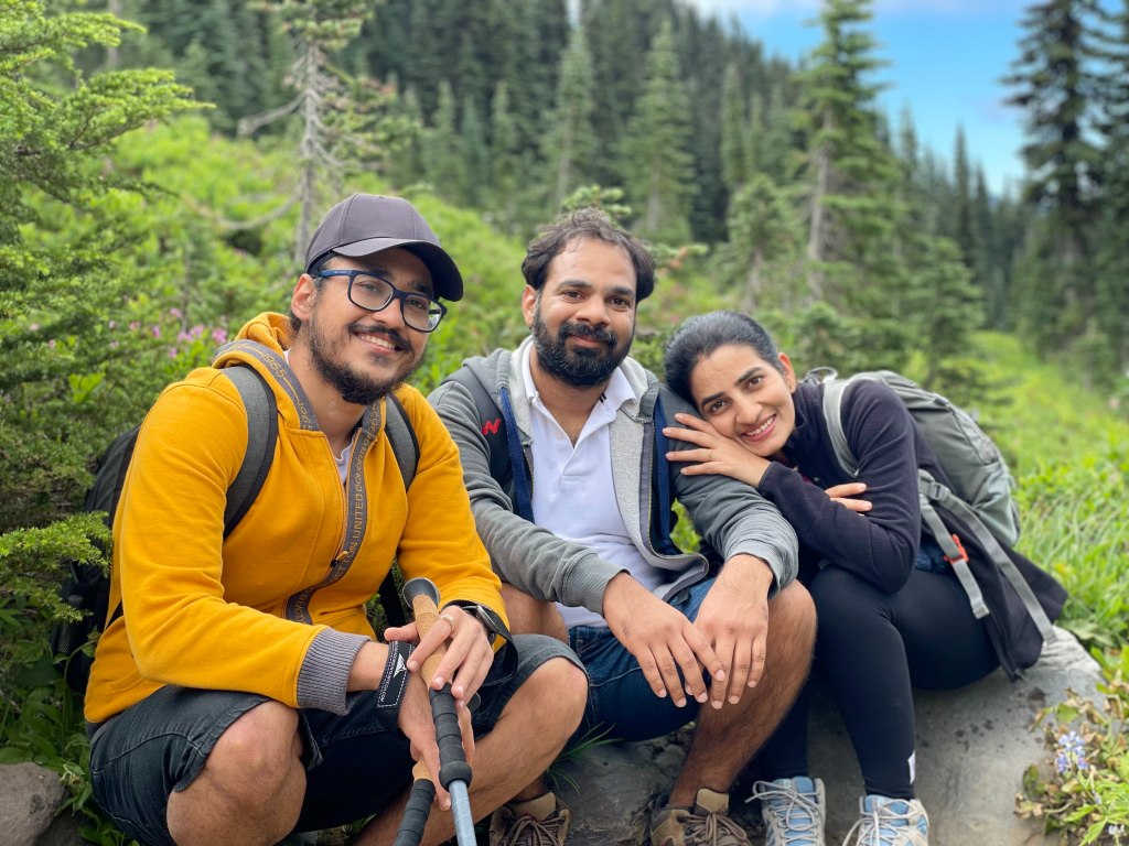
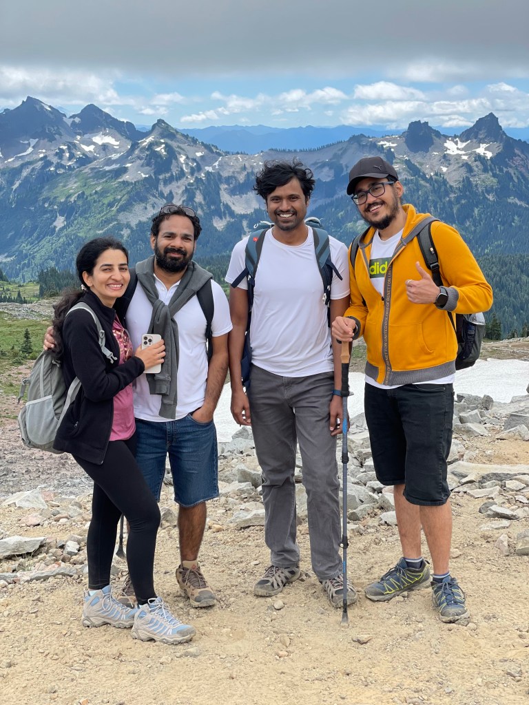
We explored popular trails in Mt. Rainier National Park and zeroed in 2 of them – Mt. Fremont trail near Sunrise point and Skyline Loop trail near Paradise point. Doing both of them in 1 day was not possible for our group. So, we decided to go with Skyline Loop. Four of us – Meena, Ravita, Baliya and me – assembled at Meena’s place around 6.15 AM in the morning and headed towards Paradise in my car. It was about 2:30 hours’ drive from there. The drive was through off beaten highway 161 and 706 via Eatonville and Longmire towns. We stopped at a subway at Eatonville to pack our breakfast and continued ahead without wasting much time. However, as we got closer to the park entrance the traffic started choking up. We spent about 30 minutes near the entrance, and probably a similar amount of time finding a parking spot. It was almost 10.30 when we started the hike. By the way, as the vehicles were lined up near the entrance Meena got out of the car and bought some Rainier cherries from the street vendors lined up on the side of the road. I tried it for the first time and they were delicious.
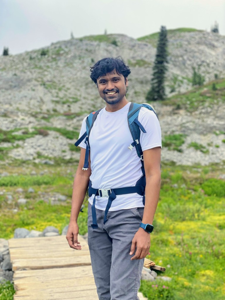
Paradise, at 5400 feet, is one of the most visited areas of the national park. It provides enthralling views of majestic peaks of Cascade Range, alpine meadows dotted by pink and purple wildflowers, ancient glaciers, pristine lakes and rushing waterfalls. Absolute best among the best. No wonder it is the spawning point of a vast network of trails with all difficulty levels. We chose to do the Skyline Loop, a 5.5 miles roundtrip hike with an elevation gain of about 1700 feet.

The trail starts with a paved concrete path with beautiful wildflowers in both directions. Just 10 minutes into the hike and the vista opens. The gorgeous alpine meadows of Paradise Valley emerge into the view – green rolling grasslands pockmarked with a bunch of pine trees and bald patches of glacial moraines.


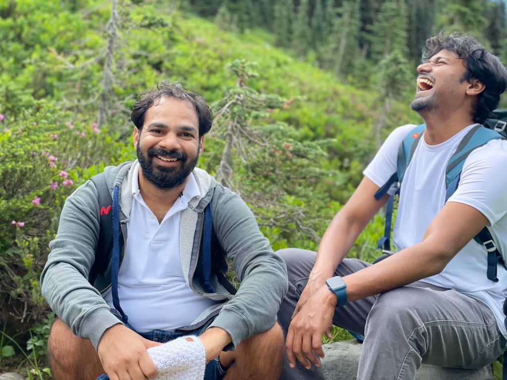
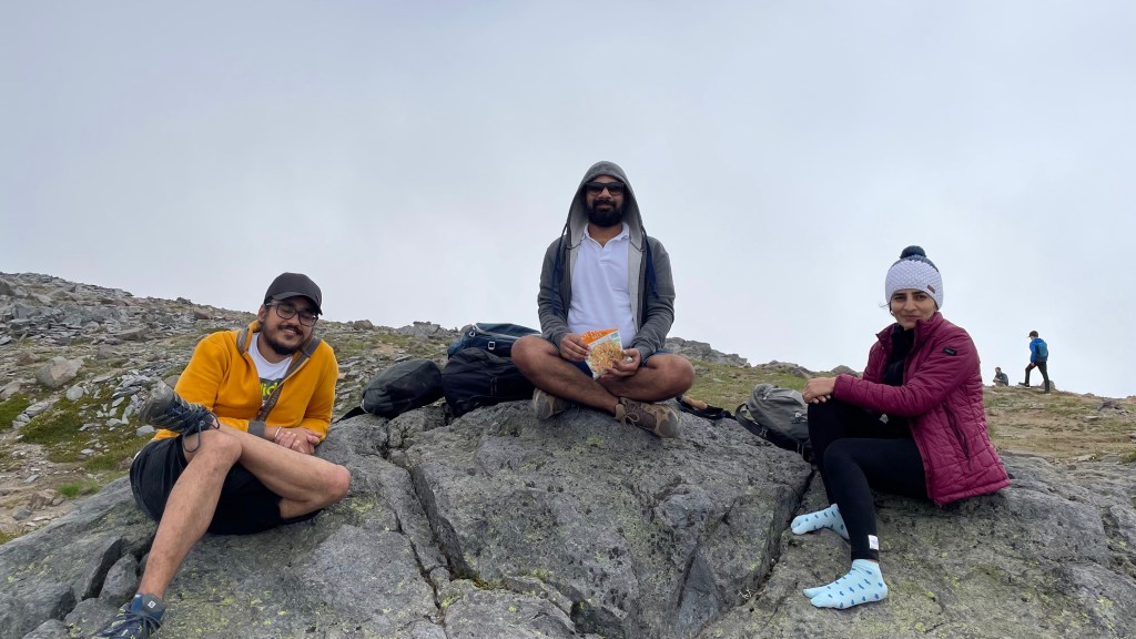
At around 11.30, we wanted to have our subway. We sat a bit off trail and were about to have our subway when an old park ranger lady came and asked us to get back on the trail. In a nutshell she asked us to get lost in the most polite way I have ever heard 😊. She first struck a conversation in the first 30 seconds about beautiful views and yada yada yada. Then she came to the point, “If you don’t mind, can I share something with you? The vegetation in this park is very fragile. You all look very comfortable there and if you don’t mind, can you have your food a bit up there…. I am sorry, you all looked very comfortable there …”. We were simply amazed at how polite the lady was. Definitely a good skill to learn. Anyway, we went further up and found a decent place with rocks to sit on and had our breakfast. About halfway into the loop, we started seeing snow patches. At some places these snow patches lied in our path and had to crossed, but nothing risky though.
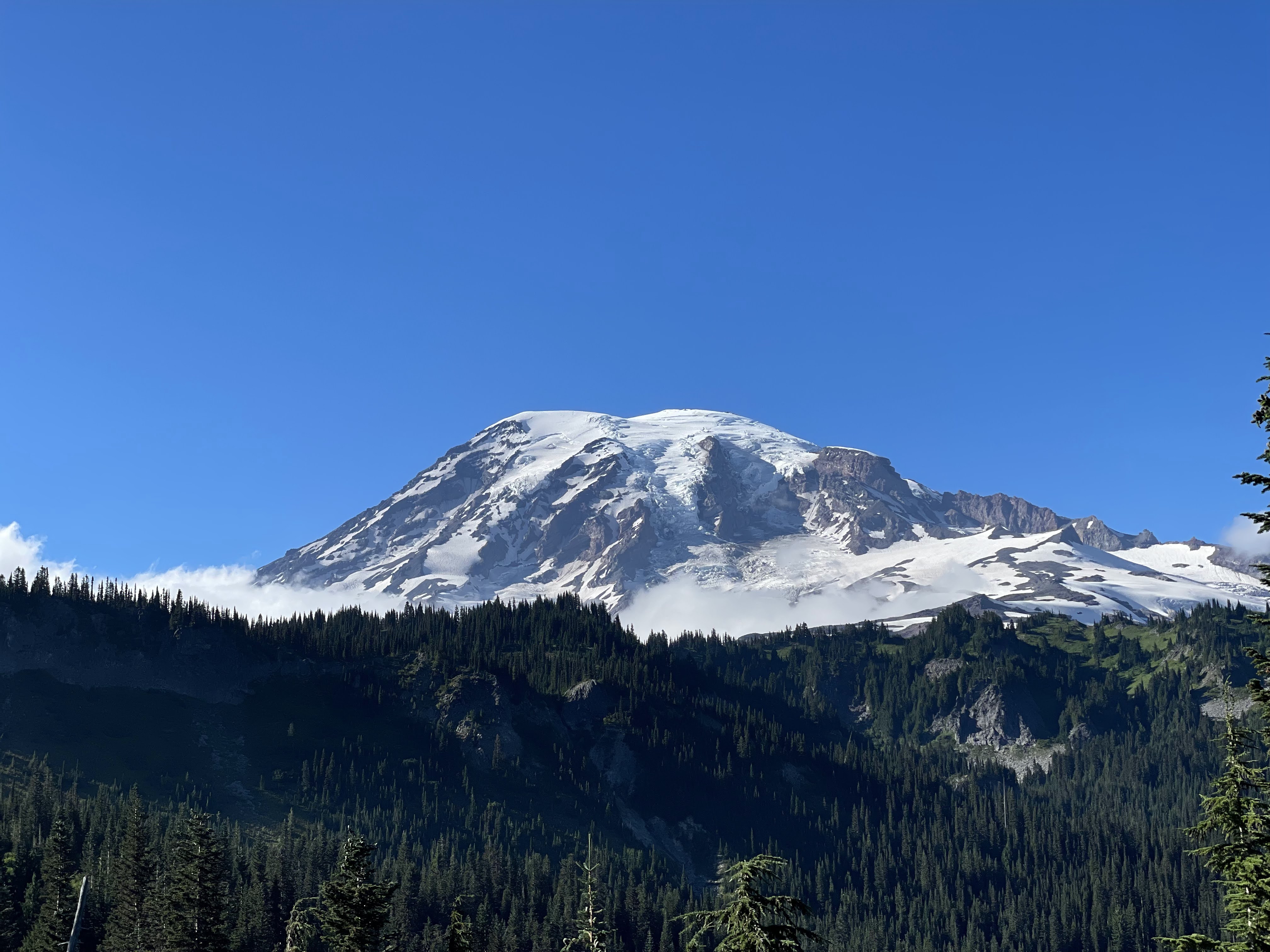
Around 1.15 PM, we were at the highest point of the loop. There is a large flat space where hikers can rest, take a bite and enjoy the view of Mt. Rainier right in front of them up close. But it was all cloudy ☹. A cloud was stuck in the Rainier and entire view was blocked. We waited there about 30-40 minutes but the view didn’t clear up. For once, the cloud started moving and we had a shimmer of hope but that faded very quickly. Anyway, we left the place around 2 PM and went ahead with completing the loop. Getting down was pretty quick. We were back at our car around 3.30 PM.
Pro tip: Do the Skyline Loop counterclockwise. When you try it clockwise, there is a steep incline right at the beginning of the trail which is quite draining. So, it is better to do it the other way round.

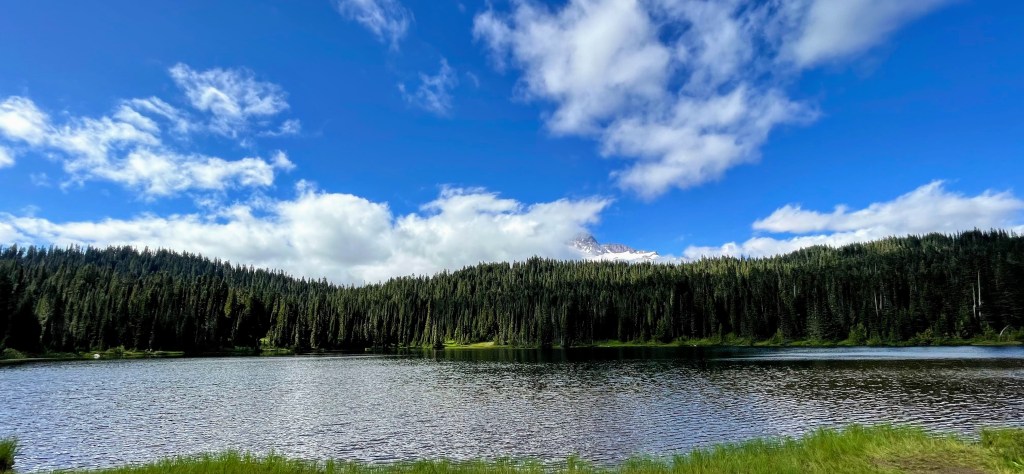
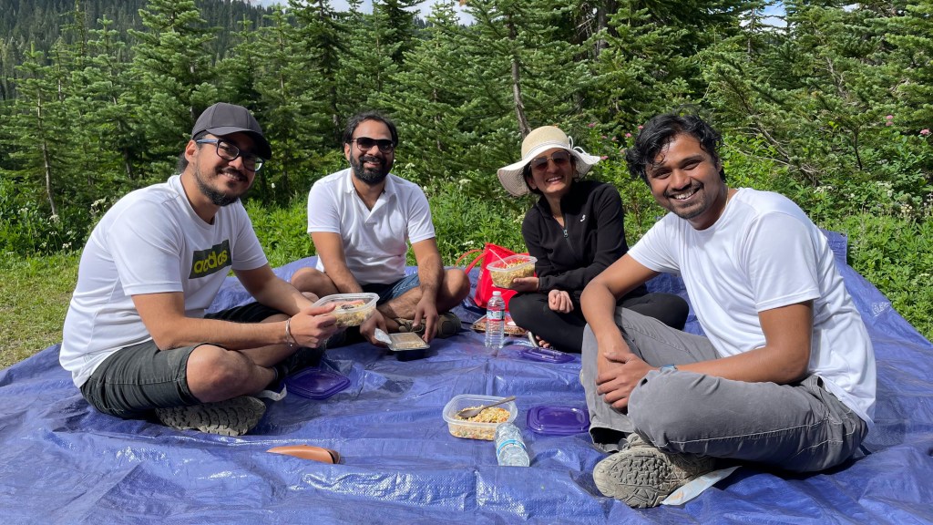
We freshened up at a restroom nearby and drove to Reflection Lake. Located along Stevens Canyon Road, this lake provides a clear reflection of Mt. Rainier. We carried our lunch boxes and tarp from the car, found a good spot near the lake and had delicious fried rice that Ravita had cooked for us.
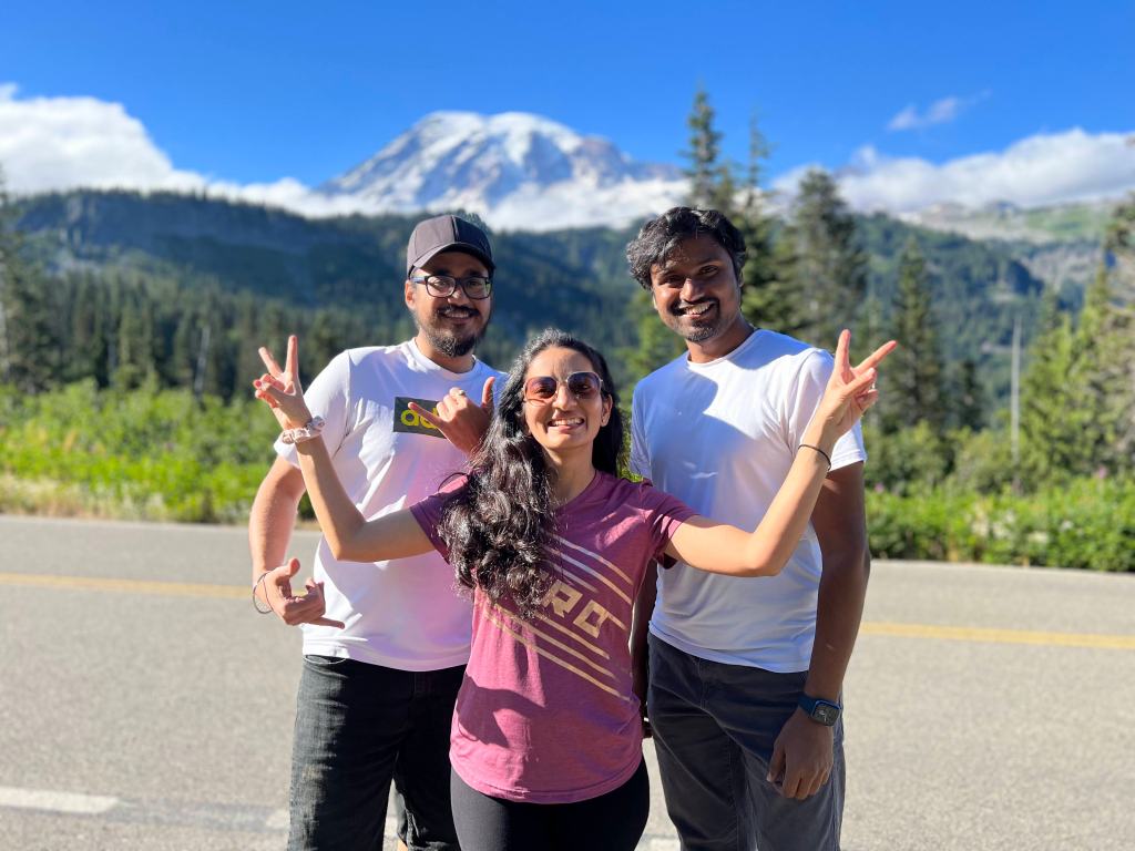
The weather was gradually clearing up. We wanted to see the reflection of Mt. Rainier in the water, but it didn’t happen. A bit disappointed, we started our return journey at around 4.45 PM. We drove eastwards on Stevn Canyon Road to return to Seattle, thus completing a loop. As we started driving, something unexpected happened. The clouds cleared in a matter of minutes and Mt. Rainier showed itself in its full glory. We stopped at a viewpoint and clicked a lot of pics. More than 50 pics and 3 hours later, we were back in Seattle around 8 PM.
Overall, it was a day well spent, full of laughter and joy. It was a bummer that we didn’t get to see Mt. Rainier during the hike, but it did show up at the end. So, no complains!


Looks like a wonderful trip! Amazing pictures too….
LikeLike
Very beautifully captured. ❤
LikeLike