
Peru is cornucopia of colors. From the snowy white glaciers of Ausangate to crimson mountains of Red Valley, from the lush green terraces of Machu Picchu to the arid pink salt mines, from grey colored granite stones of Saqsaywaman to the turquoise waters of Seven Lagoons. And if this is not enough, you can witness an explosion of colors at the stunning Rainbow Mountains. Peru’s natural diversity is as rich and complex as its exquisite weaving.
Itinerary at a glance
The idea for this trip was conceived in Feb, during our SFO trip. We zeroed down to 2 options – Alaska or Machu Picchu. Machu Picchu was enticing but it required significant training, particularly for Shalini. She hadn’t done much hiking before. I showed her videos of what hiking to Machu Picchu meant and left the decision to her. After deliberating for a couple of days, she decided to go for Machu Picchu. And thank God for that.
As we were exploring different trekking companies to do classic Inca trail with, Sneh had an amazing suggestion. She suggested following an itinerary which had something more than Machu Picchu, a change of scenery. So, we looked for alternate treks. We learnt about Ausangate treks that many companies offered. There was Ausangate + Rainbow Mountain + Machu Picchu combined trek in 4 days. But it was a bit rushed for us. As we researched more, we stumbled upon this – Ausangate Trek – First Step (firststepexpeditions.com). This was perfect! All of those in 6 days, 5 nights. We contacted Javier, the founder of First Step Expeditions. He patiently answered all our questions and even agreed to customize the itinerary to include Chocolate lake (which we didn’t end up going) in the plan.
| # | Date | Activity |
| Day 1 | May 19th, 2023 | Fly from SFO to Lima via LA |
| Day 2 | May 20th, 2023 | Arrive Cusco |
| Day 3 | May 21st, 2023 | Sacred valley |
| Day 4 | May 22nd, 2023 | In and around Cusco |
| Day 5 | May 23rd, 2023 | Trek starts, Cusco to Pacchanta to Upis |
| Day 6 | May 24th, 2023 | Trek interrupted, back to Cusco |
| Day 7 | May 25th, 2023 | Museums in Cusco |
| Day 8 | May 26th, 2023 | Trek resumes, Rainbow Mountain to Red Valley to Ollantaytambo |
| Day 9 | May 27th, 2023 | Inca trail, hike to Inti Punku (aka Sun Gate) |
| Day 10 | May 28th, 2023 | Machu Picchu, fly back to Lima |
| Day 11 | May 29th, 2023 | Lima |
| Day 12 | May 30th, 2023 | Fly from Lima to SFO |
History of the Incas
The folklore says that Viracocha, the creator god, appeared in the dream of Ayar Manco and asked him to go around the world with a golden staff in search of a fertile land where his staff would sink in the ground. Manco Capa and his wife Mama Uqllu roamed everywhere but were greeted with rocky Andean terrain. Finally, Manco arrived in Cusco valley where his stick pierced the Urubamba basin’s fertile alluvial soil. This laid the foundation of Kingdom of Cusco in early 13th century. Ayar Manco became Manco Capac, the first Sapa Inca, or the king of Incas.
Cusco was a relatively small kingdom between 1200-1400 AD until Pachacuti, the 9th Sapa Inca. He succeeded his father Viracocha Inca (not to be confused with the god with same name) in 1438 after defeating the powerful Chanka army, a neighboring Quechuan tribe. With his military might and administrative acumen he transformed the Kingdom of Cusco into the Inca empire. He divided his empire into 4 regional quarters or suyu– Chinchay suyu (northwest), Anti suyu (northeast), Qolla suyu (southeast) and Kunti suyu (southwest). Each region was governed by a governor reporting to the emperor. The four corners of these quarters met at the center, Cusco. As a result of this, Inca empire was also called “El Tawantinsuyu”, meaning realm of four regions. The citadel at Machu Picchu was Pachacuti’s royal estate. He is also credited for building other Incan masterpieces like Qorikancha, Saqsaywaman and Pisaac.

Pachacuti’s legacy was carried forward by his son Topa Inca when he assumed the throne in 1471 and ruled until his death in 1493. Topa Inca was succeeded by his son Huayna Inca (pronounced Wayna) in 1493. By this time, the Incas ruled the greatest empire on earth, covering nearly the entire west coast of South America with a population of about 10 million subjects. They achieved such a massive feat all without of use of wheels, iron, horses and even a written language. Generally, an empire grows east to west as the temperature doesn’t change much. But Inca empire stretched 4000 km north to south – roughly the width of entire North America. Incas mastered this variability.
Huayna Inca ruled until 1523 before succumbing to a fever in 1524, likely brought by Spanish people who had arrived in small number by now. Among the things that Spanish brought with them was diseases like measles and smallpox to which native population had no resistance. Thousands of Incans died due to this outbreak including Huayna Inca and his successor. After four five years of peace, a civil war ensued between two of his other sons – Atahualpa (pronounced Atawalpa) and Huaskar (pronounced Waskar). Atahualpa emerged victorious in 1532.
Around the same time, a group of Spanish conquistadors led by Francisco Pizzaro arrived in the region. Pizzaro took advantage of an empire in distress and captured Atahualpa in an ambush at Cajamarca. Although greatly outnumbered, Pizzaro had guns, iron weapons and horses that Incas had not even seen. He took the ransom of almost 1 room full of gold for the safe return of Atahualpa but reneged on his promise and executed him about a year later. This marked the start of the downfall of Inca empire.
Pizzaro installed a puppet ruler Tupac Huallpa in 1533. He was quickly followed by Manco Inca or Manco II. However, Manco rebelled against Spanish conquistadors. He fled Cusco with 200,000 Inca warriors and made Vilkabamba his new capital city. From there he and his successors fought a guerrilla war for the next 40 years, until succumbing to the Spaniards in 1572. And that’s how the mighty Inca empire fell much sooner than its rise.
Day 1, May 19th 2023 – Fly from San Francisco to Lima via Los Angeles
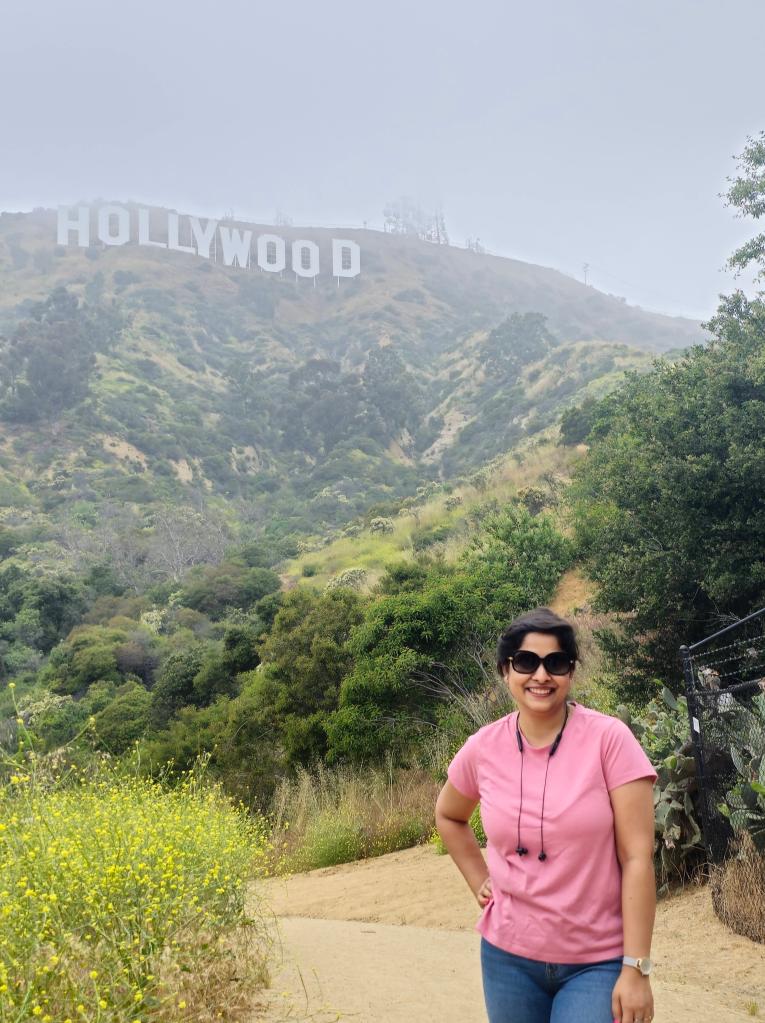
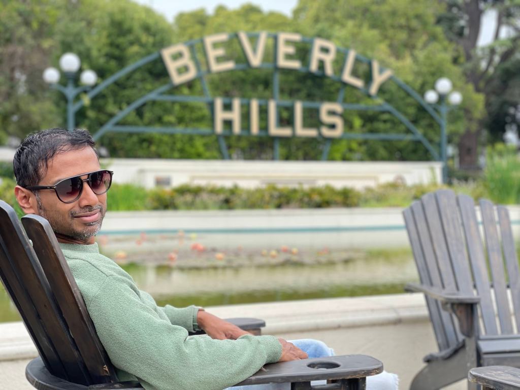
Shalini and I had flown to SFO on 17th to be with Anshu and Sneh and fly together to Lima. On 19th, we had a 6 AM flight. So, we woke up early and rushed to the airport. Ours was a Delta flight from SFO to Lima via LA. We learnt an interesting thing that day. Since our layover in LA was about 10 hours, we had to collect our checked baggage at LA and re-check them for LA to Lima leg. What would we do with that much luggage at the airport? So, after the security I booked a rental car at LA airport for a day. We reached LA at around 8 AM. We had packed awesome chicken sandwiches for our breakfast which we decided to have in the car itself, before starting to wander on the streets on LA. This was the first time Shalini, Anshu and Sneh had been to LA. So, I took the leaf out of my last travel to LA and drove them around LA. First, we headed to see the famous Hollywood sign. The spot was once again the same – The Last House on Mulholland, 6101 Mulholland Hwy, Los Angeles, CA 90068. You get the best view of Hollywood sign from here. After photo session, we headed to Hollywood Drive to see the Walk of Fame. Then we drove around Rhodeo Drive and then rested for about an hour at Beverly Hills. It was 1 PM by now. There wasn’t much for us to do. So, we headed out for a drive around Malibu. As we had a long flight ahead of us, none of us were enthusiastic about going to the beach.
Around 4 PM, we went to a beach-side restaurant Back on the Beach Cafe near Santa Monica. The food was OK here, but the view was worth the price. It was an unusually calm Friday evening. We had a peaceful late lunch (or early dinner probably😉) under beach shack with our feet touching the sand and cold breeze scooting off the shore.
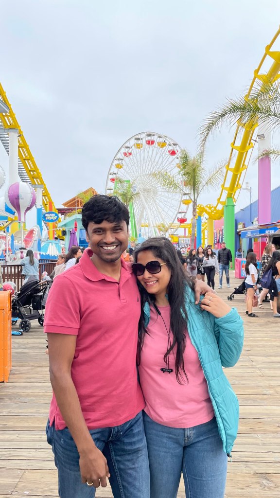
We spent some time at Santa Monica pier before heading off for the airport around 6 PM.


Day 2, May 20th 2023 – Arrive Cusco
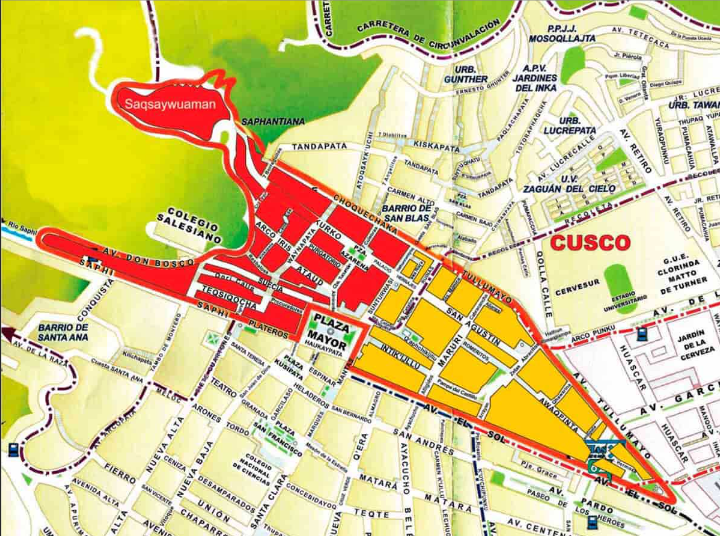
We arrived in Lima at 7.30 in the morning. The immigration was a breeze, no questions asked. Although it was a weekend, there wasn’t much crowd at the airport. We got our baggage and waited for about 4 hours before our next flight to Cusco. By 2 PM, we were in Cusco. Anshu booked an Uber for us to go to our hotel. We struck a conversation with our cab driver Cirro who told us about several places with Inca ruins in Cusco. Cusco sits at an altitude of 11,000 feet. We had 2 days of acclimatization here, before the start of the trek. Cirro showed us a book that had good information about each of these places. The history buff inside me came alive and I purchased that book from Cirro. He was generous enough to give me that book for 35 soles.
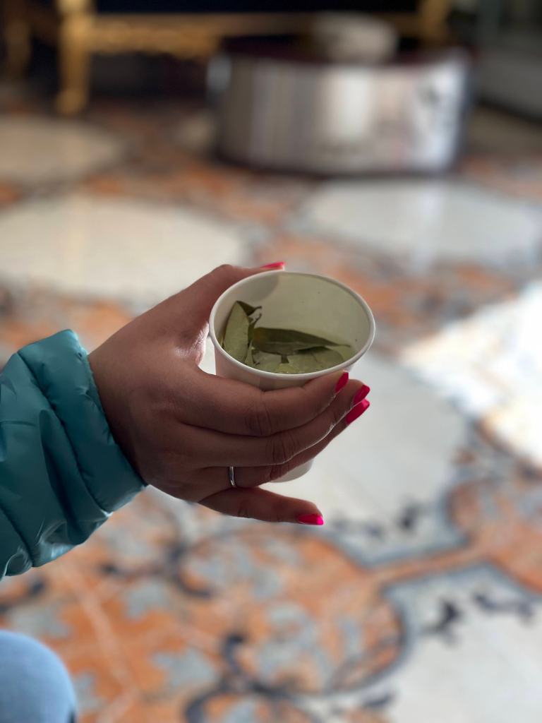
We reached our abode, Hotel Hacienda, around 3 PM where we were served with Coca tea. Coca leaves have been chewed or taken orally in form of tea for thousands of years in Peru by Andean civilizations to combat against the effects of altitude sickness. Yes, this is the same plants from which Cocaine is obtained through complex chemical process. But it is perfectly legal to eat it in leaves form. In fact, tourists are encouraged to do so as this is an easy and organic way to tackle altitude sickness.
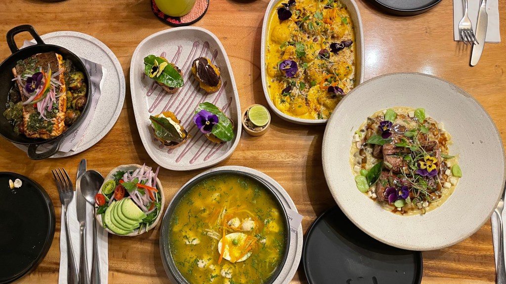
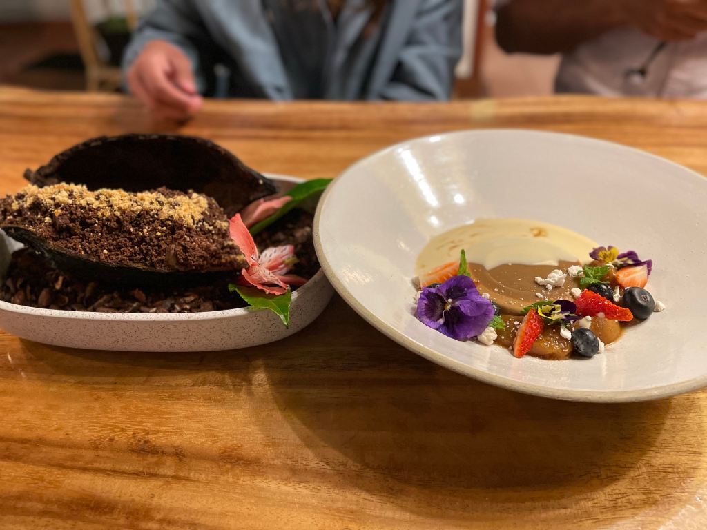
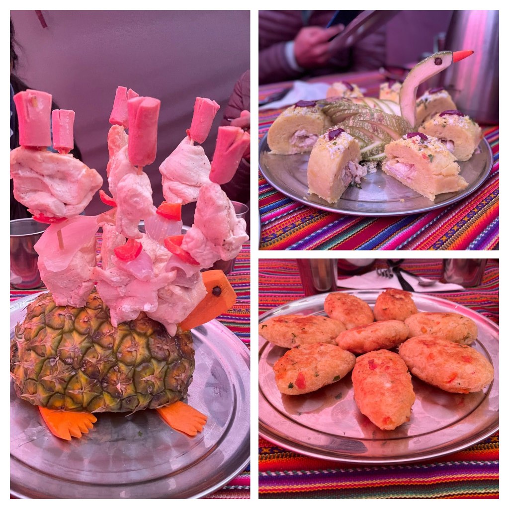
We took a shower and rested for a couple of hours. The long flight had taken a toll on us. None of us wanted to head out. We had our dinner at the hotel itself. The food we ate was absolutely amazing. I fell in love with Peruvian cuisine, particularly their garnishing skills. Look at the pics below and decide for yourself.
Anshu and I went for a small walk after dinner. Cusco reminded me of small towns that used to be the basecamps during my Himalayan treks. A rustic small town cradled within mountains with unplastered brick houses, tin sheds forming the roof of local shops, graffiti-filled walls, compact streets, bustling flea markets. Cusco took me 6-7 years down the memory lane. I was once again walking on the lonely streets of Lohajung and Dhaula under starry sky with cool wind breezing by, sending occasional shivers down the spine. But it felt good. It felt good to be reminded of your roots, of your belonging, of your home – India.
Tip – Don’t do currency exchange at Lima airport. I got the rate of 3.52 soles per USD plus 3% commission. On the other hand, in Cusco we got the rate of 3.63 soles per USD without any commission. There are some money exchanges right at Plaza de Armas in Cusco.


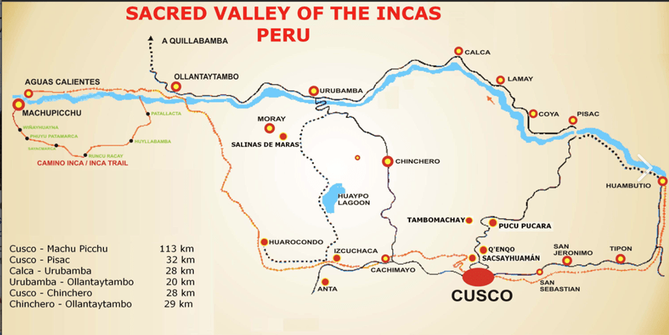
Day 3, May 21st 2023 – Sacred Valley
On our way to the hotel the previous day, we had taken the contact number of Cirro. We booked his cab for a fay for 350 soles to take us around Cusco to see Inca ruins of Chinchero, Morray, Maras salt mines and Pisac.
Why was this area called sacred valley?
Stretching from Pisac to Ollantaytambo, this fertile valley is irrigated by the Urubamba River, also known as the Vilcanota River, which in Quechua means sacred river. Incas believed Urubamba to be a reflection of milky way, hence considered it sacred. That’s why the entire valley was called Sacred Valley. The attraction of the Sacred Valley to the Inca, in addition to its proximity to Cusco, was probably that it was lower in elevation and therefore warmer than any other nearby area. The lower elevation permitted maize to be grown in the Sacred Valley which was the staple crop for the Incas.
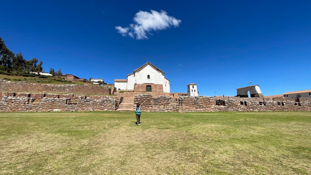
Chinchero
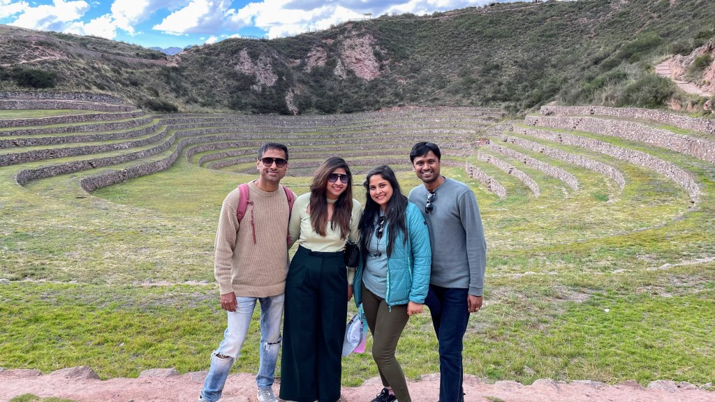
Chinchero is a small town 40 km northwest of Cusco and sits at 12,375 feet, higher than Cusco. It is the home of famous Peruvian weaving. And that is what we started the day with. Cirro took us to a shop where a local lady gave a demonstration of Peruvian weaving and dyeing process. She gave us a traditional outfit to wear while she explained. A bit melodramatic, but fun. This place had a shop for tourists to buy shawls, sweaters or other clothes made of pure alpaca or sheep wool. The idea is to introduce tourists to the local weavers and encourage them to buy their products. This supported the local community. This is very similar to what we have at places like Rajasthan and Jammu & Kashmir in India. Shalini bought an alpaca wool neck warmer and some souvenirs. Sneh bought a shawl and warm gloves. The tribal women played some local music and danced with us.


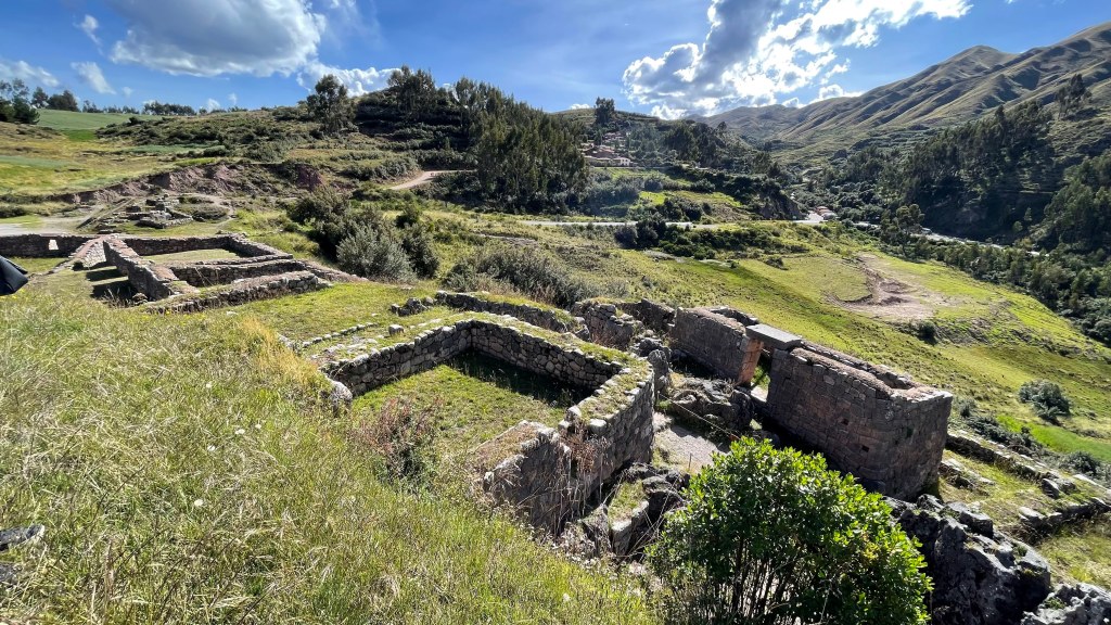
Then we went to see the Inca ruins of Chinchero. It is believed to have been built by Topa Inca, son of Pachacuti, who used this as a country resort. There are several agricultural terraces and aqueducts around what was believed to be an Incan palace. Spanish conquistadors destroyed the palace and build a church on top of it in 1607. This is the first time we saw the massive scale and finesse of Incan stone masonry.
The tickets you get at Chinchero is valid for all 4 places – Chinchero, Salineras de Maras, Moray and Pisac. It costed us 70 soles per person.


Salineras de Maras
We then headed further north to Salineras de Maras or Salt Mines of Maras. There are more than 3,000 natural salt wells each of which has a size of 5 square meters. The 3,000 pools are fed by a hypersaline underground spring that originated 110 million years ago during the formation of the mountains of the Andes Mountain Range. Since pre-Inca times, salt has been obtained in Maras by evaporating salty water from a local subterranean stream.

Moray
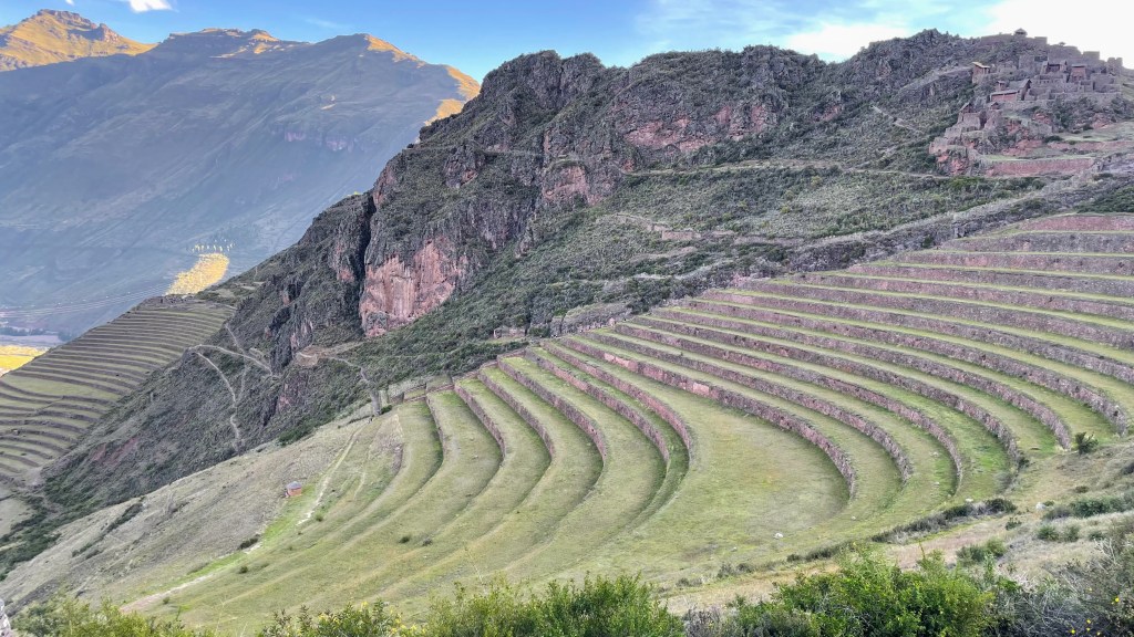
Probably built between 1438 and 1533, this fascinating archaeological center shows us the high level of techno-agricultural management that Incas had reached. Moray was an agricultural research center of Incas. Part of the evidence that supports this is the extensive irrigation system (fed by water from a reservoir located at the top of the mountains) designed on the terraces. Moray has 3 groups of circular terraces. Each of these terraces have 12 levels. The largest of the three had a diameter of 180 meters at its widest and measured 150 meters deep from top to bottom. It is said that there is a temperature difference of 5°C between the highest and lowest terrace each of which received sunlight at different angle and intensity. This micro-climate enabled Incas to carry out their agricultural research to identify the best suitable conditions for their crops to thrive. The staple food of Incas was potatoes, quinoa and corn. Researchers have found seeds and soil at Moray that aren’t native of this region, further underscoring the point that this was a crop experimentation center.

Pisac
The Inca customarily divided conquered lands into three equal parts. One part was for the emperor (the Sapa Inca), another part for the religious establishment, and the remaining for the communities of farmers themselves. In the 1400s, the Sacred Valley became an area of royal estates and country homes. It is believed that Pisac was the royal estate of Pachacuti (Machu Picchu was another). He built royal citadel, military complexes and religious sites here for his family and nobles to relax in between the military campaigns. It was destroyed by Francisco Pizzaro during Spanish invasion. The modern town of Pisac is built in a valley below the Inca ruins. It also has hundreds of terraces which were used for agricultural purposes.
We wanted to go to the top where Inca buildings were present, but entry is allowed only till 4.30 PM. By the time we reached, it was 4.40 PM. It was a bummer that were unable to go to the top of the ridge and see the view. But we made the most out of what was available. Sun was setting and it provided a beautiful background to click amazing pictures.
The day ended with dinner at Fusion Andini. This restaurant has a nice overlooking view of Plaza de Armas. But the food here was OK, not great. They served every dish with potato fries, which was weird.


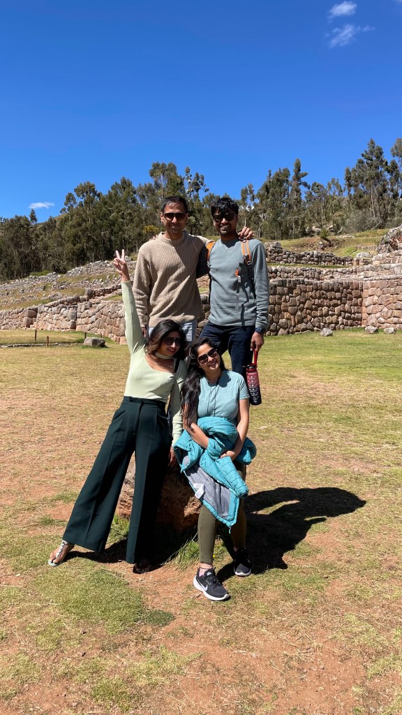
Day 4, May 22nd 2023 – In and around Cusco
We hired Cirro again this day to take us around Inca ruins near Cusco city.
But before that, we met our First Step guide, Bernabe, at our hotel. He came in the morning to brief us on the plan for next 6 days. First Step provided us duffle bags that can go with the porter. All we had to do was to carry our personal daypacks while trekking. We had the option to leave any remaining extra luggae either at the hotel or First Step’s Cusco office (we chose the latter).
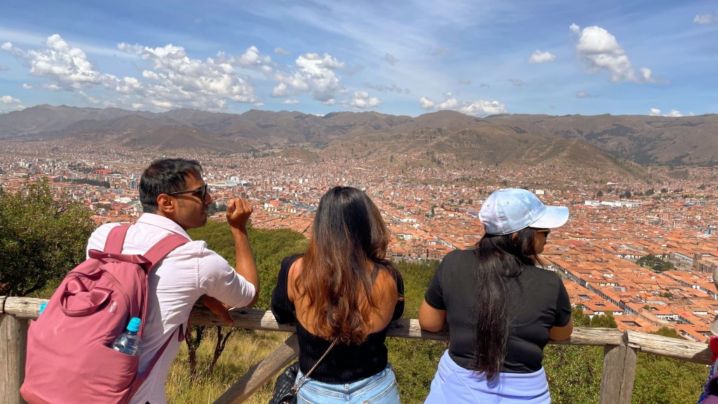
San Cristobal
We started the trip with San Cristobal Church. The church is situated at the top of a hill overlooking Cusco city. Its courtyard and the bell tower provide a picturesque wide angle view of the valley and surrounding mountains. This church is built on top of Inca structures. The walls of the church complex are still from the Inca period. There are niches in the walls circling the church which was used to keep mummies of Inca kings or nobles. It is believed that this was the first structure built by Manco Capac, the first Inca ruler. After Francisco Pizzaro defeated Atahualpa, they installed his brother Tupac Huallpa as a puppet ruler in 1533. Tupac converted to Christianity and donated this piece of land for the construction of the church which stands today.


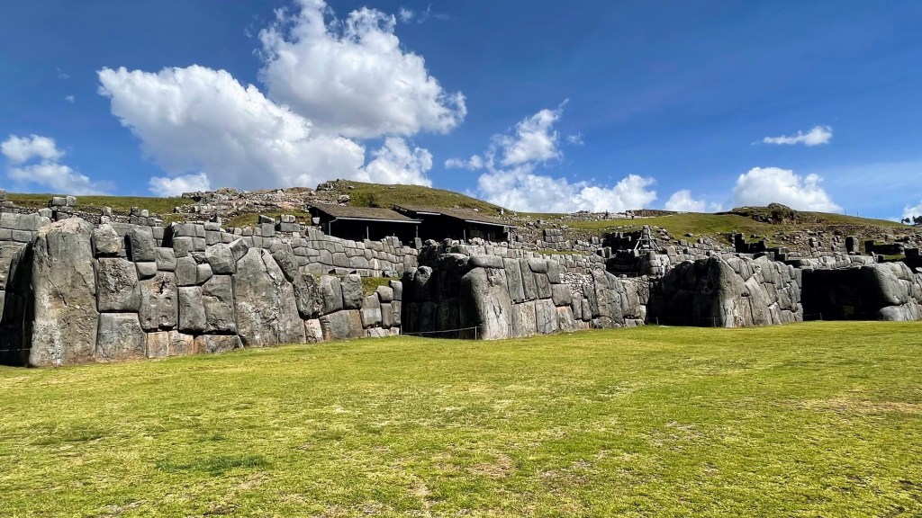
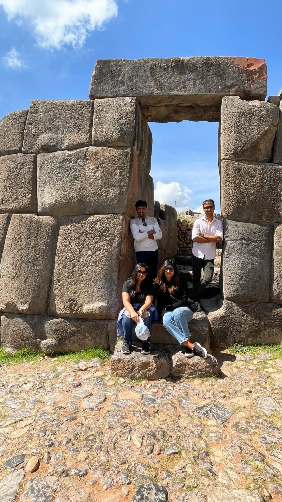
Saqsaywaman
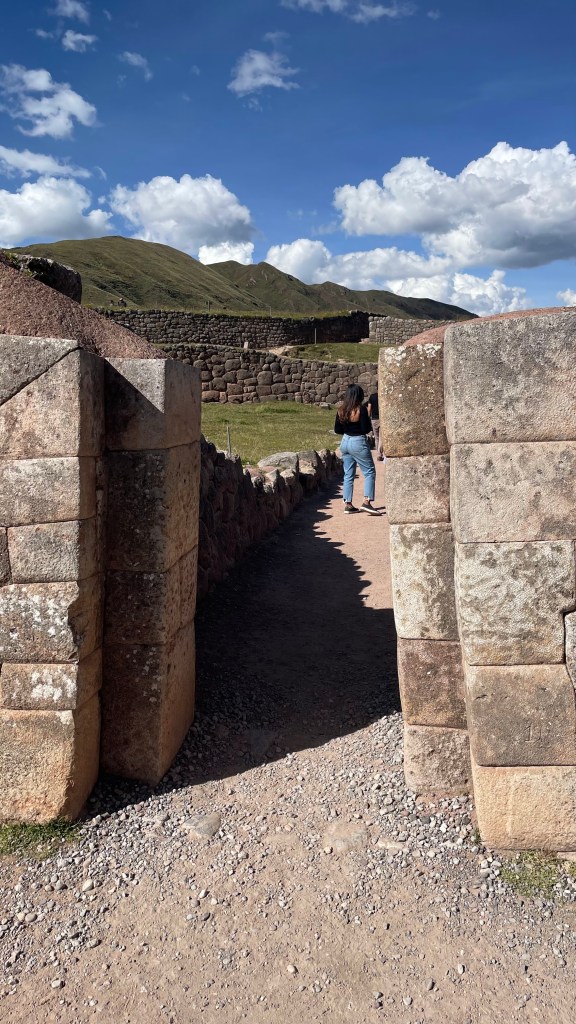
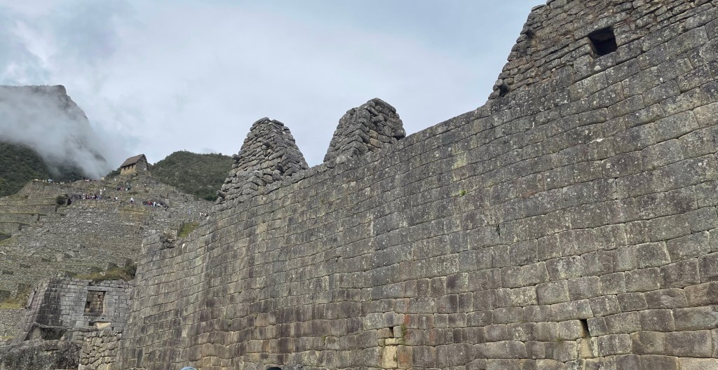
Saqsay means satisfied, waman means falcon. Saqsaywaman is believed to be the head of the puma while the city of Cusco the body. Many believe this to be a military fortress, but it isn’t the case. This was a sun temple built by mighty Pachacuti to celebrate inti raymi (inti means sun, raymi means festival). The architecture, size of stones used, and the finesse of stone masonry supports this argument. The stones are so finely interlocked that not even a piece of paper can go in between. Saqsaywaman has 3 levels of walls in zigzag shape. The longest wall of the 3 walls is 400 meters long. These walls are about 6 meters tall. The size of stones used are massive. Each level is connected to the next via high trapezoidal walls. In general, the Incas were short. But why were the doors this high? A possible explanation is that during festivities, Incas carried the mummies of their kings on palanquins. That’s why they built high doors to facilitate this tradition. The zigzag shape represents lightening. The 3 levels represent the 3 worlds – heaven, earth and underground. There are carvings of condor, puma and serpent on some stones which represent heaven, earth and underworld respectively. The stones at Saqsaywaman have been carved concavely at the corners to give a natural flow to the building. The walls lean inwards which provided a great stability to this structure. These architectural choices allowed Saqsaywaman walls to withstand numerous earthquakes and test of time. At the top of Saqsaywaman, there were 3 concentric towers, muyuqamurka (Quechuan word for circle).
The estimated volume of stones used here is about 6000 cubic meters. Spanish conquistadors decimated this place and used the stones from this place to build new Spanish government, residential and religious buildings. And yet, they were unable to use all. The remaining stands tall even after half a millennium to tell the story of their magnificent past and horrors of colonialism.


Qenko
Qenko is Quechuan word for maze or labyrinth. This name was given to this place by Spanish conquistadors. Qenko welcomes the visitor with a big stone structure. This, now decimated, piece of stone is believed to be of the shape of puma, the holy animal of Incas. There was circular wall around this massive stone structure which was higher than 3 meters. These walls had niches to house the mummies of kings and nobles. Most of it was destroyed by Spanish in 16th century. This archeological site consists of a semi-circular amphitheater-type structure, a big stone structure and a sub-terranean galleries and canals (hence the name labyrinth). Historians believe that this was an important ceremonial site, especially for performing sacrifices. When this site was excavated, many llama and alpaca fossilized bones were found here confirming the theory that this was a place to perform sacrifices. It is also theorized that the mummy of Pachacuti was placed here. But no one knows where it is right now.


Puka Pukara
Puka in Quechua means red and pukara means fortress. Probably this fortress looked red at certain point of time in the day hundreds of years back. But it certainly does not look red at all today. The stone walls here are not very well cut, unlike Sasaywaman. The entrance to Puka Pukara is a double door. A double door signifies that the place is important. I saw similar double doors in Qorikancha and other important places as well. However, the rest of the construction is relatively average. The stones are placed irregularly as if this place was built to be merely functional. There are large walls, shelter rooms, and plazas at this site. It is assumed that this was a military checkpoint. Our guide, Nyessa, had a theory that this was a security checkpoint for people who wanted to go to Machu Picchu. That’s why there were so many resting places. The height of this place provided it a great vantage point to identify any trouble from a far distance.
Anshu flew his drone here to get a 360° view from the top. But a ranger came hurriedly to stop us. Flying drone was not allowed here, like all other archeological site of Cusco. He had even tried to down the drone with his slingshot but didn’t succeed. He got the photo and video deleted and left with a warning. We should have been more careful with reading the signs; good learning for us.
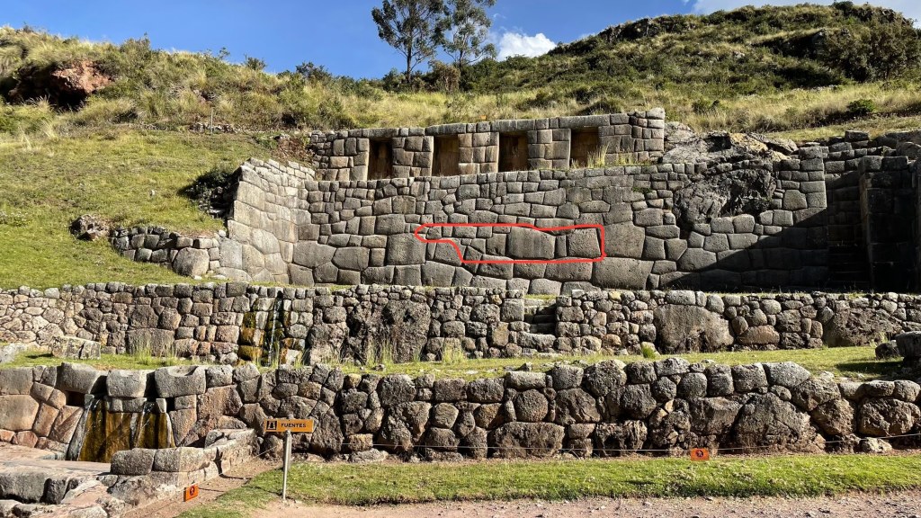
Tambomachay
In Quechua, tampu means guest house and machay means cave. It is believed to be a resting place for Inca kings. There is a jungle behind this place, which might have been used for recreational activities like hunting. This place has 3 small baths one above another. The architecture of lower level is not fine, but the top one is. The top terrace has precisely cut stones. There are niches in walls as well which were used to keep mummies. So, the belief is that it was also a sacred or ritual bath. Lower level was for common people, while the high level for kings and nobles.
Qorikancha
By now everyone was tired. But I wanted to see Qorikancha as well. So, Anshu, Sneh and Shalini waiting in the car while I went to explore this gem of a place built by Incas.
When Manco Capac and his family conquered the valley of Cusco, they established 4 neighborhoods. At the center of this settlement, Manco Capac built “House of the sun” or Intikancha. In the latter half of 15th century, the mighty Inca king Pachacuti upgraded this temple with fabulous treasures. From then on, it was called Qorikancha, or golden enclosure. All along the walls ran a thick gold band. The doors and doorways were exquisitely plated with gold. The architecture of this place did full justice to the name it eventually got. Spanish conquistadors looted the entire temple and destroyed most part of it to build a church.

Morena
The day ended with a lavish dinner at Morena. This place is totally worth the hype. The ambience, quality of food, its presentation, interior design – everything was perfect. It was a great value for money. We ordered bruschetta, gnocchi, grilled tilapia and chicken soup. Anshu and I tried the alpaca meat here, and it was delicious. In fact, everything they served was lip smacking. And not to forget the delectable dessert. It was a good, hearty meal before the tiring days ahead.
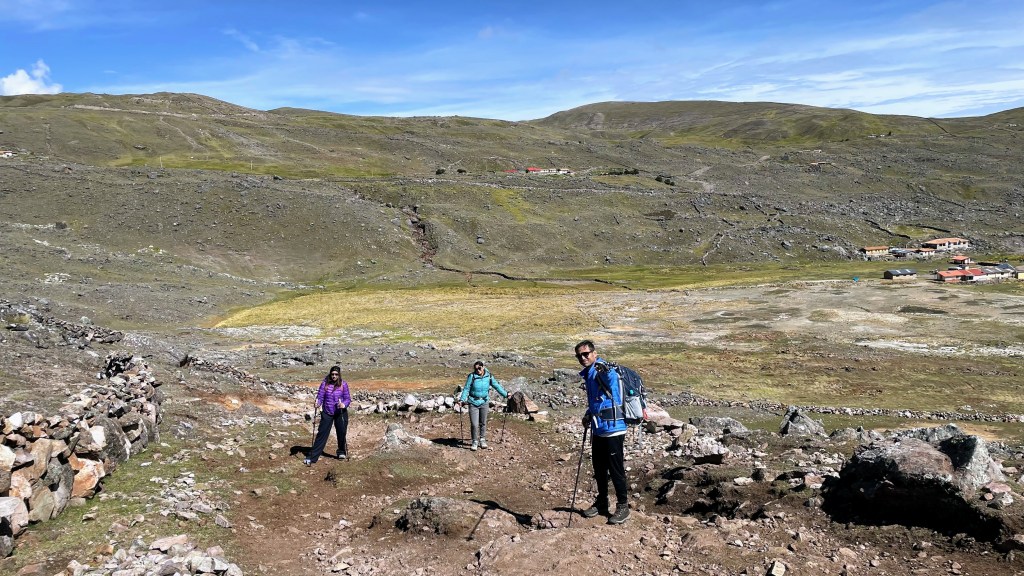
Day 5, May 23rd 2023 – Trek starts, Cusco to Pacchanta to Upis
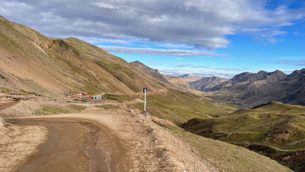
We woke up around 3 AM today. Bernabe came to pick us up at 4.30 in the morning. It was a 3-hour drive from Cusco to Pacchanta.
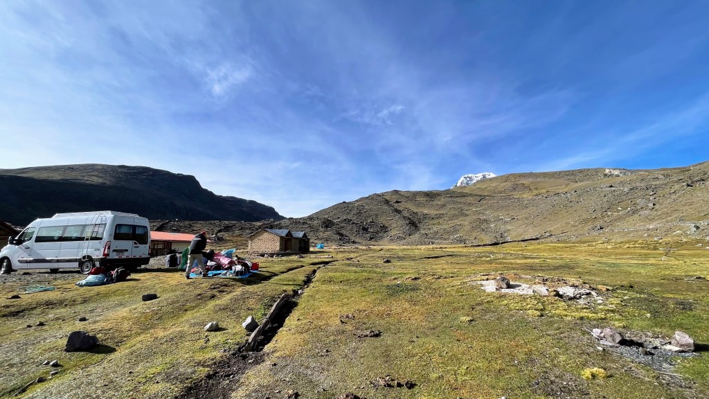
Pacchanta is a small hamlet deep in the heart of Andes. Vast grassland with a couple of brick houses emerging out of nowhere, rocky moraines jutting out of ground, snow-capped mountains squinting at us from a distance and some kids merrily hopping on their way to the school – what a beautiful morning it was.
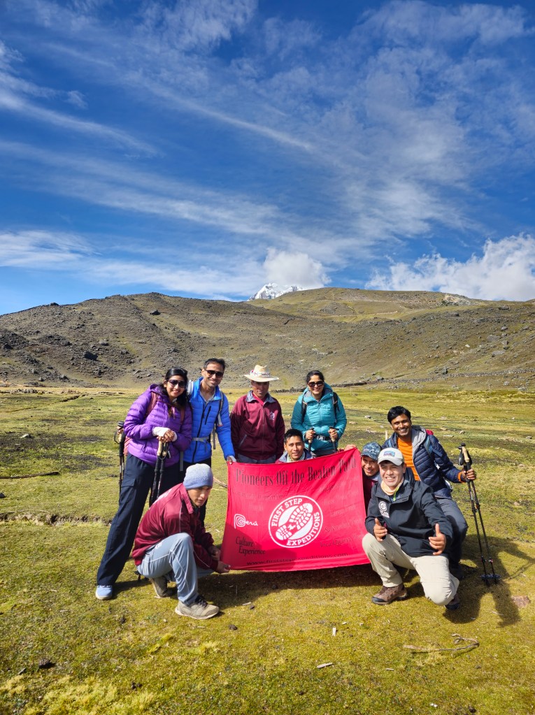
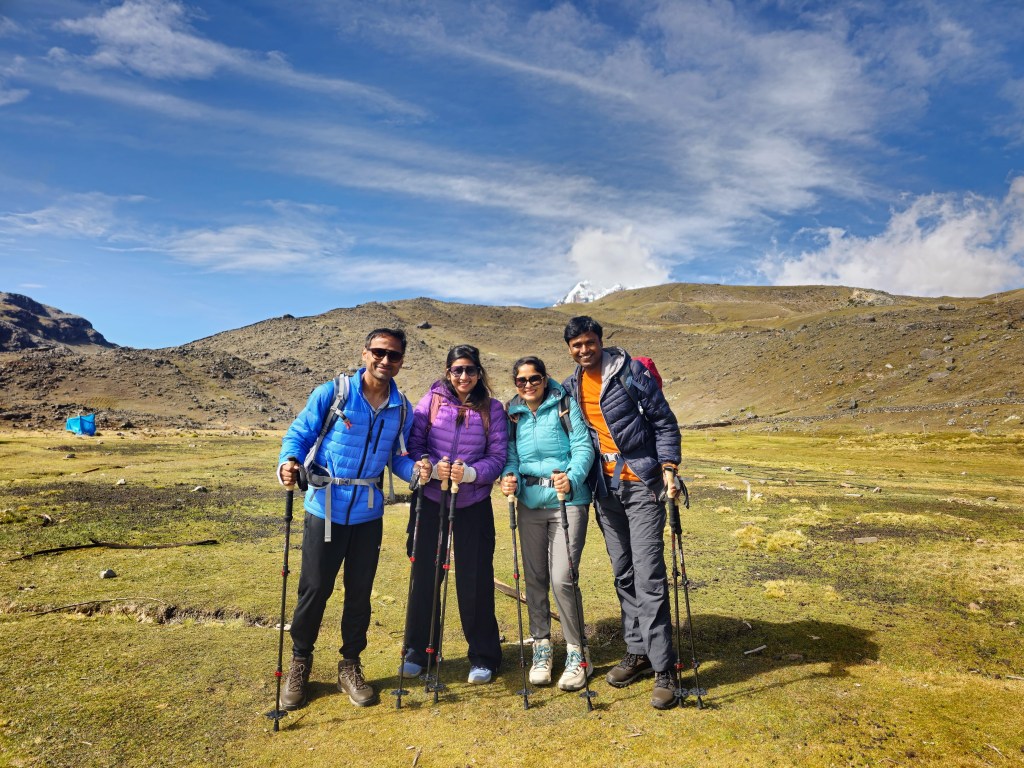
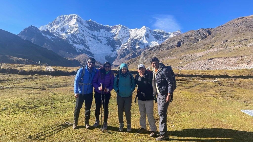
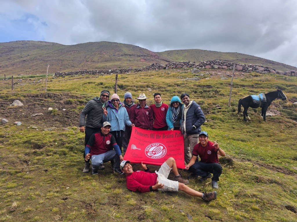
This is where we met rest of our team – the chefs and porters. We had a delicious breakfast together by 9 AM and were ready to hit the dirt by 9.30 AM. We took some group photos and marked the beginning of our trek. I had butterflies in my stomach. It was after 6 years that I was doing a multi-day trek. Last time it was Rupin Pass in Himalayas in 2017. I was excited but was also concerned for Shalini. It was her first time. Deep down I had a feeling we, as a group, had bitten more than we could chew. But, hey, the scenery was picture-perfect, the food was great, and the company was awesome. What more could one ask for?
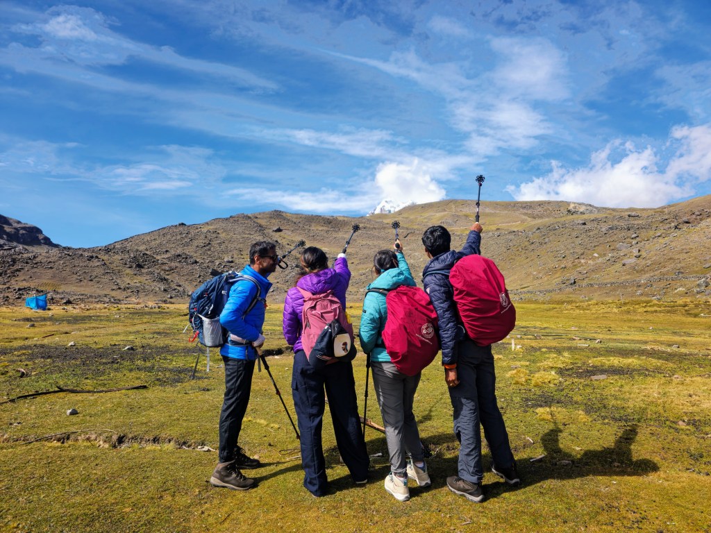
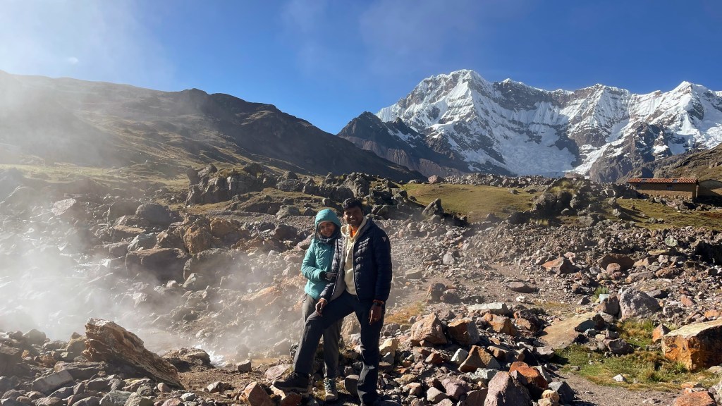
Within 1 hour only, the Ausangate mountain that was squinting at us at Pacchanta revealed itself in full glory. Nestled in Vilcanota mountain range, it has an elevation of more than 20,000 feet and houses many pristine glaciers. Also called Nevado Ausangate (Nevado is Spanish for snowy), it was deeply revered by Incas as Apus god. The herding community that lives here continue to live traditionally, often without many of the modern utilities that is in use today. We came across a few of them on our way selling warm gloves, scarfs and coca leaves.
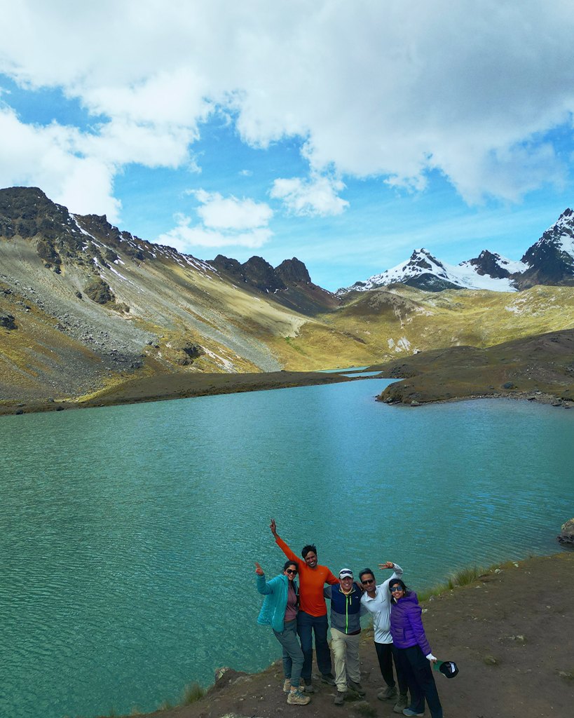
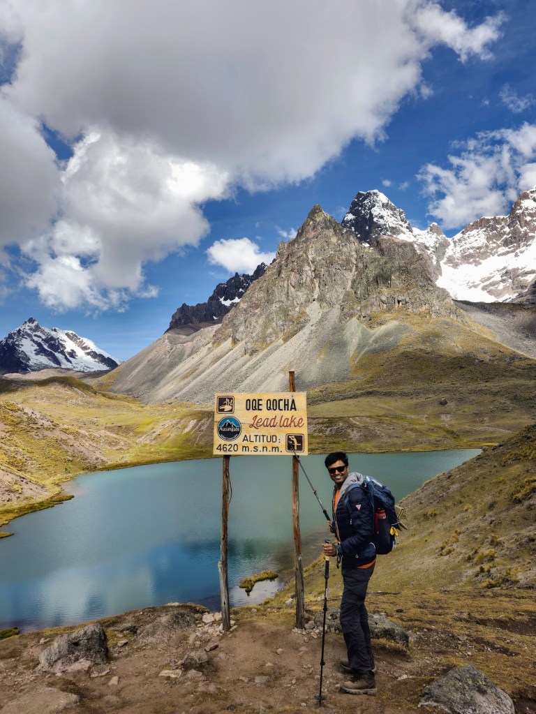
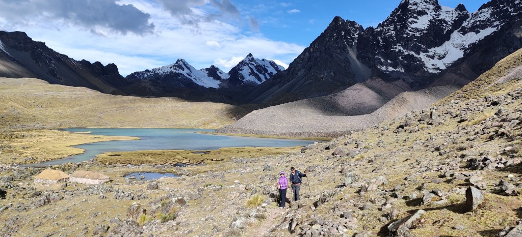
It was steep inclination for the first 3 hours. Shalini struggled a lot. We took her daypack and put it on the horse that was walking along with us. It was a big respite for her. But she was still stopping every 10-15 minutes to take a deep breath. Anyway, we crawled our way to the Seven Lakes by 1 PM. We should have reached this spot 1-1.5 hours back, but we were slow. The first of the seven lakes is called Big Red Lake. Cusco is at an altitude of 11,000 feet. We drove from there to Pacchanta which is at 12,730 feet. And this lake was at an altitude of 15,600 feet. This was a lot of elevation gain for us in 9 hours. And we could see its impact on Shalini. She was finding it difficult to breathe. All she wanted to do was sit.
Anyway, we took a lot of pictures and drone shots at this place before heading off the next lake. The view was simply stunning. The lakes were adorned with turquoise water replenished by melting ice from nearby glaciers. They were nestled deep within grey and white mountains. White because of snow and ice, grey because of various moraines that were left behind when the glaciers receded. A stark reminder of pending threats of global warming.
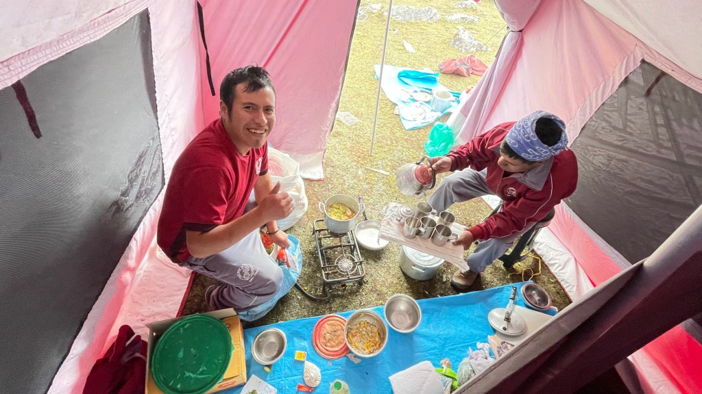
We walked our way through other lakes on a flat trail before reaching our lunch spot at 2 PM, almost two hours behind the schedule. The lunch spot was a simple tent pitched by our cooking staff. As soon as I reached, I crashed on a tarp and closed my eyes for 5-10 minutes. I was dog-tired and laying down felt so good. The elevation was showing its impact. After some time, I woke up and washed my hands and face in a nearby stream. The water was cold, of course, but I felt refreshed.
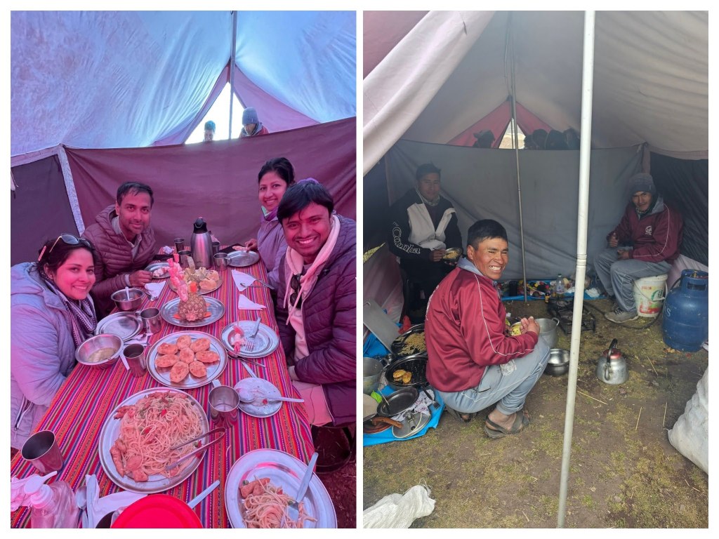
The lunch was an amazing 3-course meal. Just imagine! We started with soup and ceviche, then some starters and entrees. The things these chefs can do with a simple camping stove and some propane is mind blowing.
Anshu, Sneh and I were doing fine, but it was not good for Shalini. She had lost her appetite. She barely ate her lunch. This was not a good sign, particularly when you are at 15000 feet. So, we decided to send her on horse to our campsite so that she doesn’t have to navigate yet another steep incline coming our way.
Around 3.30 we left the lunch spot. Shalini on horse and three of us on foot. The view certainly changed after lunch. It was much greener on this side of the mountain. Because were running more than 2 hours behind schedule, it already got dark before we reached the campsite. We had to almost run towards the end. We had our headlamps on, but it is difficult in an unknown terrain. I twisted my ankle severely as I was trying to increase my pace. Thankfully, we were not far from the campsite when this happened. Bernabe contacted one of the porters on the radio and asked him to come there with a horse. I covered the last stretch of 10 minutes on the horse.
Shalini was still feeling tired, her appetite was completely gone. She just nibbled some rice and drank soup for dinner. I was worried. After discussing with Bernabe, we gave her supplemental oxygen and crashed into our respective tents by 9 PM. Around middle of the night, Shalini woke me up complaining about feeling cold. She was literally shivering. Multiple layers of clothes were not helping her. I even wrapped a blanket on top of her sleeping bag. Then I realized that her head was not in the sleeping bag. I fixed that, hugged her tight and slept. Throughout the night, I kept checking on her to ensure she was asleep. She really needed to be well rested for the next day.
It was long day with mixed bag of emotions. The views were stunning, the food was heavenly, but seeing Shalini getting mountain sick was concerning.


Day 6, May 24th 2023 – Trek interrupted, back to Cusco
I woke up early in the morning, around 5 AM. Shalini was still sleeping, which was a good sign. At least she would feel rested. I woke her up around 6. We measured our oxygen levels. It was in 80s for Anshu, Sneh, Bernabe and me. But Shalini’s oxygen level was surprisingly 95. We tried a couple of times with different fingers, but the result was still the same. It was pleasant news for us. She still had breathing issues, but we tried to keep her spirits high and convinced her to continue forward. We packed our bags and had breakfast together. We were about to leave when Shalini said that she is very scared and couldn’t make it further. She said that unequivocally. Then, it was an easy decision for me. I decided that I will skip the trek and take her back to lower altitude. After discussing with Bernabe, we thought it was better to go to Cusco rather than Ollantaytambo as it had better medical facilities, just in case it was required. Anshu and Sneh continued ahead with Bernanbe. Shalini and I stayed back at the campsite to go back to Cusco.
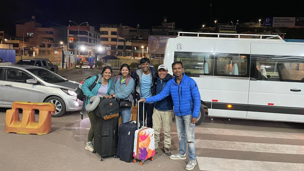
Rene was the lead porter who stayed back to take us back to Cusco. The plan was that we will walk to the nearby road from where we will take a car to Tinqui. It was a rickety 1.5 hours’ drive. As soon as we reached Tinqui, we immediately got the bus to Cusco. We were in Cusco by 1-2 PM. I got a call from Roger who was the manager of First Step Expeditions. He checked on Shalini’s health and got us the booking at the very same Hacienta Hotel where we stayed before. After reaching Cusco, he had arranged for a cab which was waiting to pick us up and drop at the hotel. Rene was with us all along. This was a great end-to-end experience provided by First Step guys. They could have easily left us to figure out our way back to Cusco. Even after reaching Cusco, Rene didn’t need to accompany us back to the hotel. They could have very well asked to manage the ride to the hotel. But they ensured that I was re-booked with the hotel and on top of it I was at the hotel safely. Of course, I paid for it but the care they showed was amazing.
As soon as we came to low altitude (or should I say relatively lower altitude), Shalini started feeling better. Given that she was already acclimatized to Cusco (thanks to our previous 2.5 day stay), her breathing issues waned.
We had a late lunch at the hotel and slept off most of the day.
Day 7, May 25th 2023 – Museums in Cusco
Roger came to meet us in the morning at around 10.30 AM. They had not given up on us. Thankfully! We discussed the plan on how to get back and regroup with Anshu and Sneh. The plan was that Anshu and Sneh will reach Rainbow Mountain on May 26th. Shalini and I will go there from Cusco and regroup. From there on, we will continue our trip together. We really felt good after that pep talk, especially Shalini because she was feeling guilty as it was because of her that I missed two days of the trek.
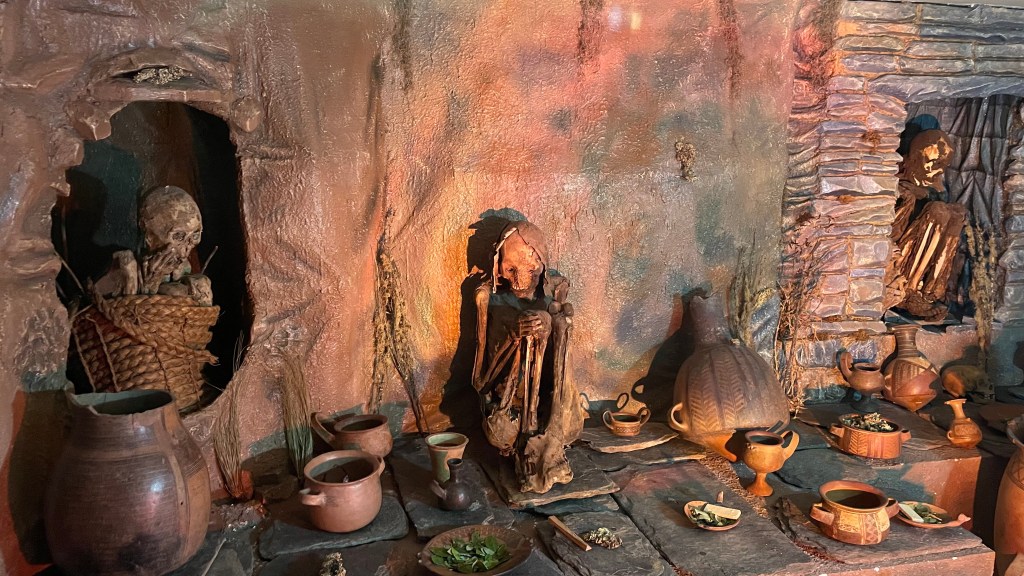
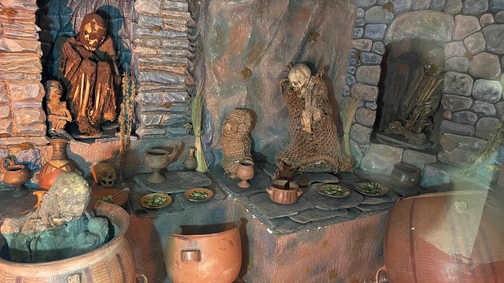
We walked to the Inca Museum which is at Plaza de Armas. Of many things we saw, mummies were the showstopper. Mummies from that period are kept there in a fetal position, the same way it was during Inca time. It gave me insight into how the mummies could be kept in those small niches in the wall we had seen on Day 2 and Day 3 of our trip. We spent about an hour at Inca musum.
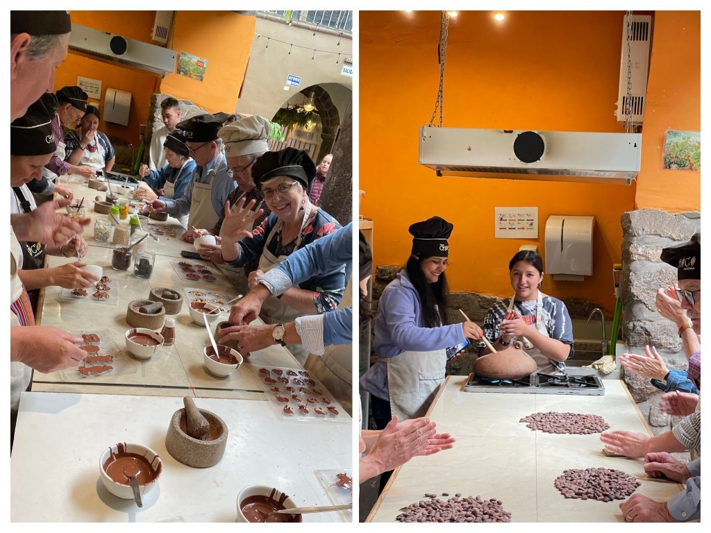
We booked a Bean to Bar workshop at nearby Choco Museum at 1.30 PM. We were with a group of around 15 old people. In this workshop, we learnt about the history of cacao, how it grows and especially how the cacao beans take the shape of chocolates we love. It was a hands-on workshop. We roasted our beans, removed them from shell and grinded them. We put the tempered chocolate paste into molds filling it with different toppings. It was a unique experience to make our own chocolates.
How chocolate bar is made?
First, cacao pods are harvested. The beans are removed from pods, then fermented and dried. It is said that having these cacao beans every 2-3 days keeps cancer at bay. The beans are then roasted at 100-150 degrees celsius. The shell is then removed and grinded to make a paste. The beans are called cacao when its raw, but after it is roasted it is called cocoa (notice the difference between ‘a’ and ‘o’). Cocoa beans have 50% cocoa powder and another 50% cocoa butter. During grinding, the butter is released which makes the resulting product a paste. This paste is then mixed with butter, sugar and milk depending on how dark the chocolate is supposed to be. It is refined for impurities and then tempered. Tempering is a very important process during which cocoa paste is heated and cooled multiple times. During this process, the cocoa butter in the chocolate takes on a stable crystalline form, which gives the chocolate its defining characteristics – shiny appearance, snap cleanly when broken, smooth texture and more stable against change of temperature. After the process of tempering, the chocolate paste is then molded and refrigerated.
So, now you know that making chocolate is not that easy. This is the reason why even though the best cacao beans are found in South America, the best chocolates are Swiss (or Belgian depending on your taste buds).
Cacao doesn’t have caffeine. It has theobromine. Theobromine has gentle effect while caffeine has intense effect. In a nutshell, theobromine is much healthier than caffeine.
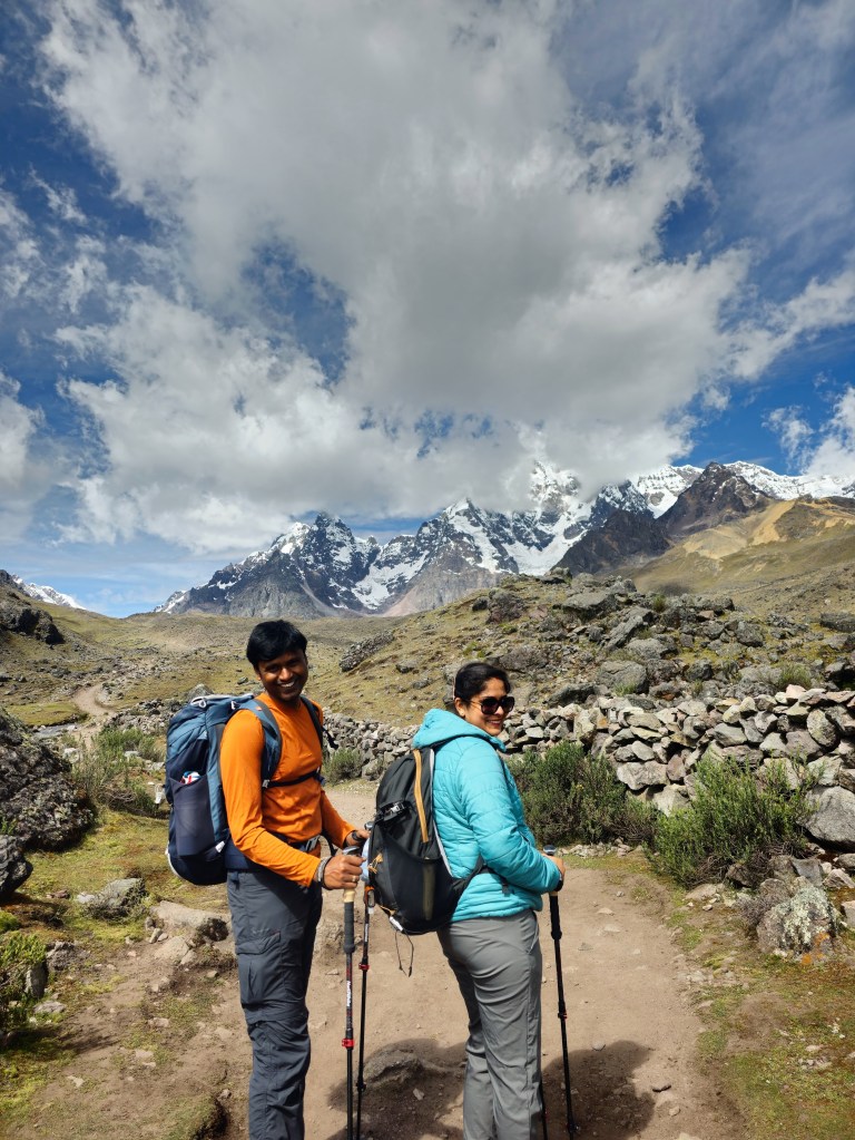
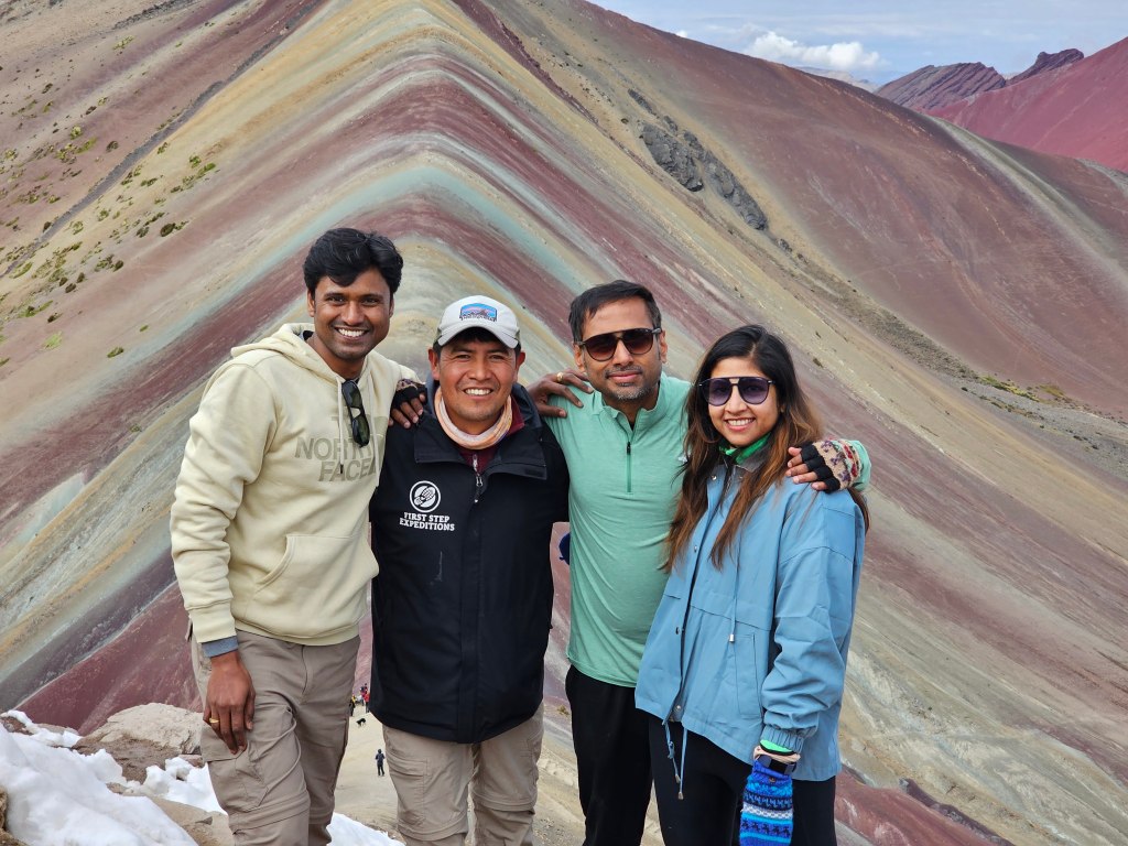
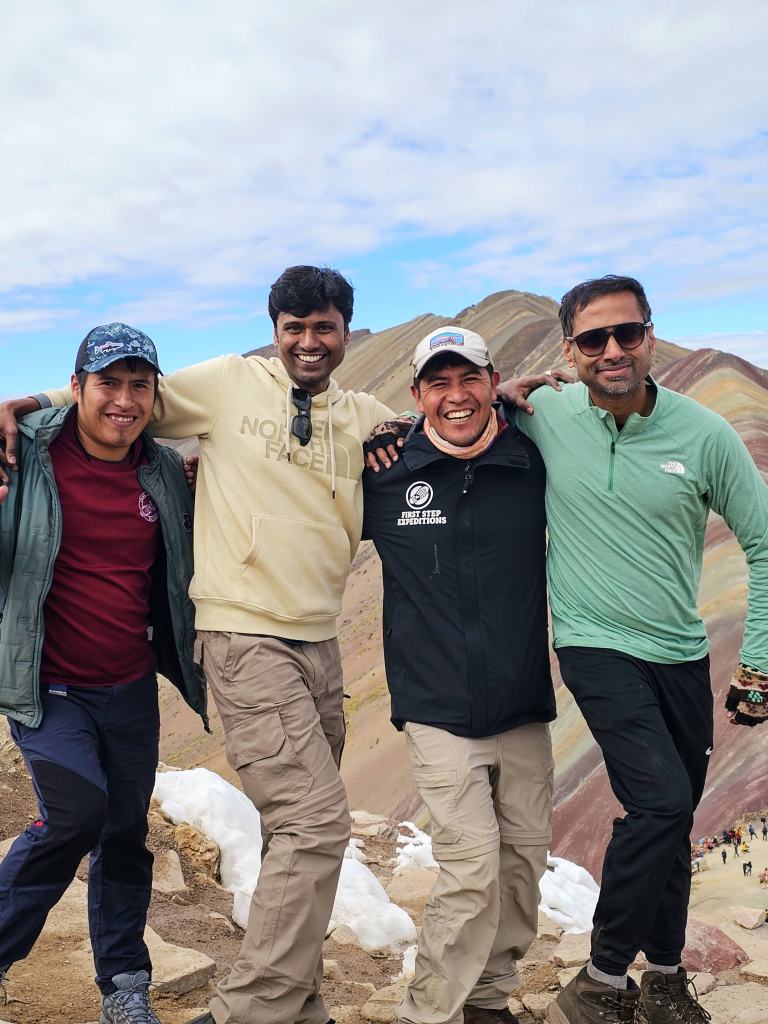
Day 8, May 26th 2023 – Trek resumes, Rainbow mountain to Red Valley to Ollantaytambo
As I was huffing and puffing my way up the steep incline towards the final push, I heard the buzz of a drone. My inner voice said it would be none other than Anshu. I pushed forward with double the energy. After 5-10 minutes I heard the drone again. I threw the dart in the dark. I shouted out loud into the thin air – “Anshu”. The response echoed in the mountains, “Aur laundey!!!”.
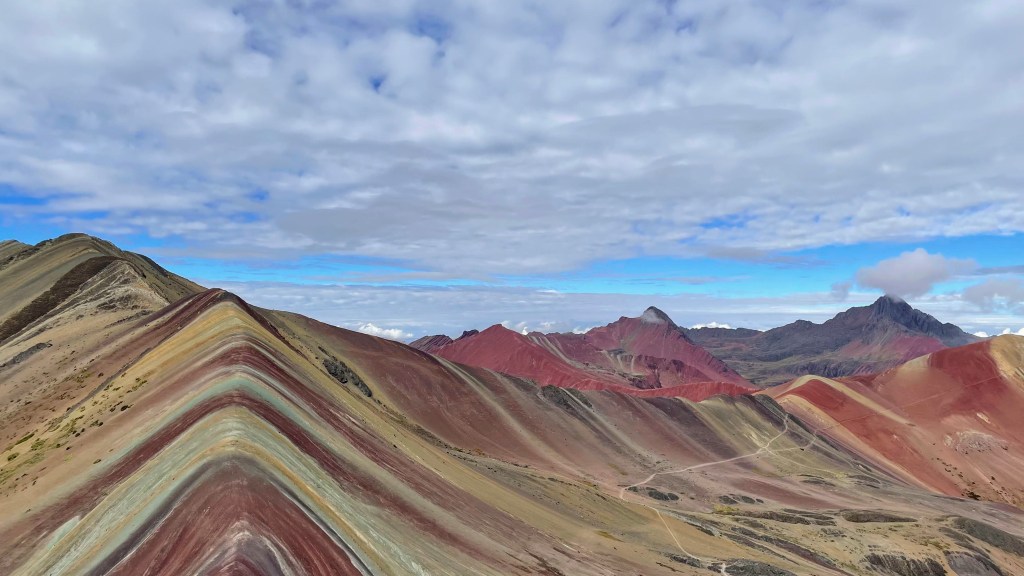
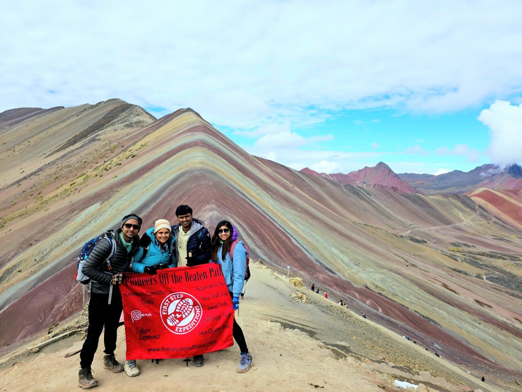
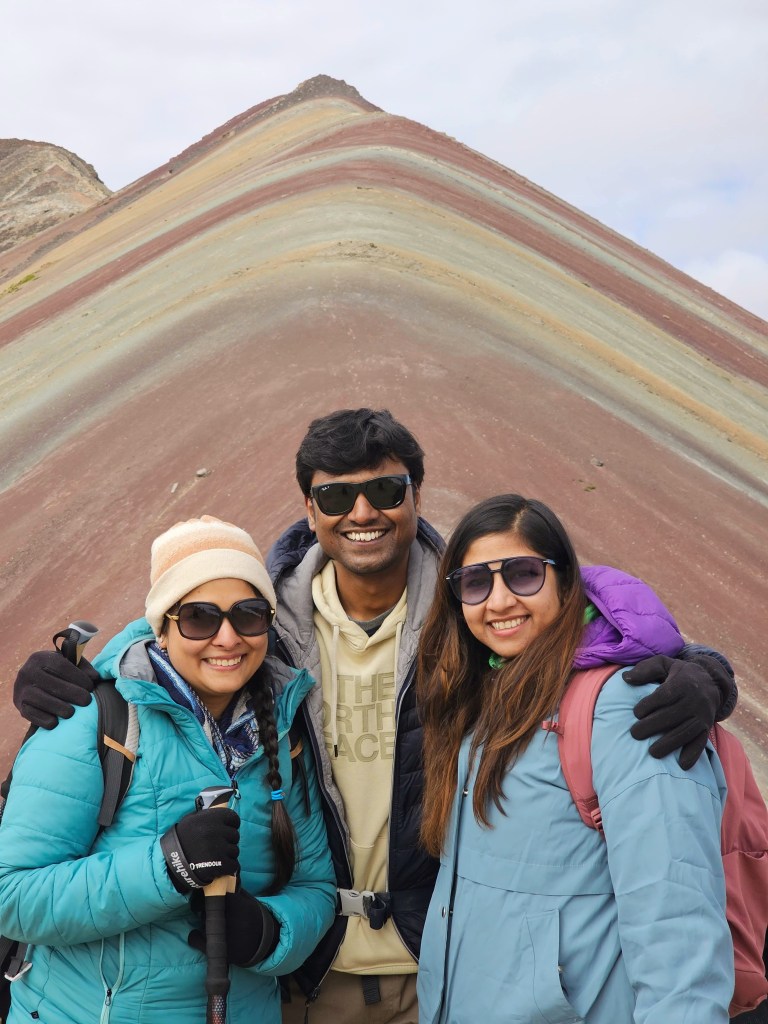
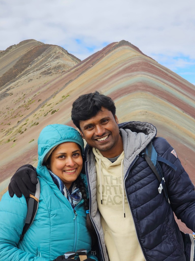
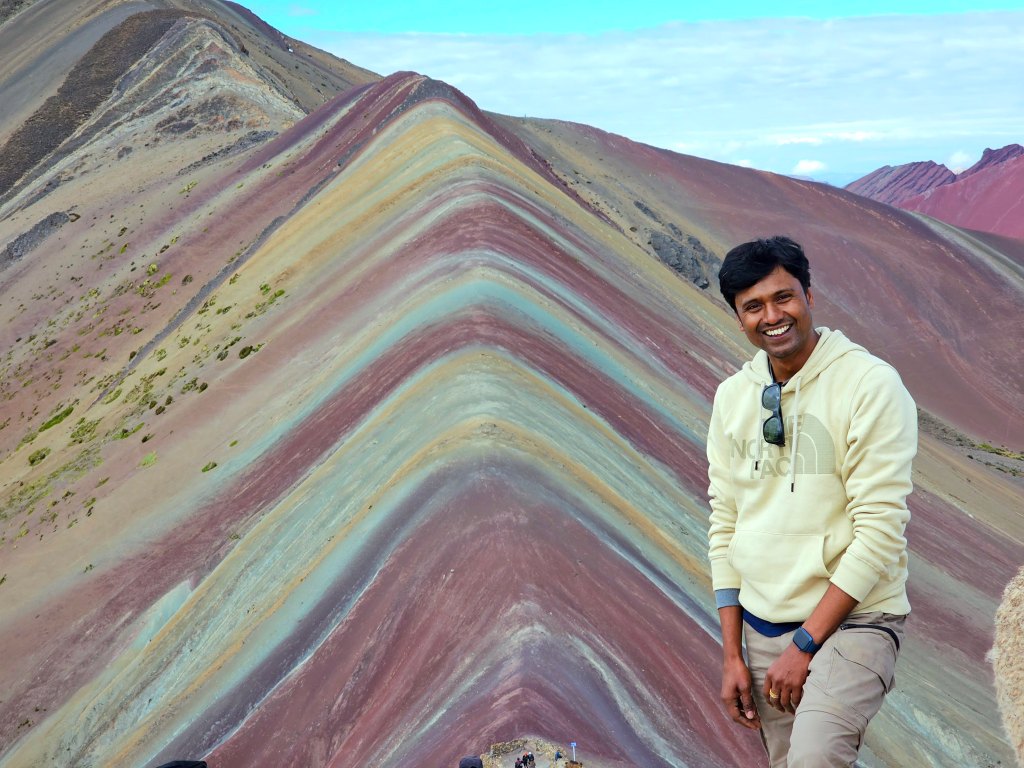
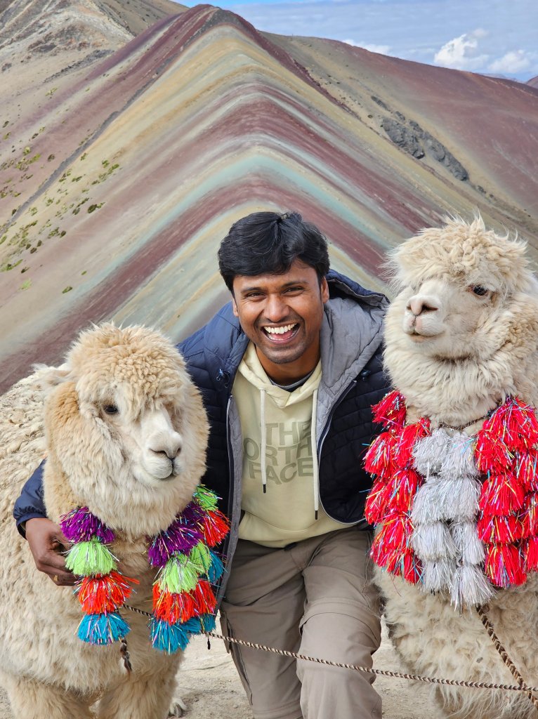
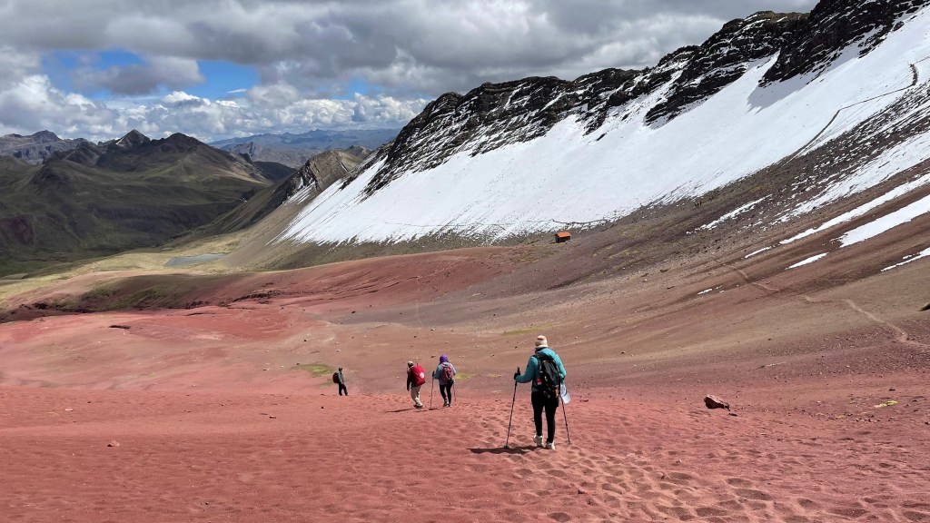
Vinicunca, or popularly known as Rainbow Mountain, is a mountain in the Andes located southeast of Cusco at an altitude of 16000 feet above sea level. This mountain and adjacent valley has distinct layers of mineral rocks each of different color – as many as 14. The pink color of the rocks comes from red clay, white color from calcium carbonate, red due to iron-rich stones, green due to rocks rich in ferro-magnesian and yellow because of rocks rich in sulfurous minerals. Till 2013, this piece of beauty was hidden beneath permanent snow.
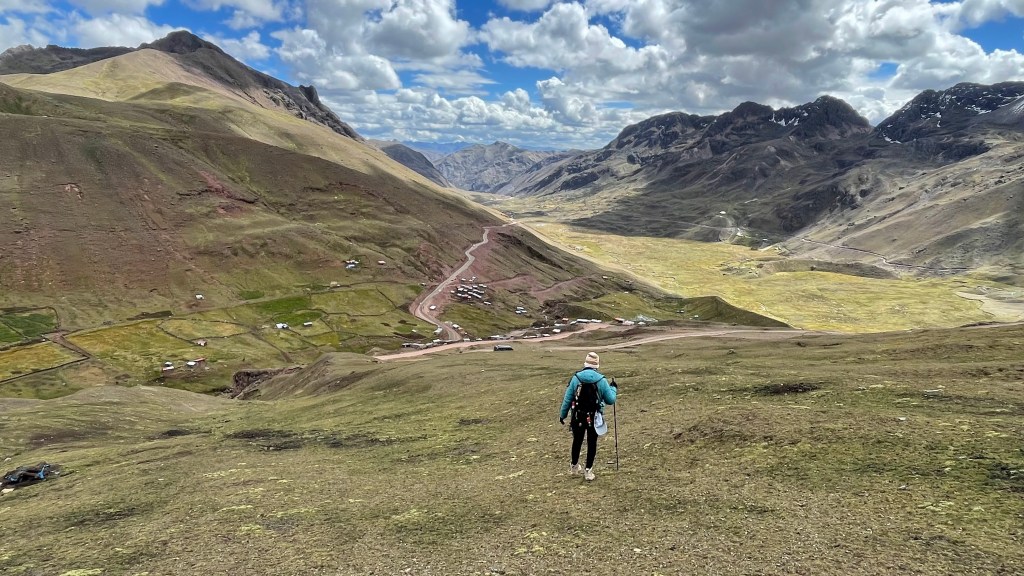
As discussed with Roger the previous day, Rene (who had dropped us in Cusco) came to the hotel in a van at 3.30 AM. It was a long 3-hour drive at the foothill of Vinicunca. We were at a good time; only 1 more vehicle was there. We started at around 7 AM – Shalini on a rented horse, Rene and I on foot. It was a steep 1-hour hike from there. I had discussed with Roger that if we are on time, Shalini and I can catch up with Anshu and Sneh who were also in mountains and planning to reach there along the same time. So, I was walking up fast. Initially the trail was wide open green landscape with snowcapped mountains at a distance. Within 30-45 minutes of walking, the scenery changed and it started getting more colorful. To my left, green mountains paved way for the red ones. And then more colorful rocks showed up – pink, green, yellow, white and many more. Oh by the way, it was not just a small patch, but the entire mountain goddamit. It was out of this world. Simply stunning.
I was at the viewpoint by 8.15 AM. This is where most of the tourists stop. Another viewpoint sits on top of this one. This one is about 15 minutes of even steeper accent. I was dragging myself up to the top when I heard the buzzing sound of drone. Meeting Anshu and Sneh right at the top was surreal. The time we started, the speed at which car drove for 3 hours on the circuitous terrain, the pace at which I hiked up and the time at which Anshu et all started their campsite – all stars had to align to make this possible. But it happened.

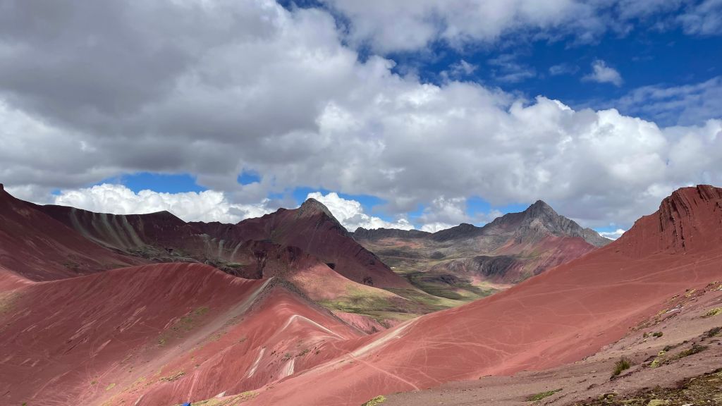
Red Valley
After clicking a lot of photos at Vinicunca, we headed east towards the Red Valley. This is simply one of the most stunning places I have ever been to. The entire valley is red in color with streaks of white and patina. The occasional patches of snow gave the ermine frosting to the crimson-colored valley. Nature’s red velvet cake indeed! No words can do justice to the beauty of this place. Anshu took some great drone shots here.
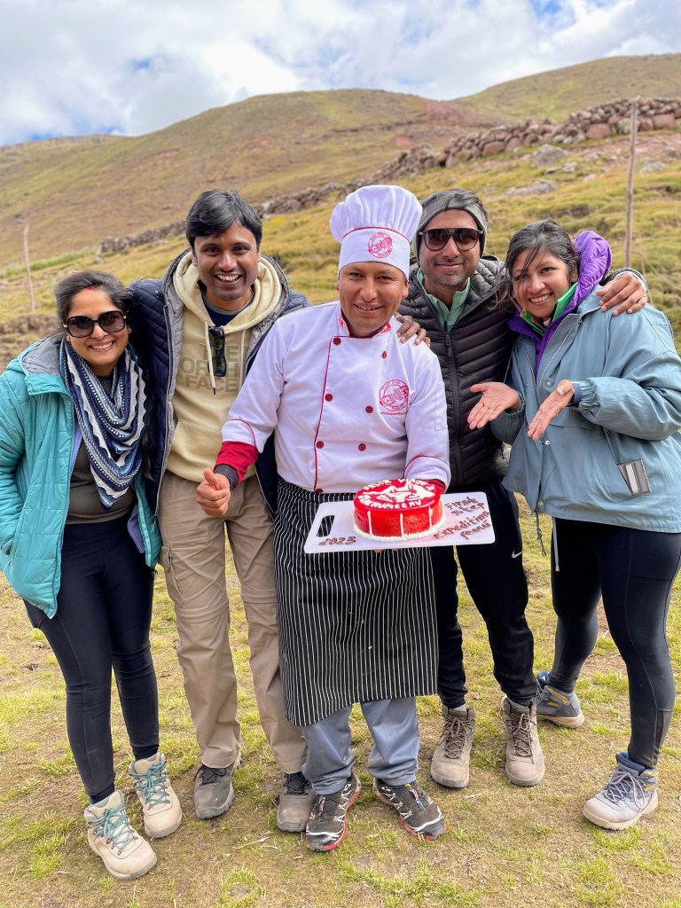
We walked for almost 3 hours navigating some precarious curves on our way before reaching our lunch spot. We were treated with delicious meal by our cooking staff. This was our last meal with this mountain crew, so they left no stones unturned. They even baked a cake for us. Just imagine! From here it was a long 4-hour drive to Ollantaytambo. This was all part of the package and arranged by First Step Expeditions itself.

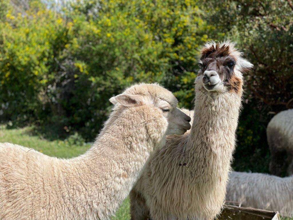
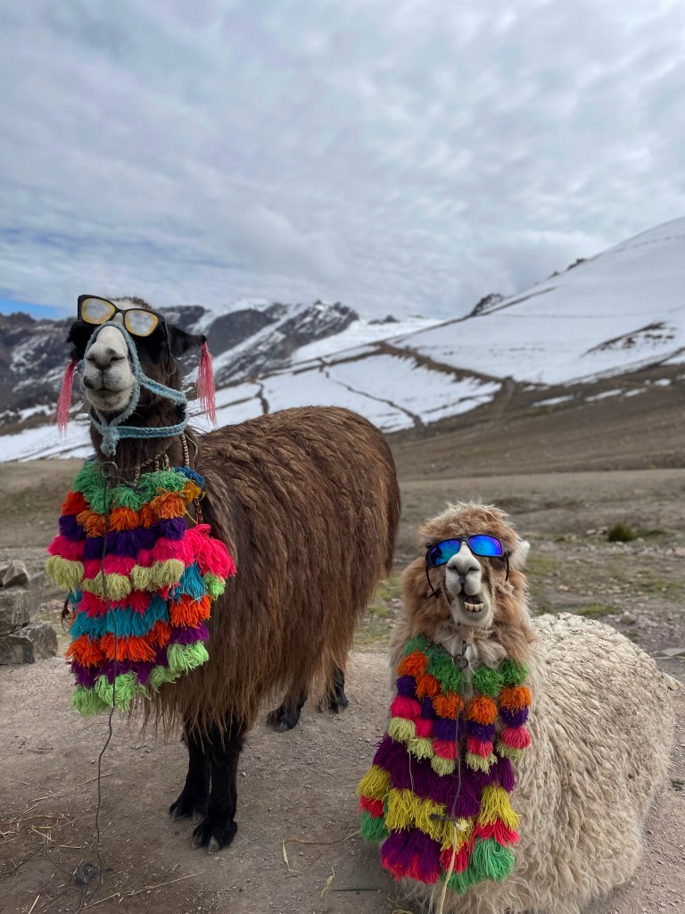
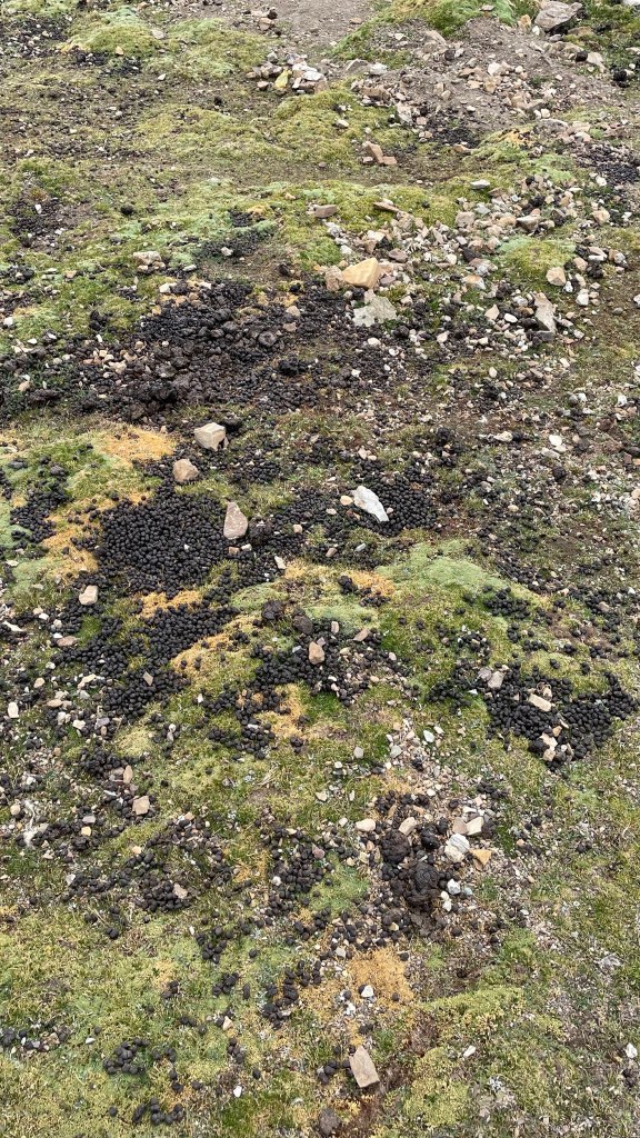
Fun fact – Alpacas are naturally drawn to poop in the same places around their paddock. They will poop in communal areas, collecting all of them at 2-3 spots. Best of all, they are not trained for this; they have evolved with this kind of behavior.
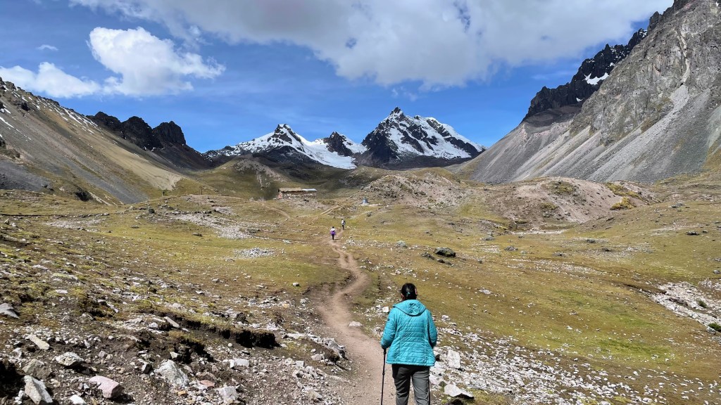
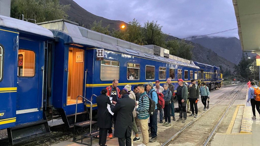
Day 9, May 27th 2023 – Inca Trail, hike to Inti Punku (aka Sun Gate)
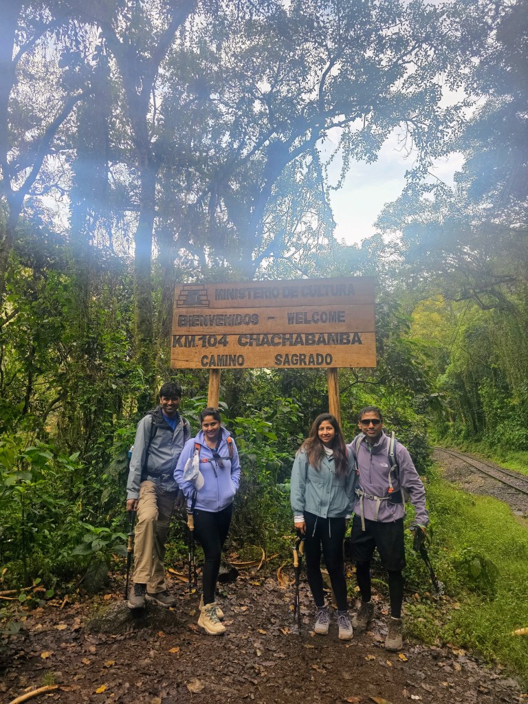
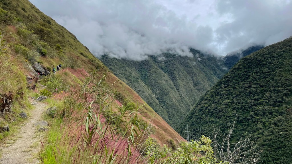
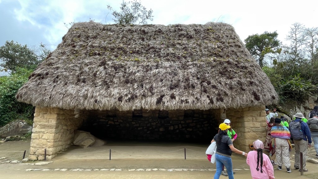
As has been the routine so far, we woke up very early and freshened up. Bernabe had arranged packed breakfast and lunch for us. We picked it up and were at the train station by 5.30 AM. It was a beautiful 1.5-hour train ride to Chachabamba or KM 104. This was route #5 of Inca trail network. This trailhead is at an elevation of 2150 meters, went all the way up 2700m at Winaywanka archeological site and then further up to 2750m at Inti Punku or Sun Gate.
There is a security checkpoint where rangers match your passport with the ticket you have to enter Machu Picchu. There is no restroom until Winaywanka, so we emptied our bladder here, applied lots of sunscreen and started our hike around 8 in the morning.


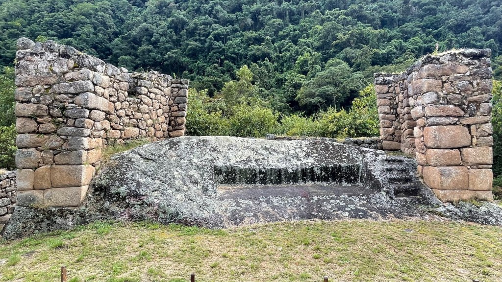
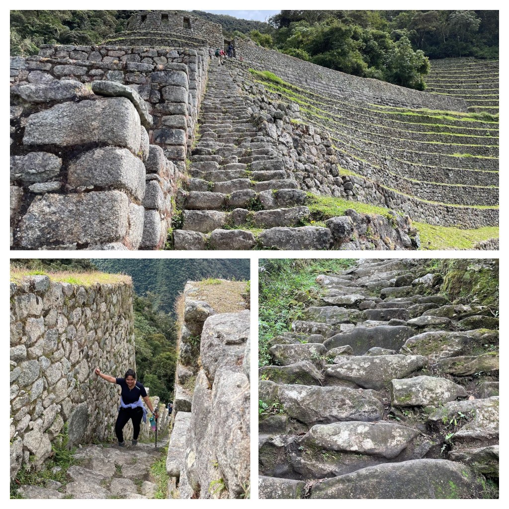
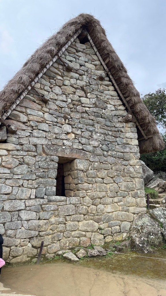
This 12-km trail started with archaeological mountain of Chachabamba at an elevation of 2150 m. It is believed that this was a resting place. Incas built a road network of 25,000 miles. The animals they used were alpacas and llamas which could not be ridden unlike horses. They had to walk a lot. So, there were resting places every 20-25 km, like the one we were at Chachabamba. There were niches in the walls which were used for food storage. There was also a large black granite rock, which is believed to be an altar or sacred place for people to worship.
There was misconception I had that all architectures Incas built were by interlocking stones. That is not true. They used this time and labor-intensive technique, also called Ashlar technique, only for important places like royal buildings or temples. Regular buildings used mortar. I had observed this at Puka Pukara on Day 4 but didn’t understand it till then. This is a very important thing to know as I was able to clearly discern the difference as subsequent places I saw. Chachabamba was for common people to rest. So, it was built with stones and mortar, not the fine stonemasonry involving precisely cut stones.
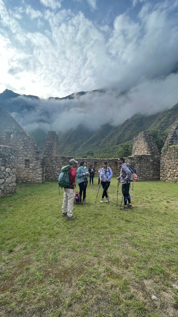

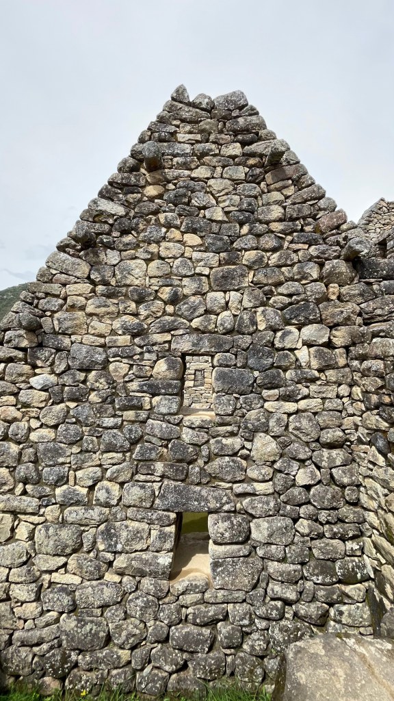
By 10, the sun was on top of our head. The steep uphill walk sucked the energy out of everyone. There were some shades built along the way for the hikers to take refuge from the burning sun which were a welcome sight. By 12, we were at the footstep of Winaywanya. There is an extremely steep series of steps that we had to cross to get the top. It took us more than an hour to cross Winaywanya. This amazing place was discovered quite recently in 1964. Given how intact this place was, it was also called mini Machu Picchu. It is believed that this was an agricultural research center, just like Moray. Seeds of many different crops were found here. The large buildings here were used for biologists and farmers to live and store food. The buildings used to store food had large windows in the east direction for cool air to come in and keep the food fresh.


Our lunch spot was 15 minutes away from Winaywanya. We finished our lunch by 2PM. After half an hour of flat walk, there was a steep incline ending up at fabled Sun Gate.
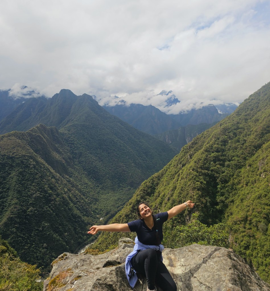
Inti Punku was one of the main entrances to the citadel. The construction and strategic location give a clue that it must have been guarded by military at that time. It was called Sun Gate because sun illuminated the door during winter solstice. The sun gate is built at an altitude of 2700 meters above sea level, roughly 300 meter higher than Machu Picchu. Getting the first glimpse of Machu Picchu from the Sun Gate was one of the best things we did during the trip. We were looking at one of the 7 modern wonders of the world.
The thing about Sun Gate is that you get to appreciate the whole landscape where the Machu Picchu citadel is situated. When you are within the citadel, you don’t realize that. Cradled between the two mountains Machu Picchu and Huayna Picchu, this modern wonder of the world last lasted hundreds of years in an earthquake marred zone. And you can appreciate that only when you look at it from a distance – from the Sun Gate.

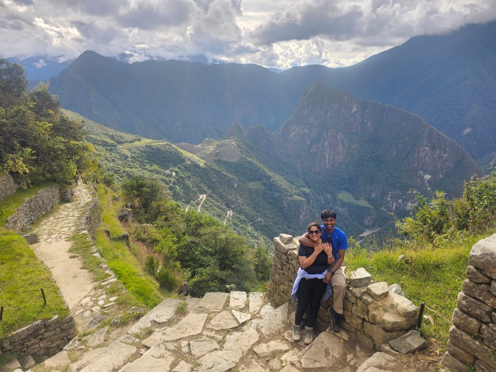
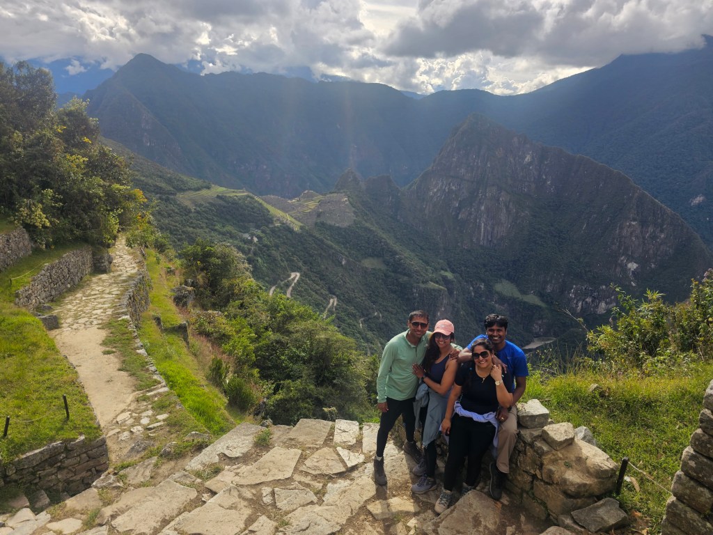
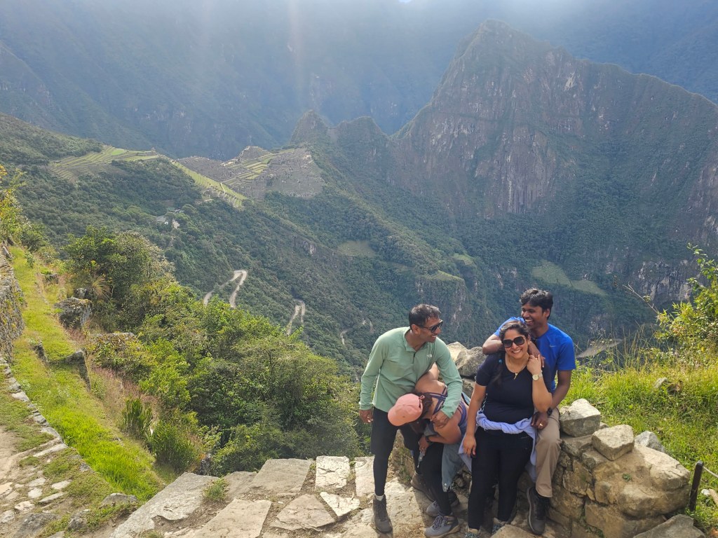
After much needed breather at the Sun Gate, there is a gradual downhill walk for 45 minutes that takes you to the Machu Picchu citadel. You don’t get to enter the citadel, but just look at it from a viewpoint that lies south of the citadel. I think most of the Instagram pics of Machu Picchu is clicked here.
As we crossed Sun Gate and continued downhill, we saw an altar. Incas believed in 3 gods – Viracocha, Apus and Pachamama. Viracocha is the god of creation. He is attributed to creating sun (Inti), moon (Mama Quilla) and all celestial bodies. Apus is the mountain god, while Pachamama was mother earth. The 3 stepped altar represented these 3 gods. Corresponding to the 3 main goods, there were 3 holiest animals that Incas worshipped. Condor – the guardian of the sky, puma – the guardian on the earth and snake – the guardian inside the womb of Pachamama.
It was genuinely a magical experience. We were looking at a city that has managed to withstand the test of time and nature’s force. We clicked many pictures here for next 45 minutes. There was so much greenery around, so much history to soak in that we didn’t realize it was already 5 PM. We took the last bus that took tourists from Machu Picchu to the nearest town, Augus Calientes, 30 minutes away. Bernabe took us to our hotel nearby.
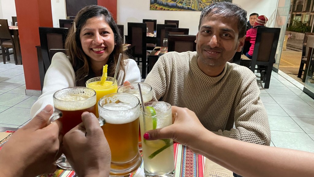
The day ended with smiling faces, delicious dinner and a lot of beer.


Day 10, May 28th 2023 – Machu Picchu
This day was the culmination of all the hard work of past few days. This is what we had come to Peru for. We entered the Machu Picchu citadel.

A bit about Machu Picchu
In Quechua language, “machu” mean old and “picchu” means mountain. It was built by 9th Inca king, Pachacuti, as his royal estate around 1450s. Built in 1450s, it is believed that Pachacuti family and his noblemen came to this place to escape the harsh winters of Cusco which is at much higher elevation than Machu Picchu. Expansion work was still going on when Spanish conquistadors arrived and ransacked Inca empire. To protect their religious structures and customs, Incas fled this city and took refuge elsewhere to keep this place a secret from Spaniards. And the plan worked. This masterpiece eluded the gaze of rest of world for almost half a millennium before being rediscovered by an amateur Yale professor Hiram Bingham in 1911.
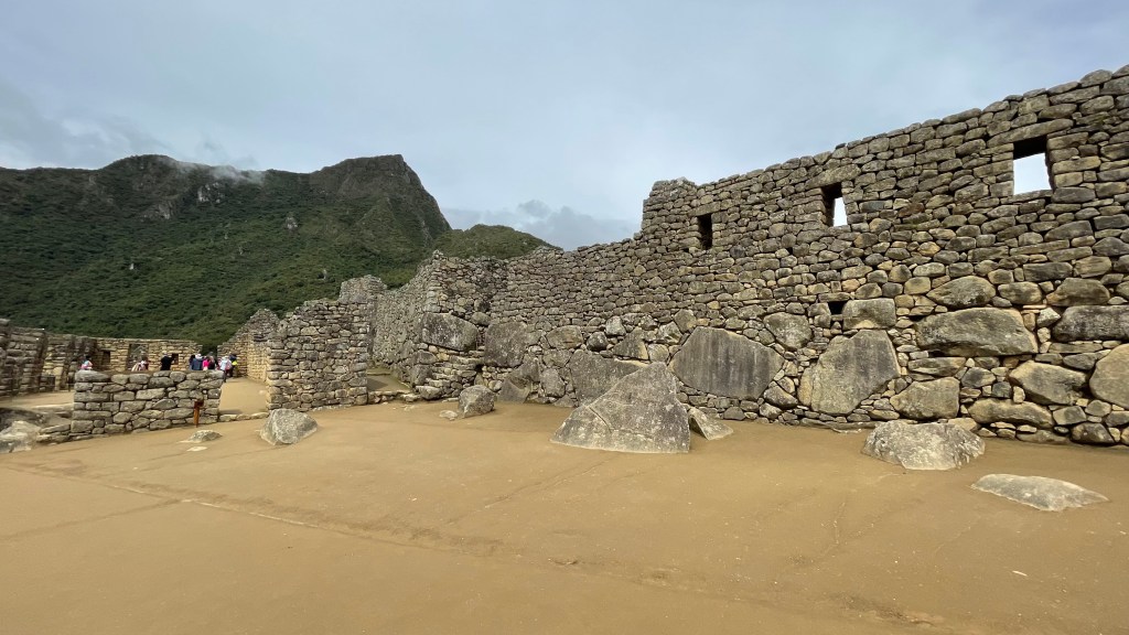
Machu Picchu city sits in a saddle between two mountains: Machu Picchu and Huayna Picchu. The fractured rocks of the fault zone upon which Machu Picchu is built serve as the stone quarry. The city is strategically located on a cliff that drops vertically almost 450 meters and is wrapped by Urubamba River from 3 sides. The hot air rising up the mountain cools rapidly condensing the water droplets in it. This causes the typical morning mist that envelops the city of Machu Picchu and imparts the citadel with a mysterious vibe.
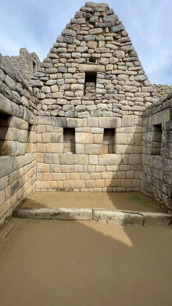
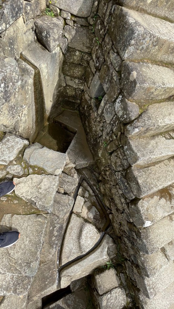
This area is a fault zone and encounters frequent earthquakes. Since the rocks are so snugly fit into each other without the use of mortar, during earthquakes the stones used in the buildings quiver and fall back into their position. The engineering genius of Inca is further reinforced by looking at the 3-meter-deep foundation on which the city is built.

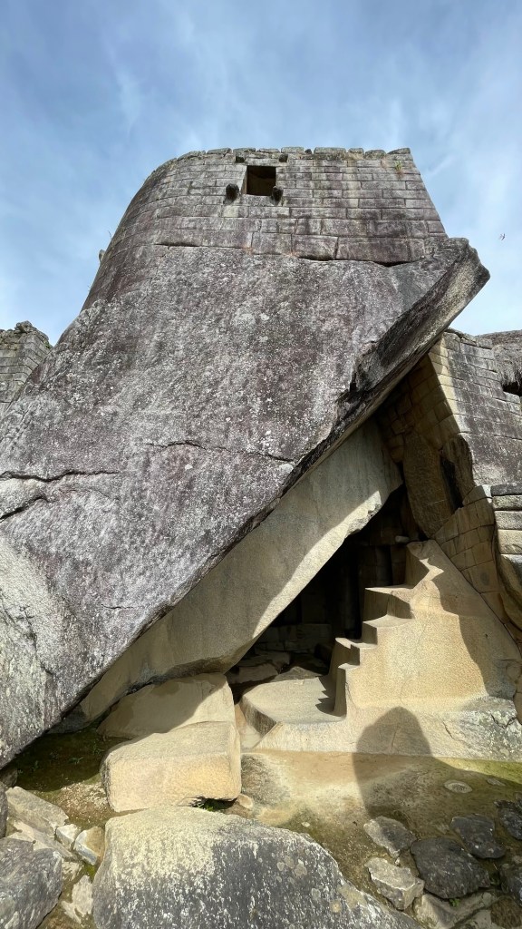
Incas had a very organic relationship with the stones. If not needed, they wouldn’t move or cut the stones at all. They would build their structure using the existing stones. The buildings seem to grow out of the mountainside. Temple of the sun is a very good example of this. It is a circular structure made of stone blocks assembled to perfection on a mysterious cavern. Inca engineers didn’t cut the huge bed rock but built the sun temple right on top of it. “Intihuatana” (pronounced intiwatana) is another good example of this. This was a solid bed rock found at the top. Incas just carved the tip out of it. It wasn’t brought or placed here. It is believed that this was used as a sun dial by Incas. At midday on 11 November and 30 January, the Sun is situated almost exactly above the pillar, casting no shadow. On 21 June, the stone casts the longest shadow on its southern side, and on 21 December a much shorter shadow on its northern side.
What was its purpose? Why was it built?
Machu Picchu was a royal estate of Pachacuti. But an emperor and the royal family can’t live on their own. The entire entourage of religious experts and skilled workers lived here as well, mostly for the king’s well-being and enjoyment. It is estimated that more than 750 people lived here at Machu Picchu, with most serving as support staff for the royalty. So, Machu Picchu city was divided in two sectors – urban and agriculture. The urban sector had residential buildings for royal family and nobles, along with temples. The agricultural sector had terraces for farming and buildings for common people. These two sectors are separated by a main square. It is believed that this plaza was the socializing place for royals, religious priests, and common people. Clapping or shouting at the main square creates an echo. Many believe it was used by kings to call their servants.
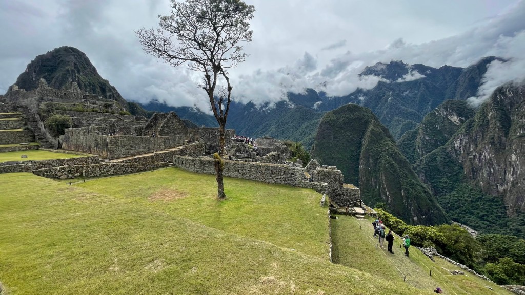
There are hundreds of terraces at Machu Picchu. These terraces not just helped with farming but also protected the mountains against soil erosion and landslides. These terraces were formed in layers. The bottommost layer had larger stones covered with loose gravel. On top of gravel was a layer of sand which was further covered with rich topsoil from the Urubamba basin. However, these terraces weren’t enough to support the food requirements of 750+ people staying here. It was imported from nearby places. This is where those massive road network of 25,000 miles that Incas built came handy.
Machu Picchu lies at the beginning of the Amazon rainforest. It received an ample amount of rainfall. So, irrigation was not needed here. However, they had to build an elaborate drainage system to control the runoff from heavy downpour. There are almost 130 outlets in the center that moved water out of the city through aqueducts. The aqueducts are zigzag shaped to check the speed of water.
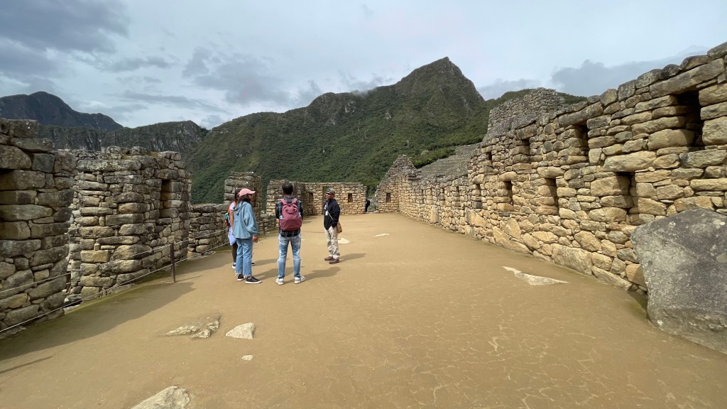

We entered Machu Picchu at around 8 AM. As we set foot in, we were greeted with a sea of morning mist enveloping the city, seeping between the stone structures and hiding the lush green mountains from sight.
For about an hour Bernabe educated us about the history of Inca kingdom, its rise and downfall upon the arrival of Spanish conquistadors. He told us about Hiram Bingham, his story of how he stumbled upon Machu Picchu in his quest to find the last city of Incas, Wilkabamba. He guided us through the pre-determined route of circuit #3 inside the city and stopped at every place to explain and answer our questions. By the time we were done it was 12 PM. We went back to Augus Calientes and had our lunch. From there it was the same train ride back to Ollantaytambo and a 4- hour drive back to Cusco airport. We had our flight back to Lima at 9 PM that night.
Important tip – There are different “circuits” to visit Machu Picchu. Inithuatana can only be visited when you take circuit 2. Circuit #2 is the best one and the only one that includes Intihuatana. We took circuit #3. The circuit you take needs to be chosen at the time of booking your Machu Picchu ticket and can’t be changed later. So, it would be good to follow up with your guide on this.Circuits of Machu Picchu ★ MACHUPICCHUGOB.PE
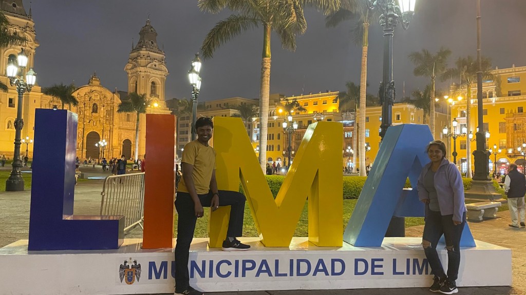
Day 11, May 29th 2023 – Lima
Much tired from past 10 days of travel, I kept the day light. Shalini and I went to see the catacombs of Lima around 1.30 PM that day. Anshu and Sneh stayed back at the hotel to rest further. Catacombs are underground passageways to bury human remains where space is scarce. The catacombs of Lima are built under Basilica and Convent of St. Francisco. Built in 1546, the use of these catacombs for burial continued through Spanish occupation of Peru until 1810. It is believed that almost 25,000 bodies lie within the labyrinthic walls of this structure. A special catalyst was used to expedite the decomposition of the bodies so that the burial space could be reused. However, the stronger bones like skull, hip girdle and femur persisted and still sits within the confined walls of the catacomb. There was an eerie feeling walking on those dimly lit narrow passageways filled with hundreds of skulls and other skeletal remains. A complimentary English tour is included in entry ticket of this place. You can also take a private tour if interested. We went with the former.
We had registered for free walking tour of Lima. Shalini and I joined the group at 3.30 at the meeting point; Anshu and Sneh gave it a skip. Frankly, based on my experience at Bruges and Ghent, I had higher expectation of the walking tour, but it was sub-par. The guide tried, but his explanation lacked a cohesive story. His pronunciation was also not clear enough for me. Anyway, we left the walking tour (we tipped the guide nevertheless!) in between and joined Anshu and Sneh for an Italian dinner at the main square.
Day 12, May 30th 2023 – Return to San Francisco
I must say that the breakfast spread at the Lima hotel was much better than Cusco hotel. We stuffed our stomachs and left for the airport at 10 AM. The flight back to San Francisco was without any hiccup. We landed at San Francisco post-midnight on May 31st.
A word about First Step Expedition
I can’t finish without talking about First Step Expeditions. The people who we trekked with were amazing. Javier, the founder of First Step Expeditions, patiently answered all our questions and guided us through every step during booking. Bernabe, our trekking guide, was very knowledgeable and helpful. When Shalini fell sick on day 1, I was a bit concerned but his calmness gave me some respite. We gave supplemental oxygen to Shalini, but he made it feel as if there is nothing to worry about. Unfortunately, Shalini and I had to return to Cusco on day 2 as she didn’t feel any better. Rene, who was one of the porters travelling with us, accompanied us all the way to the hotel. That’s the end-to-end customer experience. The local manager of First Step Expedition, Roger, visited the hotel the next day to check on Shalini’s health. These simple gestures matter, particularly when you in a different country where you don’t speak their language. Then there were cooks and porters. Oh my god, what Carmello, the head chef, can do with a simple stove in a small tent is simply magical. You can read more about the team here – Who We Are – First Step (firststepexpeditions.com).
I had an experience of lifetime with First Step Expeditions and I would whole heartedly recommend them to any of my friends and family travelling to Peru.

Wow!..what an exhaustive account of your trip and the details of Machu Pichu, Rainbow Mountain etc.
Thanks….added to bucket list!
LikeLiked by 1 person
This is wonderful, thank you for sharing your photos.
LikeLike