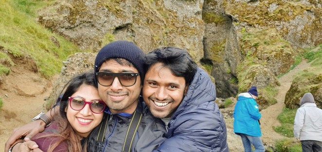
Seriously, Iceland is a land of ice and fire. Its history, its geology stands testimony of this. Iceland was forged by fire 20 million years ago and molded by Mjölnir of ice some 1.5 million years ago. The diversity of geology, flora and fauna in Iceland is mind-boggling. You see things here that are exclusive to this small island, you do not see it anywhere else in this world.
What happened 20 million years ago?
Geologists have gotten clues by observing an active volcano Hekla in Iceland. Hekla sits along the mid-Atlantic ridge. It has tear that not only spans the width of volcano but extends 5 km around it. And analysis of rocks here showed presence of elements like Caesium that found deep within earth. That means this magma came from deep pockets of earth.
So, what really happened? The answer is union of hotspot and mid-Atlantic ridge.
Mid-Atlantic ridge is a mid-oceanic ridge that separates Eurasian and North America tectonic plates. And hotspots are underground volcanic regions anomalously hot compared to surrounding mantle. The position of hotpots on the Earth’s surface is fixed; it is independent of tectonic plate boundaries. These are the same hotspots that are found in Yellow Stone National Park and Hawaii. The hotspot beneath Iceland is almost 100 miles wide and 400 miles deep.
Millions of years ago, mid-Atlantic ridge drifted eastwards meeting the fixed Icelandic hotspot. This deep Icelandic hotpot force combined with mid-Atlantic ridge. The decompression of rocks in mid-Atlantic ridge led to the melting of rocks. These molten rocks when combined with deep Icelandic hotspot force created a huge amount of magma to spew up, thus creating a volcanic landmass which is present-day Iceland. This hotpot and mid-Atlantic ridge are locked in a deadly partnership even since.
Scientists got of glimpse of what it would have looked like on 14th Nov 1963 when Surtsey island formed in front of the world.
Iceland is a place where mid-Atlantic ridge (which usually in beneath Atlantic sea) rises 3000 meters above the sea floor. So, you can literally see a fissure separating North American and Eurasian tectonic plates.
But what sculpted the distinctive shape of Iceland?
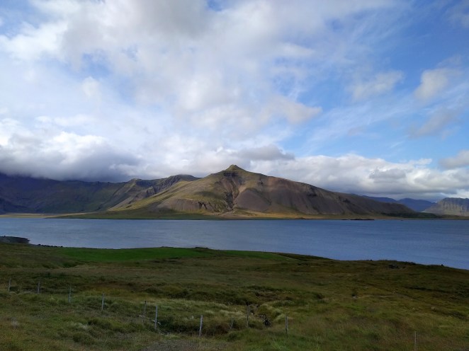
If Iceland was just formed by volcanic eruptions, it would most probably have been somewhat rounder in shape like Hawaii and Tahiti. But that’s not the case. Iceland’s northern coastline is indented by deep burrowing fjords that extend far inland.
Notice the jagged northern coastline of Iceland
The answer lies with power of erosive power of glaciers. About 1.5 million years ago there was an ice age that covered entire Iceland. As the ice retreated, it carved out Fjords in northern Iceland. The glaciers on top of active volcanoes are a deadly combination. Glacial floods are caused by hotspots beneath the thick sheet of ice. The fissures are created beneath ice sheet and channels the water (near the source of hotspot) towards the edge of glaciers. The erosive power of such floods can change landscape within matter of days. These same glacial floods eroded otherwise rounded island forming fjords and indented coastline.
Grimsvotn is one such active volcano beneath ice in Vatnajokull which last erupted in 1996 and wreaked havoc in Iceland with glacial flood. Vatnajokull is largest glacier in north hemisphere. It squashes land and gouges out solid rocks and played an important role in shaping past and present-day Iceland.
Iceland is a place where volcanoes and glaciers are locked a titanic battle for supremacy. Nature’s song of ice and fire indeed!
Itinerary at a glance
| Date | Places | Accomodation |
| 08/14/2019 | Reach Reykjavik | Cosy central apartment |
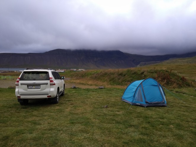
| 08/15/2019 | Reykjavik to Snaefellsnes Peninsula | Grundarfjörður camping ground |
| 08/16/2019 | Snaefellsnes Peninsula to Akureyri | Reykhús Guesthouse |
| 08/17/2019 | Sightseeing around Akureyri | Same as above |
| 08/18/2019 | Akureyri to Reydarfjordur | Reydarfjordur camping ground |
| 08/19/2019 | Reydarfjordur to Hofn | Hofn camping ground |
| 08/20/2019 | Hofn to Skaftafell | Skaftafell camping ground |
| 08/21/2019 | Skaftafell to Hvolsvollur | Eystra-Fíflholt farm |
| 08/22/2019 | Sightseeing around Vik | Same as above |
| 08/23/2019 | Golden Circle | Stopover Apartment |
| 08/24/2019 | Leave Iceland | NA |
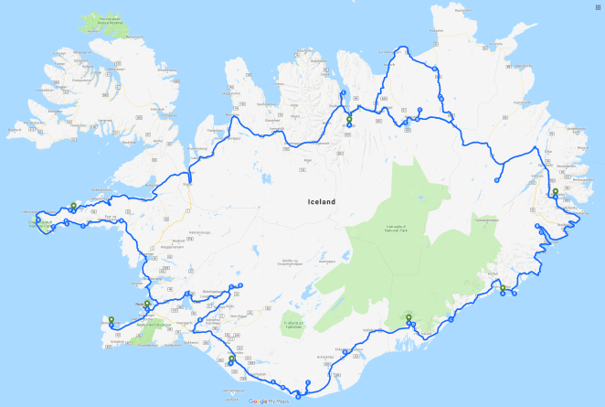
Drove a total of 2727 km around Iceland
Day 0: Halló Iceland! 14th August 2019
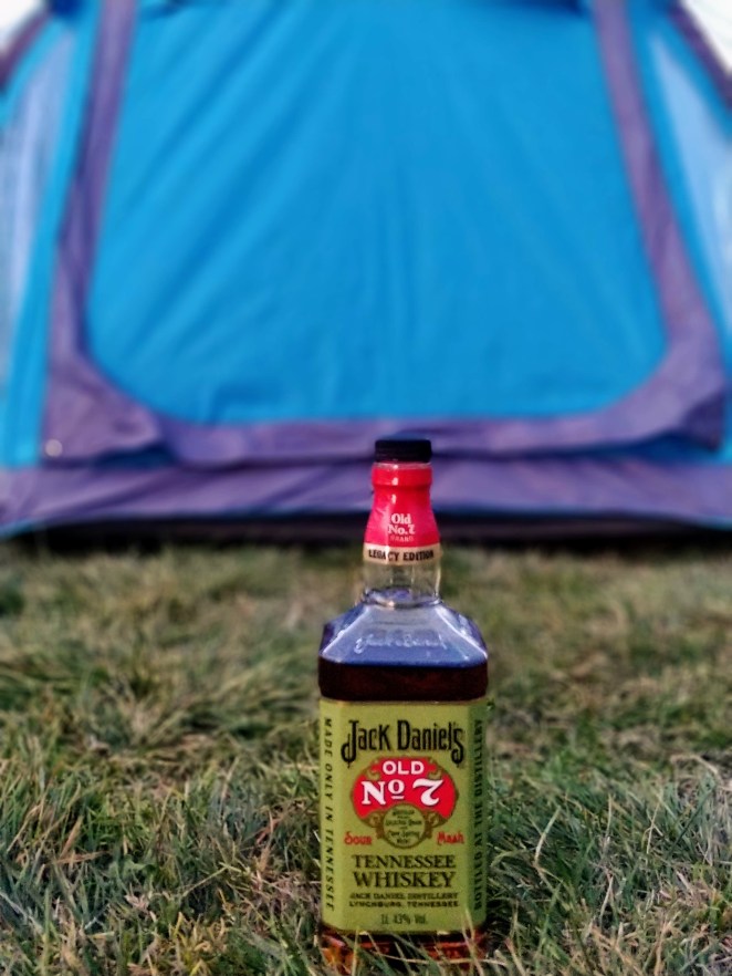
We had a 10:30 AM flight from Brussels to Reykjavik via Copenhagen. We ate apples in the morning and left for airport by 8 in the morning. Anshu was hell bent on buying some alcohol from duty-free for Iceland as it is very expensive over there. And I was sort of not in favor as we were supposed to drive for next 10 days and I didn’t want alcohol to impact our driving. Eventually, I yielded. Who wouldn’t? The convincing power of Anshu is well-known in my coterie of friends. We picked up a legacy edition of Jack Daniels and Baileys. I also picked a pack of Carlsberg for myself. After all, when in Denmark why not pick the local Danish delicacy.
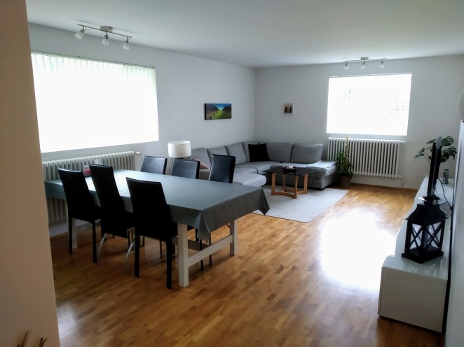
We reached Reykjavik at around 3 PM local time. There is a free shuttle that runs every 15 minutes from arrival and takes you to different car rental agencies in airport campus. We had rented our car from Iceland Car Rental. By the time we were done with formalities it was 5.30 PM. The car we got was Toyota Landcruiser. Anshu sat behind the driving wheels first and we drove towards out Airbnb. It was a nice, cozy 2-bedroom apartment with well-equipped kitchen and bathroom in Fellsmuli, Reykjavik. The host Karen was kind to wait a bit longer for us and showed us the apartment.
We were famished by now. We quickly got freshened up in half an hour and left to have some food and do some grocery. Grocery was important because we were camping the next night. We had our dinner at Tian Chinese Restaurant and bought some grocery stuffs afterwards.
It was a calm day, not very happening, but much needed for a roller coaster awaiting ahead. And we did raise a toast to it.
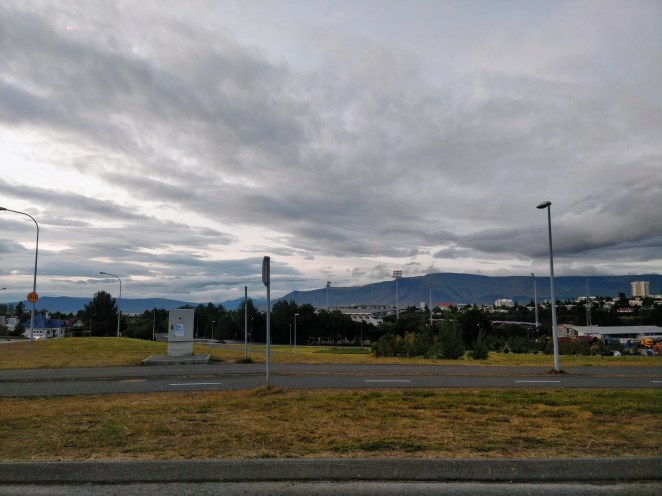
Entering Reykjavik
Our Airbnb

Nothing can go wrong with this combo!
Day 1: Reykjavik to Snaefellsnes Peninsula, 15th August 2019
It was Rakshabandhan on that day. Woke up to a video call and blessings from my lovely sister. We usually underestimate the fact that there are people in this world who love you unconditionally. No matter what you are doing, no matter where you are. In this world full of negativity, one should feel privileged to have someone like this in life.
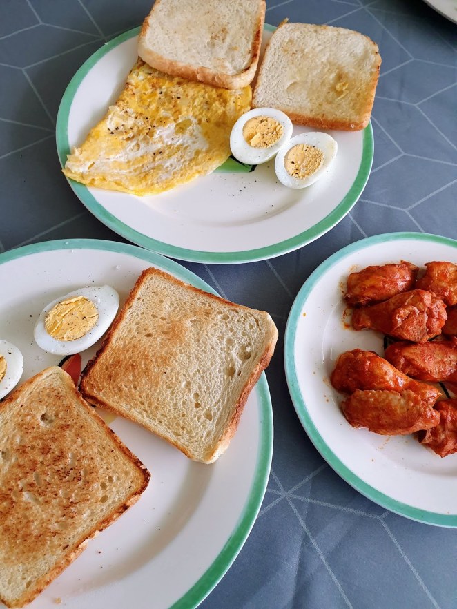
We prepared an awesome breakfast – bread and omelet. Actually, Anshu prepared it. I “supervised” him 😉. We went to Iceland Camping Equipment to pick up our camping stuffs. We had pre-booked a tent, 2 sleeping bags, 2 sleeping mattresses and a gas stove. I had brought my own sleeping bag and mattress with me. Additionally, we picked up cooking utensils and a hammer (required for pitching tent) when we went there. We chose Iceland Camping Equipment because it is pretty popular and has very good reviews. The best thing in my opinion is 24/7 pick-up and drop-off facility they provide. You don’t have to necessarily come during their office hours.

and it begins…
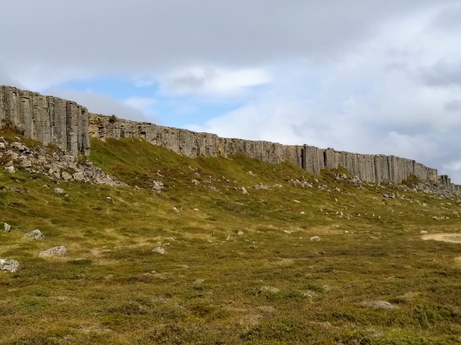
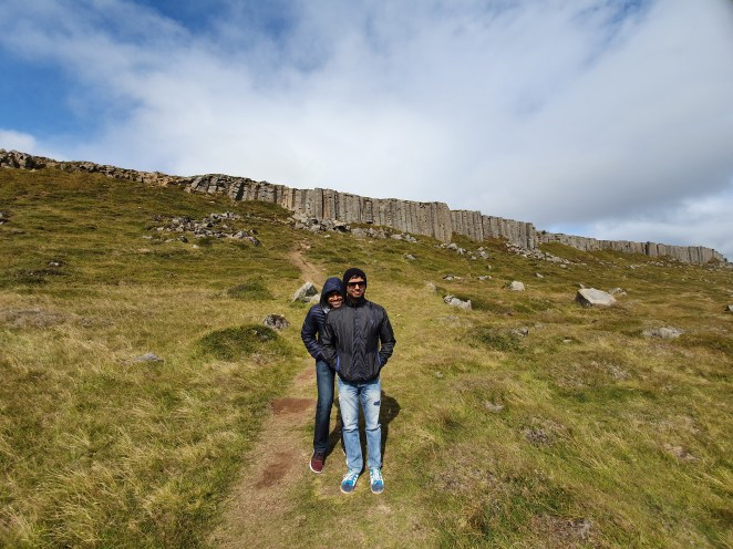
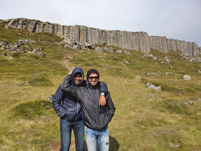
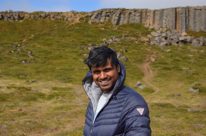
We officially started our road trip after this, at around 11.30 AM and headed towards our first stop of the day – Gerduberg basalt columns. It is simply breathtaking. Almost a kilometer-long cliff of hundreds of basalt columns stacked vertically like a standing army. The way these basalt columns form is sheer beauty and stands an epitome of how nature brings order in chaos. When a wet mud dries, it develops polygonal mudcracks. Similarly, these columnar basalts are formed when magma cools slowly and cracks into columns, usually hexagonal, as the surface area decreases. This by no means is a proper explanation of how they are formed; there is still ongoing research on why hexagonal shape.
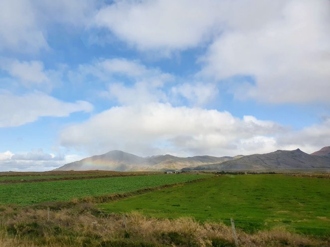
Not even 1 hour into our drive and we saw a mountain smeared with rainbow
Landscape painted with black volcanic mountains
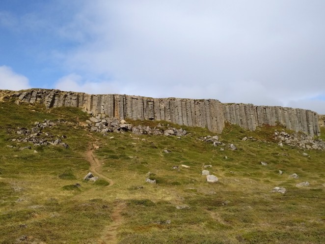
Gerduberg cliffs
Nature’s attempt to bring order in chaos
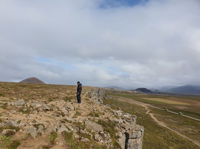
On top of Gerduberg cliffs
Our next stop was Yti Tunga Seal Beach. It’s a golden sand beach which is a popular seal colony. We were lucky to see a few seals lazing around. We didn’t spend much time here and quickly headed for our next stop which was Bjarnafoss waterfall. It’s a small hike all the way to the top of the waterfall. None of us felt like hiking that day. And moreover, we had a few other interesting spots to see. So, we chucked that.
We made a quick stop at Budakirkja Black Church. There is a lava field near this wooden church. A vast field of landscape pockmarked with black undulated solidified lava. Some of it was covered in green and grey moss while others were still barren and black. There is a hiking trail through the lava field as well. Some tourists were doing that; we skipped it. We headed towards Raudfeldsgja Gorge. This is small mountain fissure that leads to a mossy grotto. There is a secret’ish passageway between tall imposing cliffs looming on all sides. This gorge or fissure was cut by a waterfall. You can clearly see the path of once flowing river nearby. The gorge can easily be entered, but as you go deep further, it narrows down. One has to clamber the rocks and confront the water stream to go deep inside this ever-narrowing gorge. I went a little bit deeper, but then backed out sue to difficult terrain. You should also have waterproof shoes for this place.
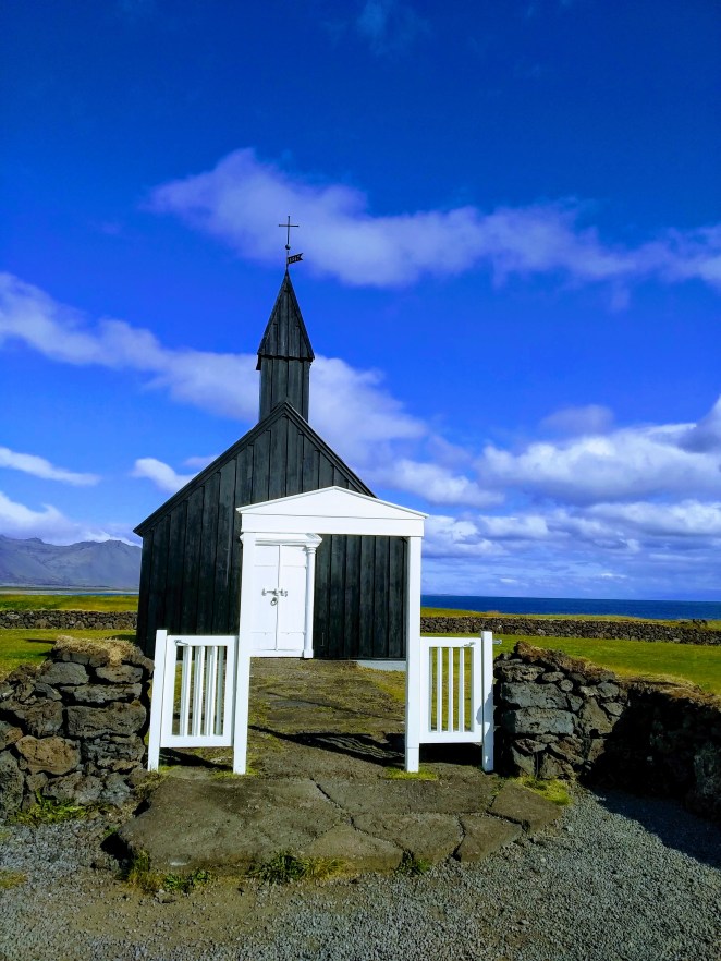
Budakirkja black church
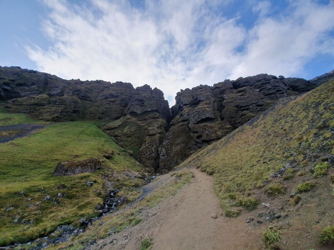
Raudfeldsgja Gorge
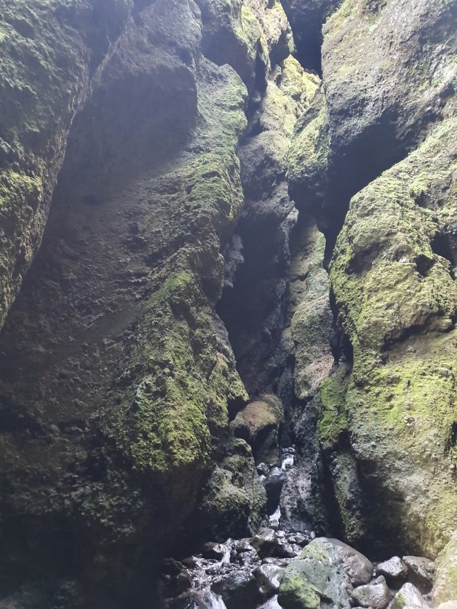
The gorge narrows further as you go in
View from top of the Raudfeldsgja Gorge
 We, then, went to see Saxholl Crater. Saxholl is estimated to have erupted 3,000 years ago, and much of the surrounding landscape is the result of that eruption. A staircase is constructed to reach the top of the crater. Usually it is 5-10 minutes’ walk up the top, but probably we took more because it was super-windy. It was difficult for us to stand straight. The rim of the canyon provides a beautiful view of dried lava field that this volcano spewed upon eruption.
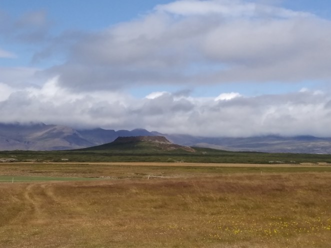
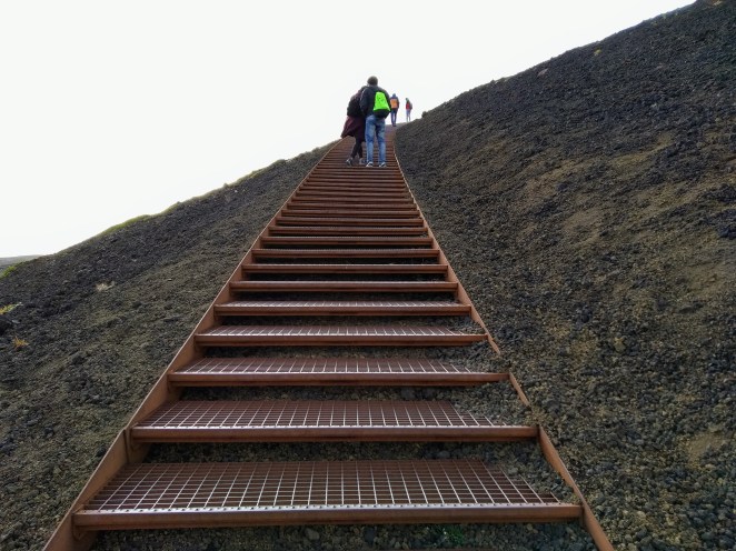
Staircase leading up to Saxholl crater
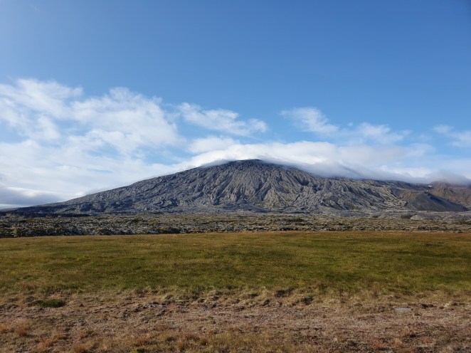
Look at the lava flow etched into a volcanic mountain we found on our way
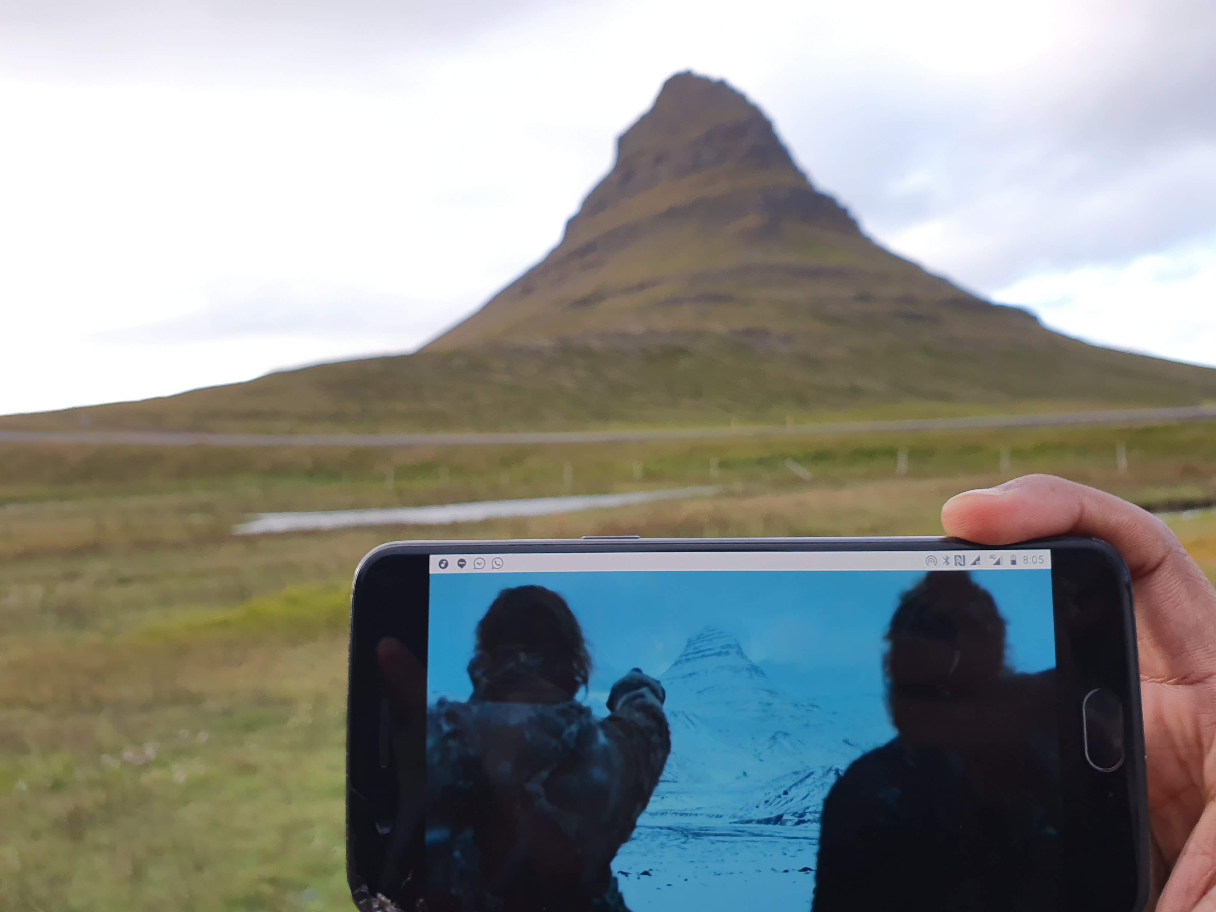
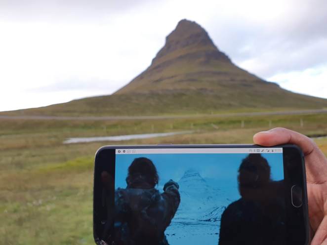
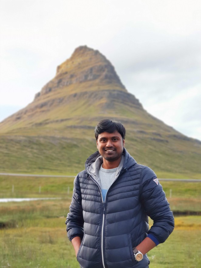
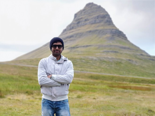
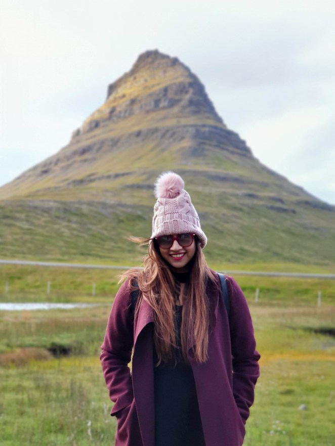
Our last site of the day was Kirkjufell. This is also referred to as “Church mountain” because of its resemblance to a church steeple. Still doesn’t ring a bell? How about “arrow-head mountain”? Fans of Game of Thrones would have figured it out by now. Yes, this is the same mountain that The Hound saw in his vision. This mountain is showcased from the scenes ‘North beyond the Wall’ when Jon Snow, The Hound and Jorah Mormont, amongst others, brave the wilderness in hopes of catching an undead wight. The colors of Kirkjufell changes with season. It was lush green when we went, but it is covered in snow during winters (probably that’s when it was shot for Game of Thrones episode). A namesake Kirkjufellsfoss waterfall flows besides this mountain turning out to be photographers’ delight. No doubt this is one of the most photographed waterfalls in Iceland. It is difficult to fathom that a mountain with such a distinctive shape can actually exist. But Iceland has a lot of surprises in its scuttle.
Looks similar, eh?
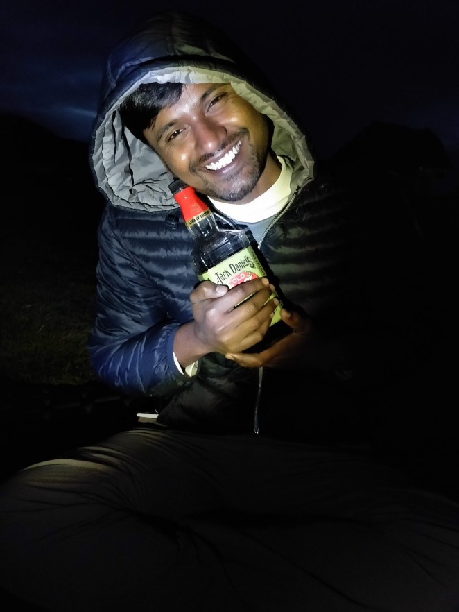
This was our last pitstop today and we went to our camping site Grundarfjordur which was just 10 minutes’ drive from Kirkjufell. By the time we pitched our tent it was 9.30 PM. The camping price here was 1100 ISK per adult which is pretty cheap by Iceland standards. We cooked instant noodles for our dinner with Sneh at the helm. And to calm our body and resist the cold wind, all three of us had a couple of pegs of Jack Daniels.
Snaefellsnes Peninsula is often referred to as “Iceland in miniature”. It truly is. We saw vast lava fields, volcanic craters, black volcanic mountains, green meadows, fjords, black and golden sand beaches, gorgeous gorges, picturesque waterfalls and cute fishing villages. And this was just Day 1.
Grundarfjordur campsite
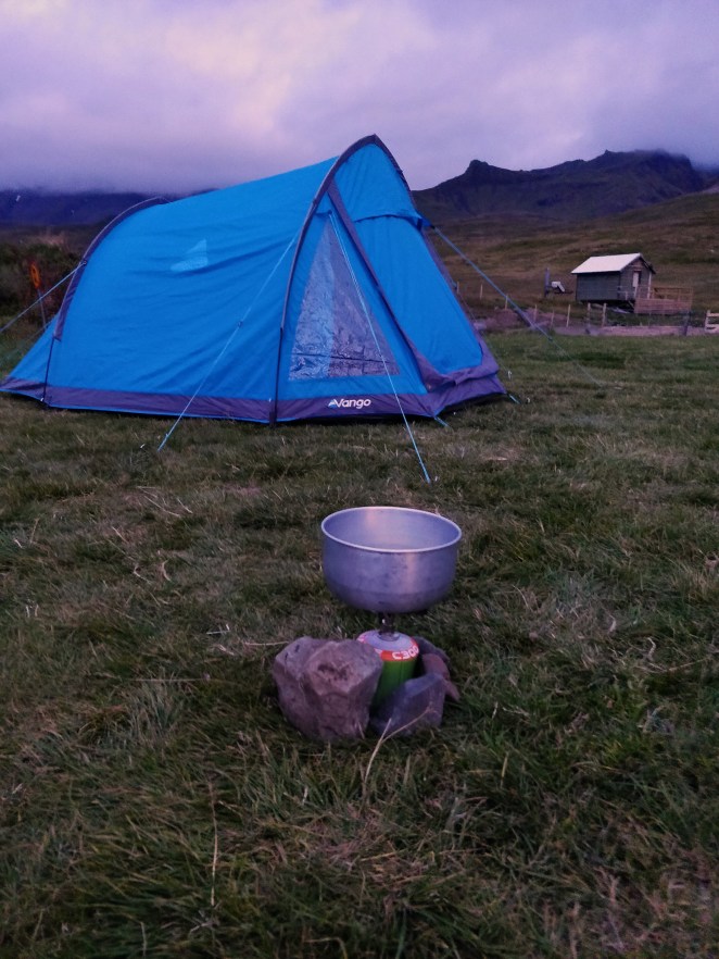
Dinner
Like a boss…
My precious 😉
Day 2: Snaefellsnes Peninsula to Akureyri, 16th August 2019
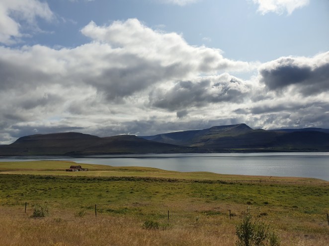
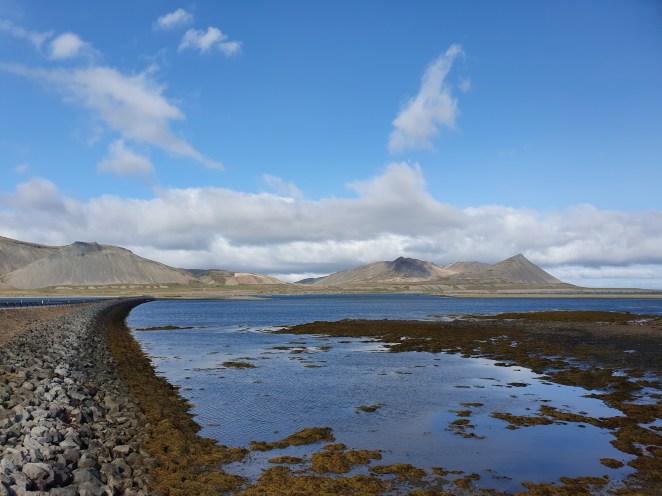
Snuggled comfortably in your warm sleeping bag, I woke up to the sound of strong gush of wind slapping my tent. I didn’t want to come out, but my bladders were bursting. When I got out of tent, I was amazed by sheer beauty of the campsite. I had missed seeing it last night. Against the backdrop of black barren volcanic mountains, nestled was this beautiful meadowy campsite. Different shades of green spluttered all around, a blue fjord flowing nearby, and dotted by a few wooden houses with red rooftops.
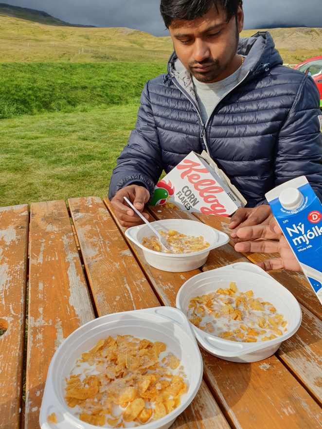
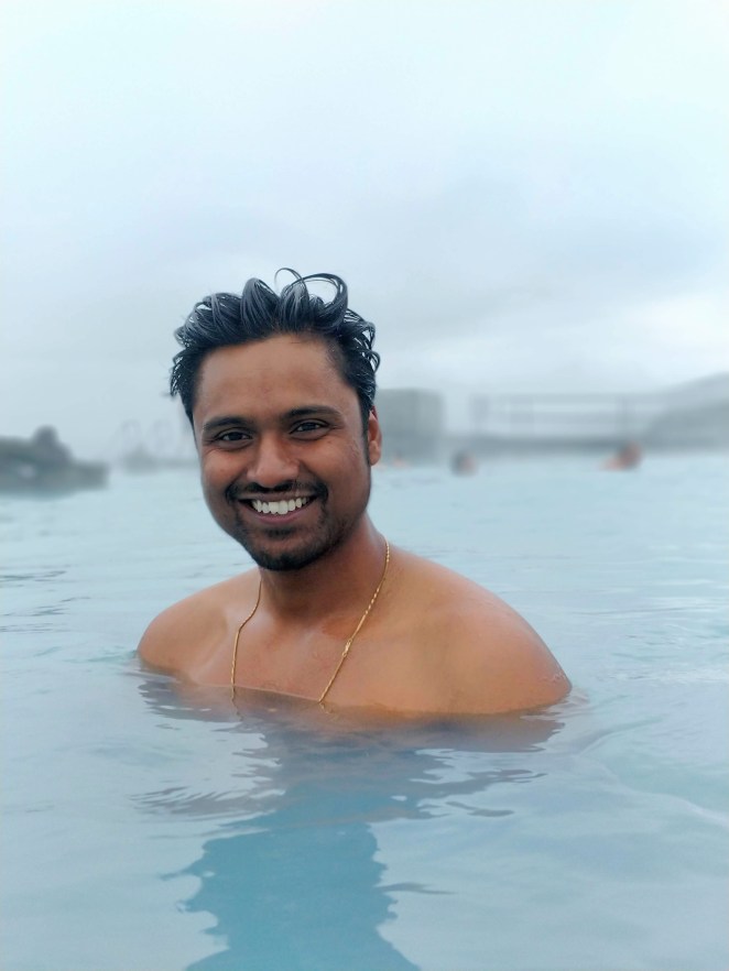
All of us freshened up and had our breakfast – cornflakes, muesli and milk. Thanks to the grocery shopping we had done on 14th. It was a long 5 hours’ drive to Akureyri that day. We left the campsite at around 11 AM that day and reached our Airbnb in Akureyri at around 5 PM. When we reached there, our host was not present, and our call was going to her voicemail. Fortunately, after waiting for some time, her son Hendrick showed up and he opened the house for us and showed us around. It was a 1-bedroom apartment with an additional sofa bed, decent enough for 3 people. More than the house, I was impressed by its location and greenery all around. We hadn’t taken a bath at the campsite in the morning and decided to go to Myvatn nature bath. Myvatn was 1-hour drive from our Airbnb. We were running quite late than the scheduled arrival time. We quickly booked our slot for 7.30 PM and started driving at around 6:15PM. We wanted to go early and come back early and take rest as we had a busy schedule next day.
Myvatn is a man-made lagoon that draws its water from National Power Company´s bore hole in Bjarnarflag. The alkaline water of Myvatn has a temperature of about 36-40 °C and is rich in minerals. Owing to its chemical composition no bacteria grows in this water and is very good for skin. It was a cold evening. The temperature was about 4°C. Taking bath in open at this temperature may sound outlandish to some, but guess what, this is what tourists come this far for. You have to take a mandatory shower before going in the pool. Since, it was so cold outside I ran from the changing room and jumped into the pool. It was so cold outside that those 5- seconds felt like eternity. The hot water of the lagoon provided much needed respite. We spent about an hour and a half there and left by 10 PM. While going back, we encountered a mountainous stretch that was so foggy that the visibility was mere 3-4 meters. It was a precarious drive. Fortunately, it was not long. While coming back, we picked a Domino’s pizza and chicken wings for our dinner.
Morning breakfast
Isn’t that cute?
Barren volcanic mountains cut by deep burrowing fjords
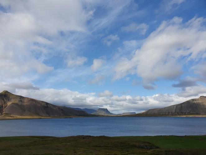
Barren volcanic mountains cut by deep burrowing fjords
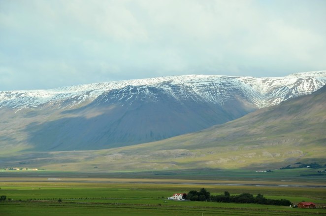
Landscape changed at every turn
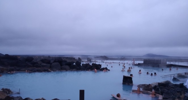
Myvatn nature bath
Myvatn is towards Husavik and you have to pay a tunnel toll of 1500 ISK each time you cross a tunnel between Akureyri and Husavik. So, a round trip will cost 3000 ISK. This toll tax has to be paid within 3 hours of crossing the tunnel if paid on the fly. Else, you can also schedule it in advance and the amount will be deducted when you cross the tunnel. Details can be found here – www.tunnel.is. Crucial thing is to pay it in on your own. We didn’t pay 1 toll tax (when we left for Egisstadir on 18th August). The result was that we had to pay 2500 ISK (increased amount as a fine), plus the car rental agency charged an additional 2490 ISK as a service fee for paying it to government on our behalf. So, we ended up paying 4490 ISK instead of 1500 ISK.
Day 3: Places around Akureyri, 17th August 2019
We had a booking at 10.30 AM for whale watching with North Sailing in Husavik. However, when we reached there, we came to know that due to bad weather it was canceled. We were given an option to either get a full refund or opt for whale watching in Hjalteyri (instead of Husavik). Hjalteyri is 15 minutes’ drive from Akureyri. So, we chose 6 PM slot on that very day and planned to go visit the other schedules sites before this.
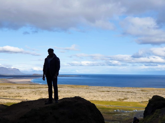
We started with Asbyrgi canyon. It is a massive horseshoe-shaped canyon located in north-eastern side of Iceland. It is believed that two to five thousand years ago, special circumstances existed in northern edge of Vatnajokull glacier. Huge lakes of melted water were formed near three active volcanos. When these volcanos under the ice erupted, they broke the “ice dam” that held these lakes. Massive amount of water flowed in a matter of day or two towards sea and carved out this canyon. It is just mind-blowing to witness what a massive force water could be; carved out a canyon in matter of days. Amazing! Botnstjorn pond at the bottom of Asbyrgi is remnant of a big waterfall that fell from the cliffs. We got a good view of cliffs from a viewpoint here. We, then, did a short hike to another viewpoint which was a greater height and got a complete view of the canyon. It is so perfectly formed that local folklore says that it was formed by the stomping of one of the hoofs of eight-legged horse of Norse god Odin.
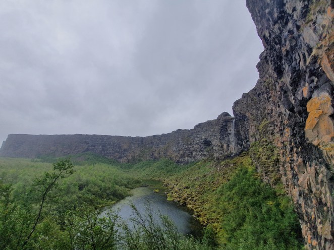
Horseshoe-shaped Asbyrgi canyon
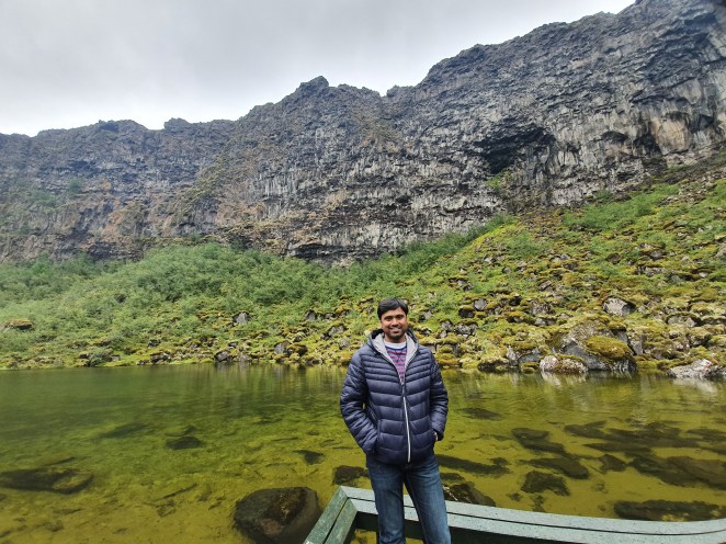
Botnstjorn pond at foot of Asbyrgi
Next, we headed towards the falls Dettifoss and Selfoss waterfalls. These two falls lie in the northern part of great Vatnajokull national park and are fed by powerful glacier river Jokulsa a Fjollum originating from Vatnajokull glacier. I was amazed by Dettifoss. The massive force with which millions of tons of water falls into an abyss is jaw-dropping. It is 100 meters wide and 45 meters deep, but the force is water is so massive that I wasn’t able to see the bottom. The wind was so strong here that we were able to see smoke of water rising up in the sky from far far away. The impact is further enhanced by the vicinity from which you can observe this waterfall. There are other waterfalls in Iceland which are this powerful and massive, but the thing that stands out for me is how closely you can experience it. In case of Dettifoss, you can get quite close and feel the power. A sibling of Dettifoss is Selfoss which was 0.6 km away. Selfoss is also fed by the same glacial river. It is slightly smaller than Dettifoss.
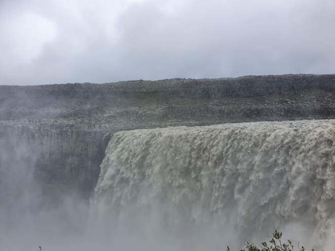
Dettifoss waterfall
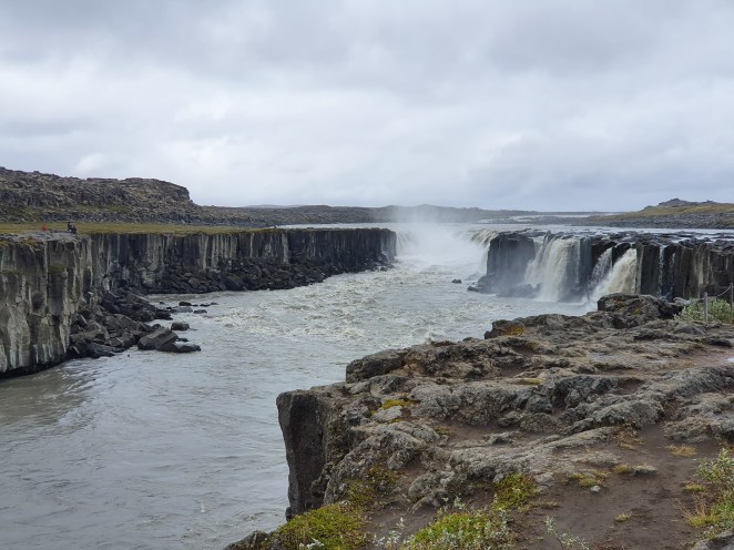
Selfoss waterfall
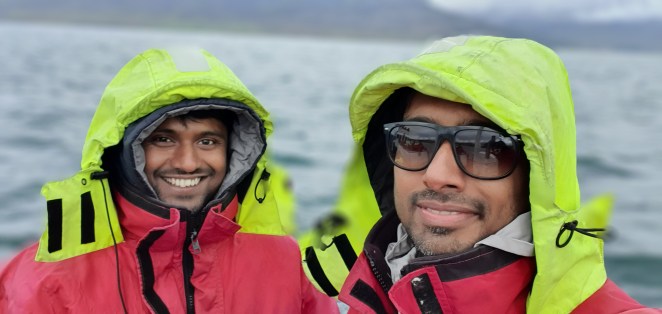
After seeing these two waterfalls, we headed towards Hjalteyri for whale watching. When boarding the ship, we were given jumpsuits. It was to keep us warm and safe. These jumpsuits prevented against strong wind in the middle of the sea. There were almost 50-60 people on the ship. Within minutes we saw the first humpback whale. To take a deep dive into the ocean, these whales comes to the surface and go vertically down to create necessary force exhibiting their trademark tail in the wake. It was fascinating. Having said that, I usually get bored in whale watching or dolphin watching kind-of activities. You get to see whales 5-6 times (that too when you are lucky) for a fraction of second and for rest of time you just keep staring at the sea. For me, the best part of this entire activity was the hot chocolate that they served on the ship towards the end. On ship, it was so cold and windy that hot chocolate felt like elixir.
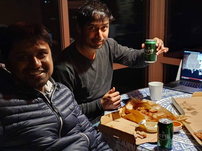
However, we ended the day on a high with same Domino’s pizza, chicken wings, beer and Sumit Anand’s funny standup comedy show.
Whale watching at Hjalteyri
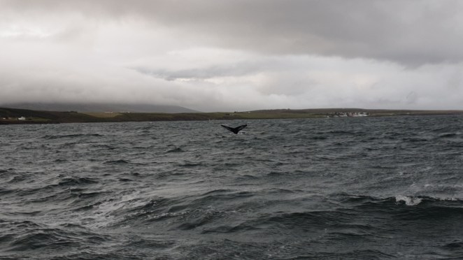
Tail of humpback whale visible
Day 4: Akureyri to Reydarfjordur, 18th August 2019
The day started with grocery shopping at Bonus. Bonus is supermarket chain in Iceland and most cost effective according to me. We were doing camping on next 3 nights and had to prepared.
Namafjall is a high-temperature geothermal area about 90 km east of Akureyri. It was not in our original plan. While driving, we saw smoke rising in the sky and cars parked in the vicinity. We stopped to check it out and were pleasantly surprised to see it. Namafjall is a steaming, bubbling desert. Quite an oxymoron, isn’t it?
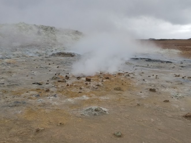
Located at the foot of a towering volcanic mountains, lies a huge expanse of boiling mud pots and smoking fumaroles. Fumaroles are opening in earth’s crust near volcanoes which emit steam and gases such carbon dioxide, sulphur hydroxide, sulphur dioxide and hydrogen sulphide. Cold ground water seeps down to magma intrusions where it is heated and transformed into steam. This steam comes out of fissures or fumaroles along with gases like sulphur hydroxide. If the water only reaches the surface in the form of steam, it is called a fumarole. If the water is mixed with mud and clay, it is called a mud pot. And if the water becomes so hot that it builds steam pressure and erupts in a jet above the surface of the Earth, it is called a geyser. Namafjall has only fumaroles and mud pots, no geysers.
Acres of arid land devoid of a single sign of vegetation, gurgling hot springs, smoking piles of rocks, colorful geyserite clung to the rim of fumaroles and noxious stench spread all across. This was not a place on Earth. It felt extra-terrestrial.
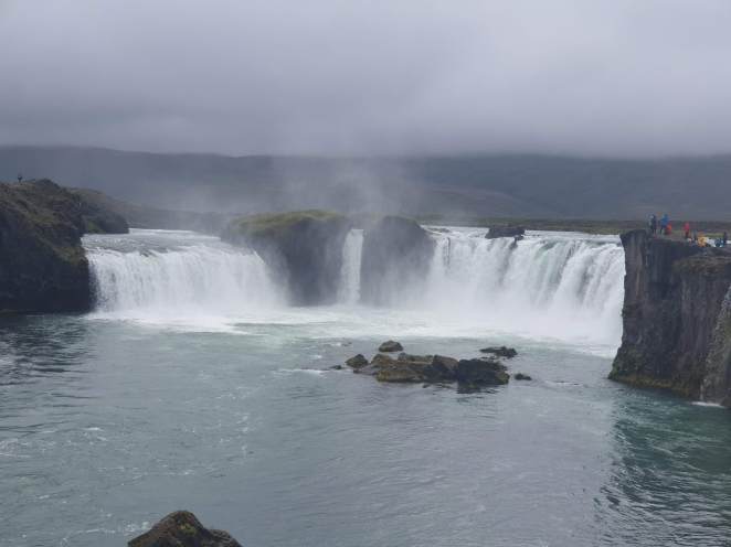
Godafoss waterfall
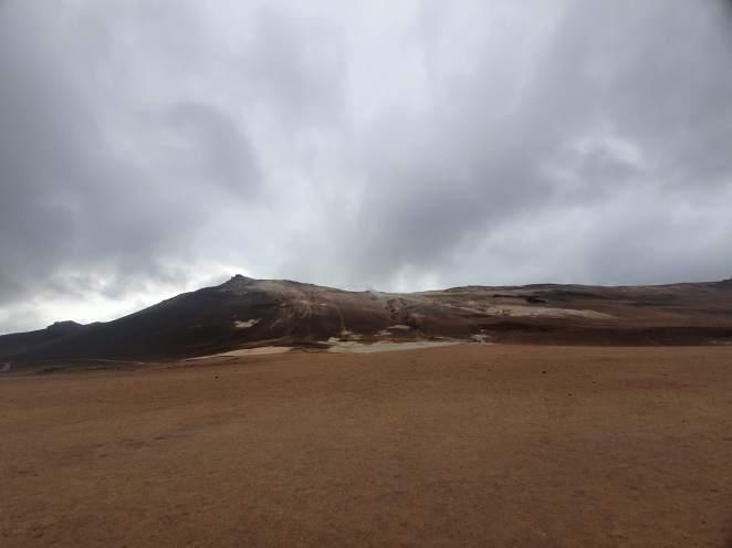
Namafjall: Acres of arid land devoid of a single sign of vegetation
Slurry mudpots
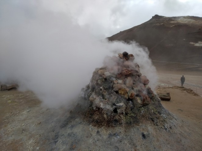
Fumaroles
Moving on from there, we went to see Viti crator which was roughly 10 minutes’ drive from there. But the area was closed due to safety reasons and we couldn’t see it. We were able to see nearby Krafla crater lake though.
We drove further east from there for about 2 hours to see Studlagil canyon. It’s a marvelous site that Sneh had suggested us to go to. Turquoise water snaking through majestic basalt columns. The pics on Instagram were exquisite. We had to drive off Route 1 and take Route 923 which was a gravel road to reach Studlagil. After a rickety drive of about half an hour on Route 923, we reached there. But it was a disappointment for me, I must say. It’s not that the canyon is not beautiful, it very well might be. It was just not looking beautiful at that time. Extra water from a nearby dam was released. The turbid water flowing through the canyon was in stark contrast with the turquoise water in the pics. Probably a different season would be a better choice for seeing Studlagil canyon.
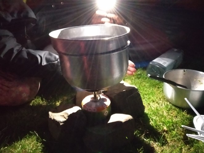
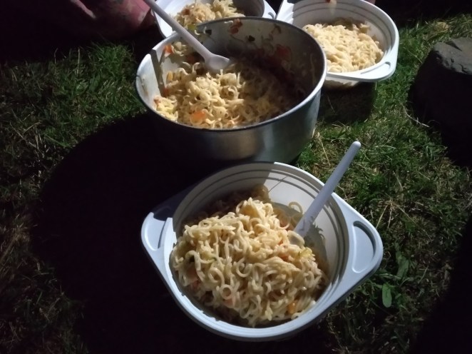
We reached Egilsstadir campsite by 8.30 PM. Staying here for the night was our plan. But this campsite was not as beautiful as Grundarfjordur where we camped on Day 1. There was enough daylight. So Sneh proposed to find other campsites nearby. She searched on internet and found a campsite at Reydarfjordur, almost 30 minutes further east. It was secluded and more beautiful campsite than Egilsstadir’s. The price here was 1400 ISK per person and it included shower facility as well. Not bad. We quickly pitched our tent and started preparing our dinner – 4 packets of instant noodles and 1 packet of pasta. Cooking that night was quite difficult. Strong wind was blowing off the gas stove every now and then. Three of us had to keep our fingers wrapped around the flame to prevent it from extinguishing. We succeeded a couple of times and failed for the most part. Sipping JD kept the enthusiasm high for the two men and the love for cooking kept the woman going. Finally, the food was ready, and it was great. Above all, hard work improves the taste of food.
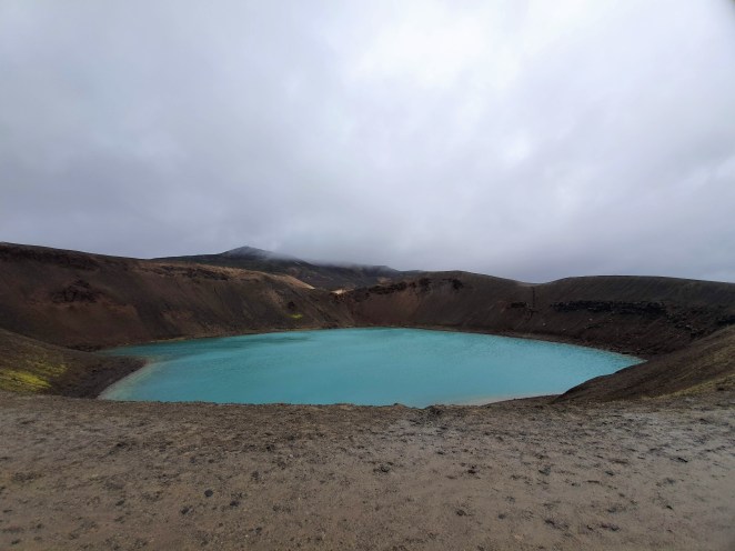
Krafla crater lake
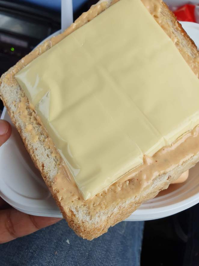
Sneh used to prepare these amazing sandwiches on car
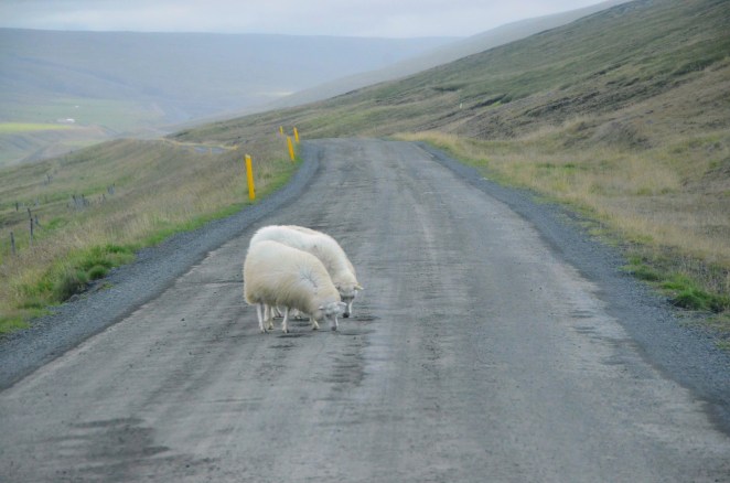
Sheeps blocked our path
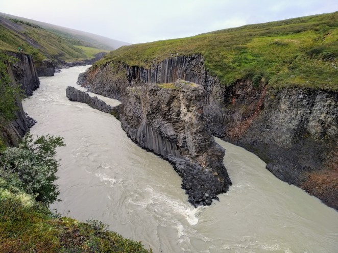
Studlagil canyon
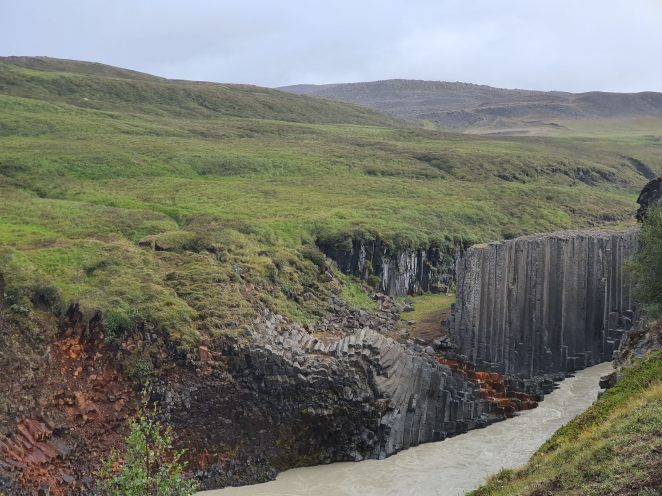
Basalt columns forming the edges of Studlagil canyon
Work in progress
Finally …
कुछ तो गंदा बोला होगा ये 😉
बताइये ज़रा 😉
