…. Journey began here
Day 5: Reydarfjordur to Hofn, 19th August 2019
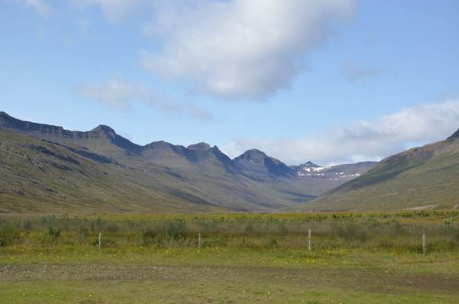
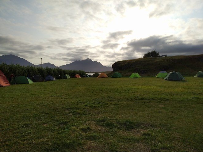
Lush green grassland enveloped by mountains from all sides. A stagnant freshwater pond with sauntering swans. A fjord whose tranquility was disturbed by occasional gush of winds. And a cold morning basking in overnight dew. Cold enough to make you snuggle in your sleeping bag, but not too much that put you off from feeling the morning breeze on your face. Just the right amount. This was one of the most beautiful places I have ever camped at. What a dreamy start of the day!
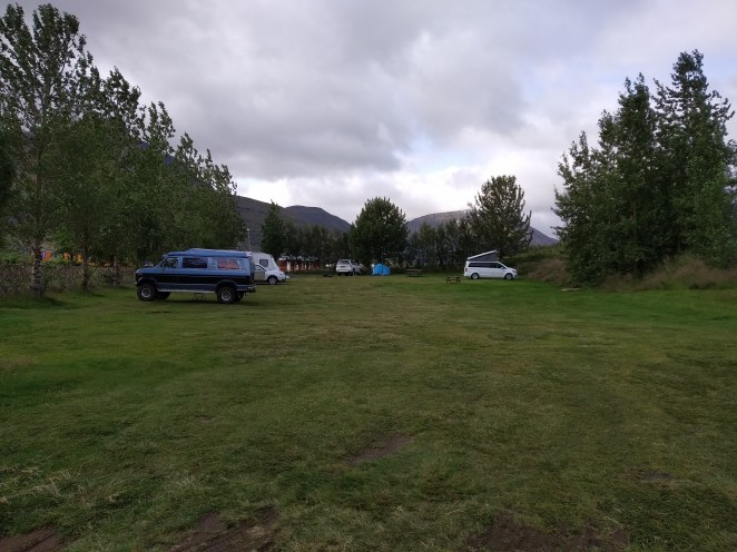
Reydarfjordur campsite
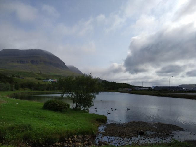
A small pond adjacent to this campsite
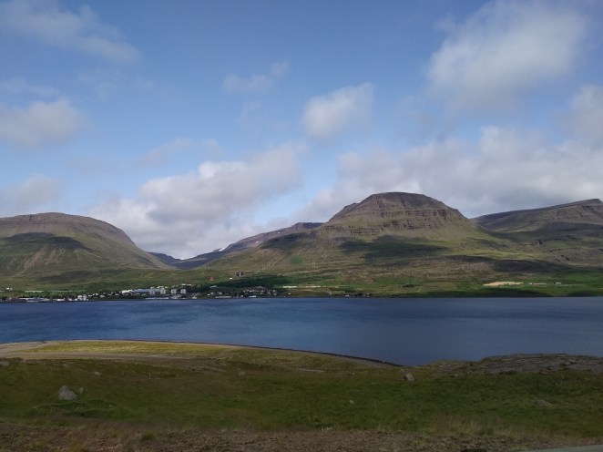
A nearby fjord
Reydarfjordur campground had a hot shower facility. With just 4-5 more families here, there wasn’t any wait time. I had a good shower and healthy breakfast. We left the campsite at around 12 PM towards Folaldafoss waterfall.
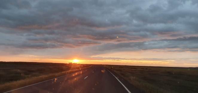
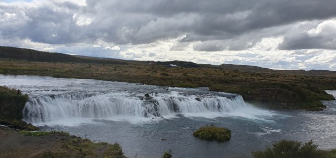
Folaldafoss and Sveinsstekksfoss waterfalls in itself are run-of-the-mill waterfall; nothing very exciting about them. However, the drive all the way up to it was gorgeous. Route 1 runs all the along the edges of fjords in East Iceland. We drove past treacherous bends and hairpin curves with inseparable fjords to our left and black volcanic mountains with spiky peaks strutting out like horns to our right. We halted at a couple of places to enjoy the scenery. One such place was a pebbled stretch of land running deep into the sea. The stone skipper in Anshu woke up from slumber and he had a good time there honing his skills.
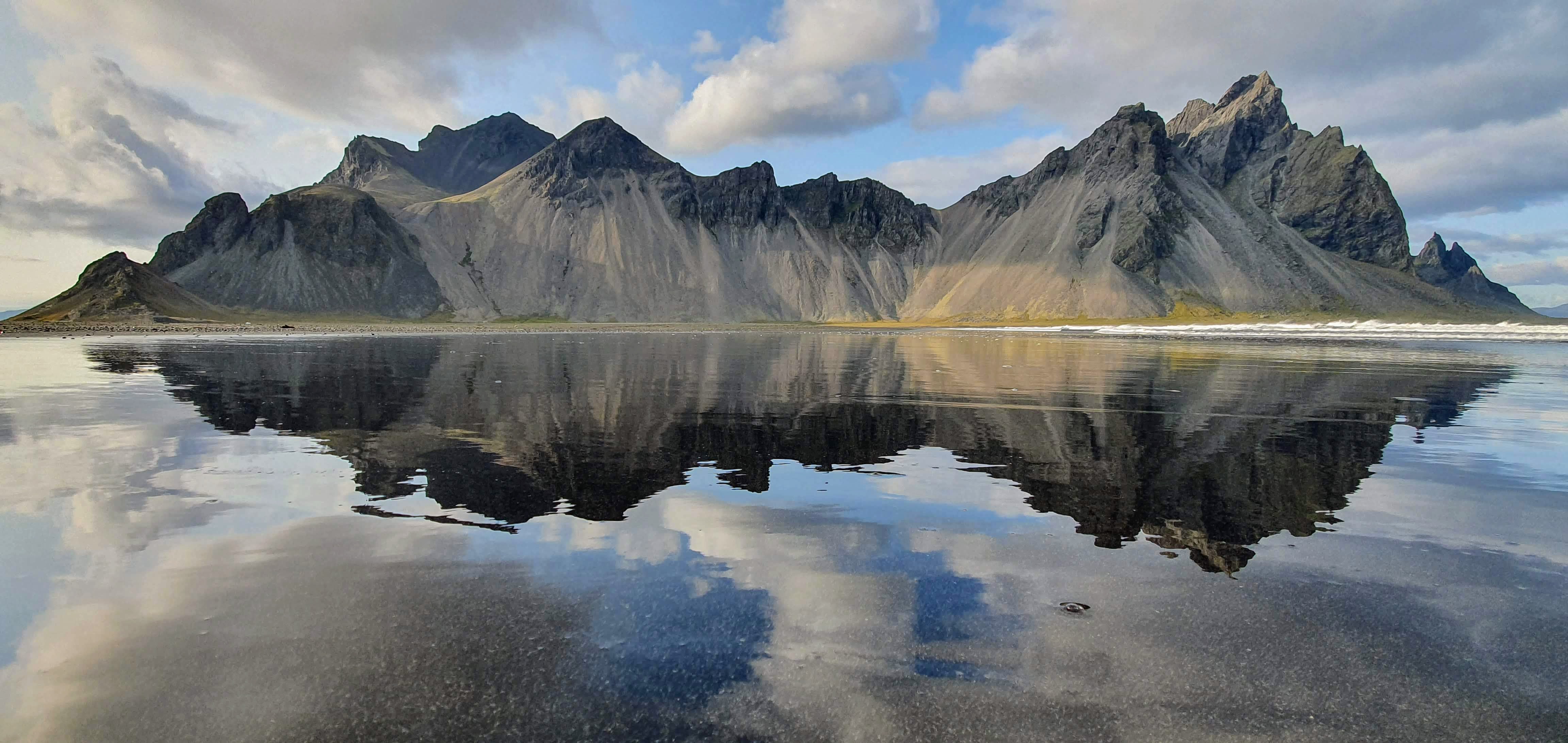
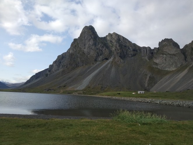
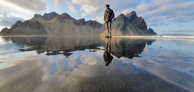
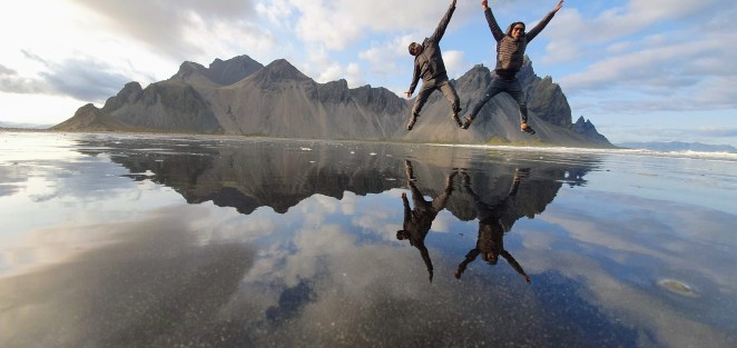
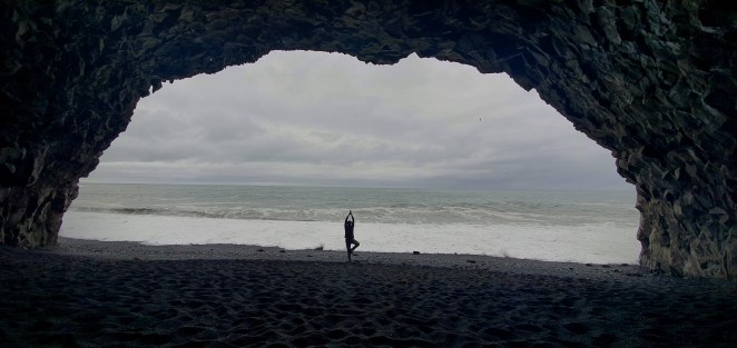
Around 6 PM, we reached Vestrahorn. To see this place, you have to pay an entry ticket in a café owned a local farmer who owns that land. This is only one of the two natural attractions in Iceland that you need to pay a small entry fee to reach. The other one being Kerid crater in Golden circle. Vestrahorn literally means west horn. It’s a 454-meter-tall scree mountain located besides a sea. This place is popular for its reflection photos on black sand shore. And we took a lot of them. Courtesy Sneh’s amazing photography skills.
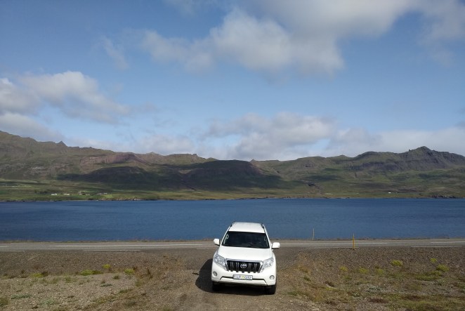
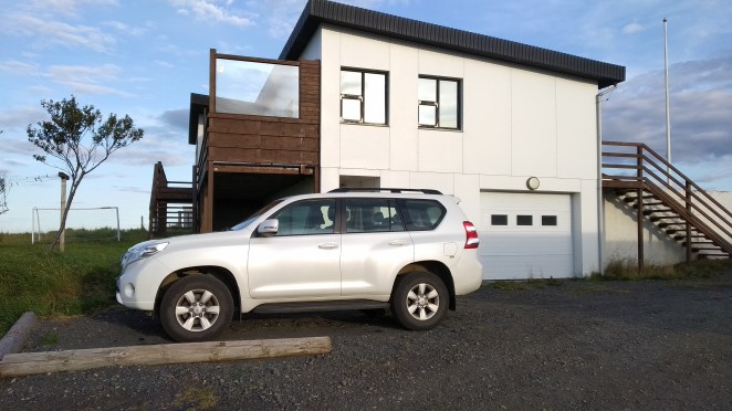
Our Toyota Landcruiser
Mountains with spiky peaks strutting out like horns
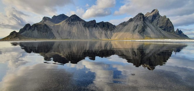
Vestrahorn
So untouched, pristine
After spending about an hour and a half at that place, we left that place and headed towards Hofn which was not more than half an hour drive from there. Hofn is a one of the largest towns in East Iceland and has good restaurant options. We chose to have our dinner at somewhere good and then go to campground. So, we went to a restaurant named Ishusid in Hofn. We ordered a pizza, a chicken salad and a fish & chips. We reached campground by 10 PM. There was still light in the horizon that helped us pitch the tent. Hofn campsite is quite commercialized. There was per person charge, per tent charge and per car charge. So, we paid for 3 persons, 1 tent and 1 car. Cost was roughly 1800 ISK per person. Shower charges were additional 100 ISK for 3 minutes. Can you imagine? I had never seen such a system for shower 😉. Campground staffs were also renting out camping equipment. And obviously at exorbitant prices.
After pitching the tent, we watched first episode of Sacred Games 2 in tent and slept by midnight.
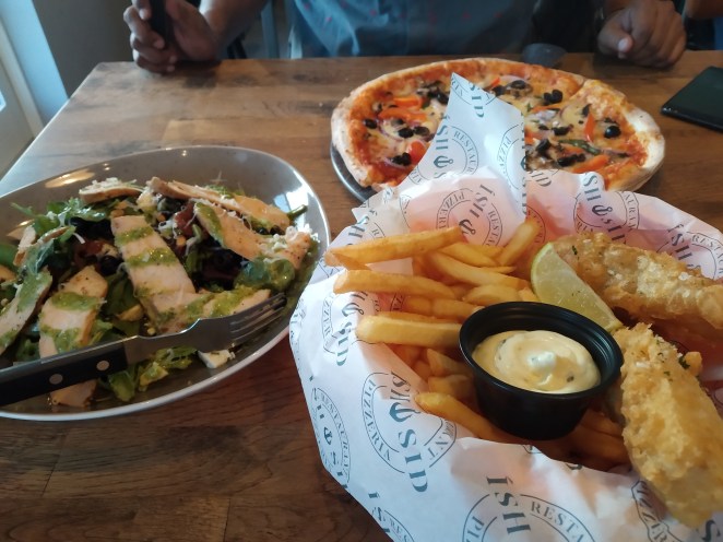
Dinner at Ishusid
Hofn campsite
Watching second season of Sacred Games inside tent
Day 6: Hofn to Skaftafell, 20th August 2019
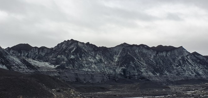
As we started driving on this day, the landscape changed. Glaciers revealed themselves. Straight limitless roads leading up to glaciers perched on top of black mountains. Vatnajokull glacier covers 10% of Iceland’s total land and is the Europe’s largest ice cap. It has about 30 outlet glaciers or so to say glacier tongues. These glacier tongues form a mind-blowing landscape along the southern part of Ring Road aka Route 1.
Glaciers in Iceland
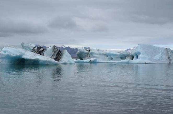
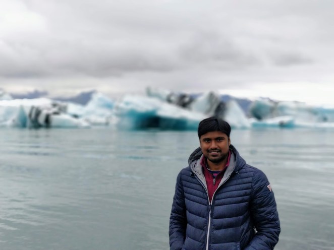
Jokulsarlon glacier lagoon is one of the crown jewels of Iceland. It is formed by meltwater from an outlet glacier. The outlet glacier that powers Jokulsarlon is Breidamerkurjokull, one of the 30 outlet glaciers of Vatnajokull. It stands out because of floating icebergs on its surface.
I was mesmerized by its beauty. There were giant blocks of eclectic blue ice with black streaks floating on water. Black mountains cradling white glacier provided the perfect contrast in the background. But, Jokulsarlon also stands testimony of the grim reality of global warming. This lagoon formed only around 1935. Rapidly increasing temperature is causing Breidamerkurjokull to retreat and leave a glacier lake in its wake. In 1975, Jokulsarlon was less than half of its current surface area. This lagoon is accelerating at an alarming pace. With water as deep as 248 meters it is already the deepest lake in Iceland. It is also growing to be one of the largest. It is estimated that in not so distant future, it will become a fjord.
The icebergs from Jokulsarlon slowly melts and drift out to nearby sea where they are polished by Atlantic waves and washed ashore on a jet-black sand beach called Breidamerkursandur, commonly known as Diamond beach. These ice crystals glisten against the black sand and look like diamonds. Hence the name.
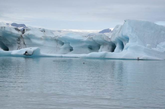
Jokulsarlon glacier lagoon
Volcanic ash ruptures embedded inside layers of ice form beautiful black streaks in icebergs
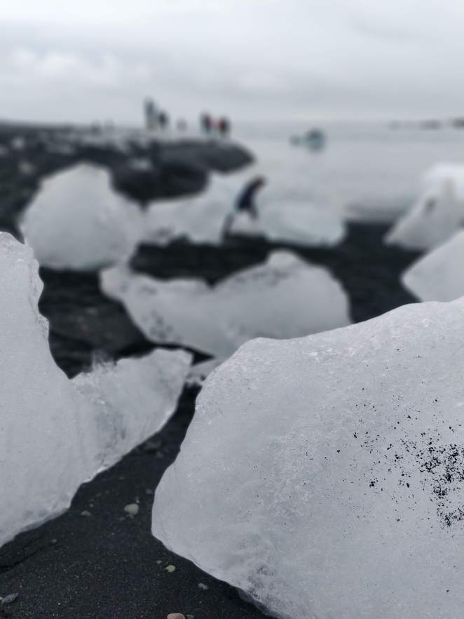
Fragments of icebergs get polished and come ashore at Diamond beach
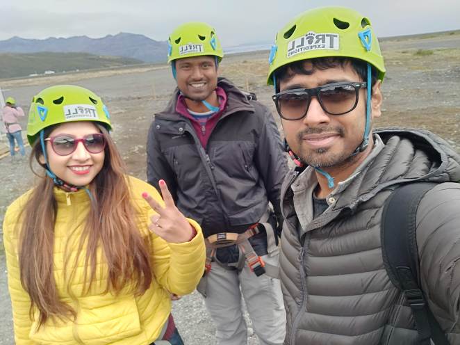
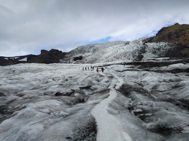
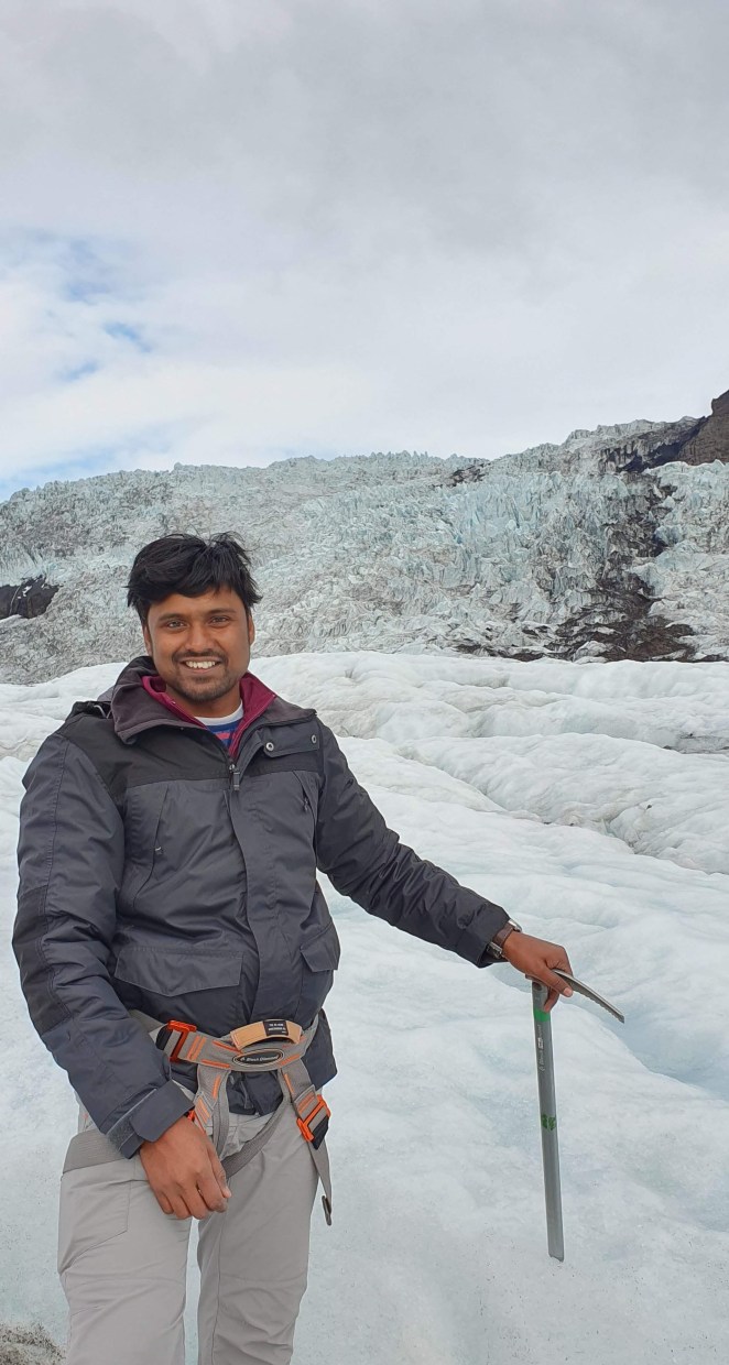
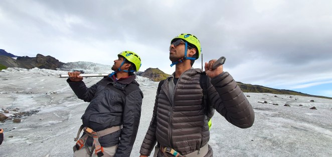
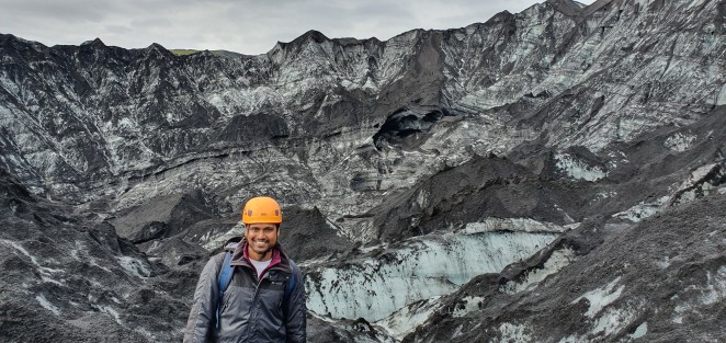
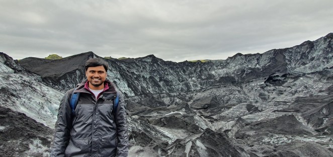
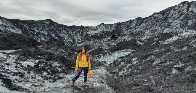
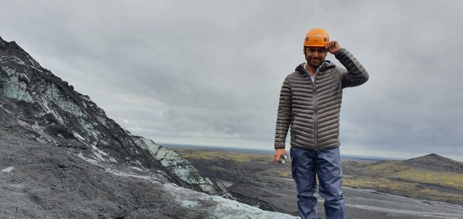
After Diamond beach, we had to reach Skaftafell for our glacier hiking. We had a booking with Troll Expedition at 3PM. We reached the meeting point right on time. We were given our equipments there – harness, crampons, ice axe and helmet. It was a group of around 30 people. We left in a bus to the parking lot of the glacier and another 20 minutes’ walk all the way up to foot of the outlet glacier, Svinafellsjokull. We got divided into 2 groups, each with a guide. Our guide was Pablo. Pablo taught us how to wear crampons and use ice axe. It was around 60 minutes’ walk on glacier where we saw interesting ice formations like moulins, crevasses and seracs.
A moulin is a circular vertical shaft where water enters from the surface and flows down toward the base of the glacier. According to Wikipedia, “water from moulins may help lubricate the base of the glacier, affecting glacial motion. Given an appropriate relationship between an ice sheet and the terrain, the head of water in a moulin can provide the power and medium with which a tunnel valley may be formed”. If you take a cross-section of glacier, you will find several holes like in a swiss cheese. The holes are moulins. Crevasses are deep vertical cracks in ice sheets of glaciers. They are usually formed by movements of glaciers and can be as wide as 20 meters and deep as 100 meters. When two crevasses intersect, they form something called seracs. As the seracs are formed at the intersecting crevasses, they do not firmly stand and tend to be quite unstable.
We hiked on Svinafellsjokull glacier and from the top were able to see Falljokull, meaning Falling Glacier. It was called Falling Glacier because of too many unstable seracs present there. After spending about 15 minutes on top, we returned back. We were done with hike by 6 PM and headed to Skaftafell campsite. We were relatively earlier to our campsite that day. Three of us watched yet another episode of Sacred Games 2 and slept early that night.
All set for glacier hiking
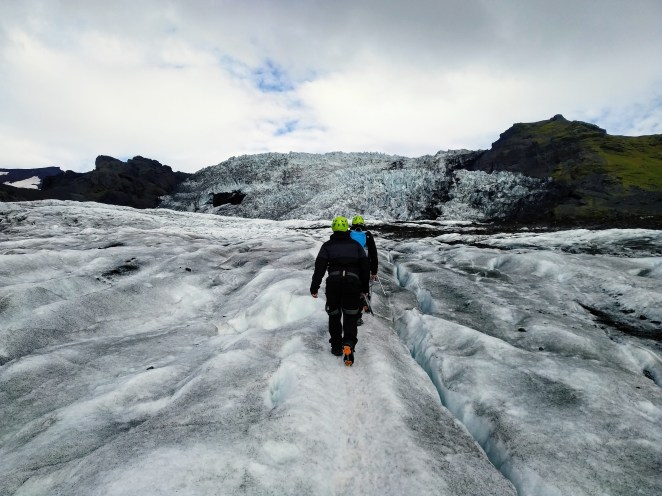
Hiking on Svinafellsjokull glacier, which is a glacier tongue of Vatnajokull
Falljokull with its deadly seracs can be clearly seen
People busy doing what they do best 😉
Day 7: Skaftafell to Hvolsvollur, 21st August 2019
We drove via Katla Geopark on this day. Katla is UNESCO recognized geopark and first of its kind in Iceland. UNESCO Global Geoparks are single, unified geographical areas where sites and landscapes of international geological significance are managed with a holistic concept of protection, education and sustainable development. Katla Geopark got its name from one of the most well-known volcano Katla which sits under the glacier Mydalsjokull. Katla Geopark is a natural wonderland that houses active volcanos, glaciers, waterfalls, black beaches, canyons and moss-covered lava fields. This geopark is roughly 9% of total area of Iceland with a population of roughly 3000 people. Traditional agriculture is main source of employment in this area especially sheep and dairy farming with Hvolsvollur, Vik and Kirkjubaejarklaustur being the main towns.
Fjadrargljufur canyon is yet another amazing place I saw in Iceland. It was as if you have entered Steven Spielberg’s Jurassic World. Steep moss-laden cliffs jutted out from side walls of the canyon. Chaotic edges made way for turquoise water of river Fjodra and merging into a vast expanse of lava field. Words cannot do justice to the aura this place had. Fjadrargljufur canyon was created by progressive erosion by flowing water from glaciers through the rocks over a long period of time, some say 9000 years ago. The canyon is 100 meters deep and about 2 km long. It was different from Asbyrgi canyon which looked much more rounded and well-carved.
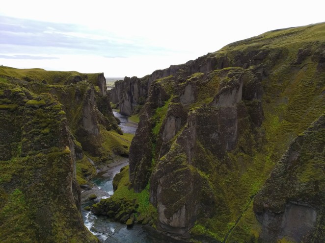
Fjadrargljufur canyon
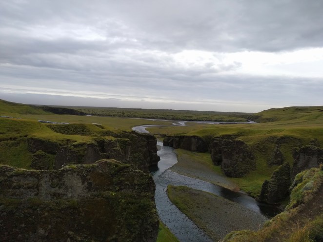
Canyon water merging into a lava field
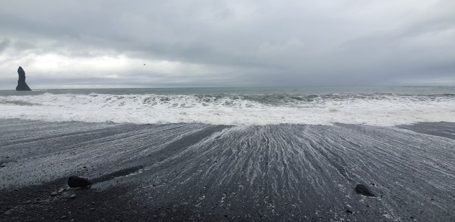
After the canyon, we headed to Reynisfjara Beach. But before that, we made a small pit-stop at a lava field and took a short walk. Walking inside lava field was extremely difficult because of sharp undulated rocks. I stumbled a couple of times because of that. Reynisfjara Beach is the popular because Gerua song was shot here. When we reached there, it was super-windy. The wind speed there was around 50 kmph, which was sort of an entry-level gale. I was not able to stand straight. On some occasions, wind thrust me so hard that I almost fell. Initially, we didn’t take it seriously and ventured on to the beach to click a couple of photos, but gradually it became scary. And to make the situation worse, it started raining and deadly sneaker waves of the sea grew more violent. At this point, we thought to head back and come back here the next morning when weather improves. But guess what, even heading back to the car turned out to be an arduous task. The wind was carrying the coarse black sand of the beach and was slapping on the face. We, literally, had to wait for micro-gaps between two gushes of wind to move forward. It was one hell of an experience.
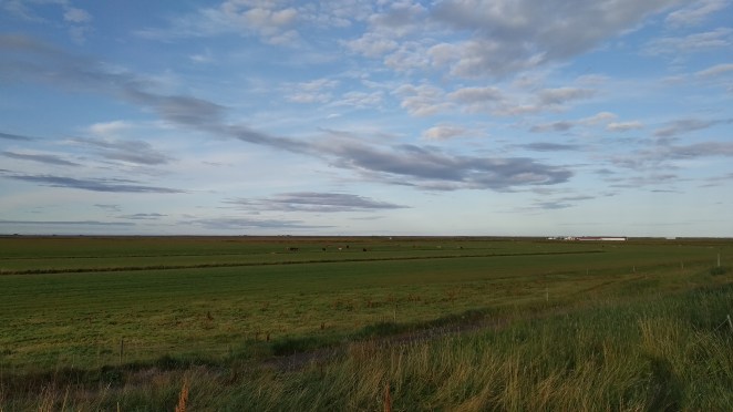
We decided to call it a day and head to our Airbnb. We stooped for an early dinner at Halldorskaffi in Vik. Anshu and I drank Viking beer. We ate pizza, breadsticks and fish & chips. Our Airbnb was about an hour away from Vik. But the drive was nice. Acres of green grassland on both the sides of the road. Sun had already set but left a tangerine hue in the sky in its wake. This side of Iceland was quite green and agriculture heavy. Our Airbnb was a farmhouse in the middle of nowhere. We had to follow GPS coordinates shared by our host. The moment we reached the place, 2 dogs came running towards our vehicle. Thankfully the host, Sophie, came out quickly and pacified them. The location was spellbinding. Green grasslands all around with sheep, horses and cows grazing. And in middle of all this was a small house that we had rented for a couple of nights. 100 points to this place for the location.
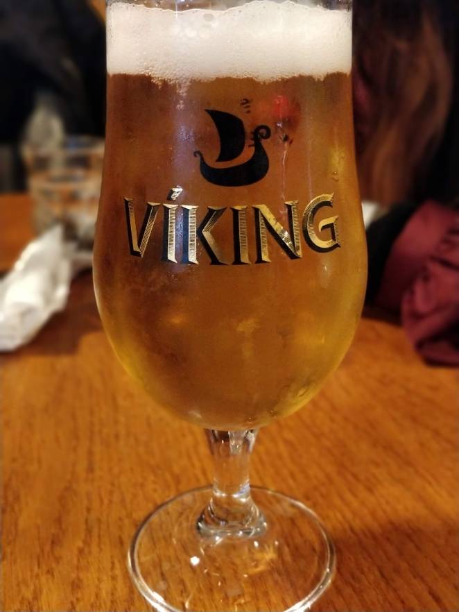
#BeersOfEurope
Magical!
Day 8: Ice Cave tour andplaces around Hvolsvollur, 22nd August 2019
I woke up early and went out on a morning walk. It was peaceful and green all around. Occasional mooing of cows was the only thing breaking the silence. The air was fresh, my mind was tranced. Without doubt, it was one of the best Airbnb I had stayed at.
Eystra-Fíflholt farm
Farmlands all around the house
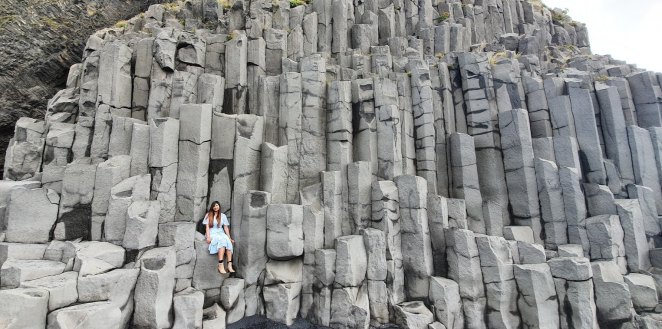
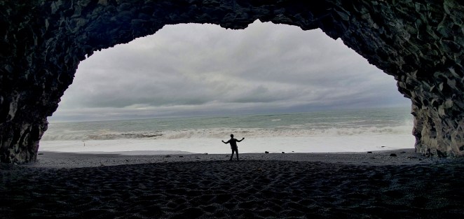
We started with Reynisfjara Beach. It was pleasant weather today. And since we reached there a bit early, not many tourists were present. All three of us got plenty of pics. More than the black sand beach, I was fascinated by the basalt caves nearby. This beach has been shown as Eastwatch in Game Of Thrones. The stones in the nearby cave there reminded me of dragon glass cave of Game of Thrones. I am not sure, but I think it was shot here.
Eastwatch
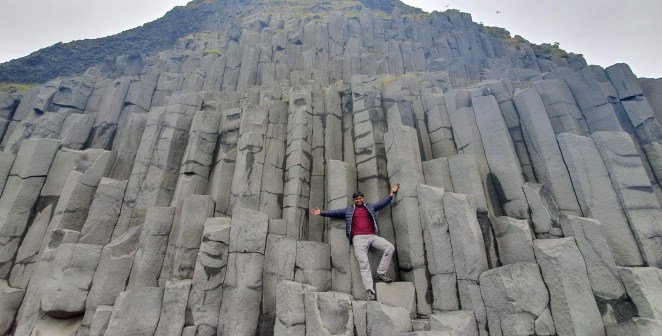
Basalt columns at Reynisfjara Beach
Remember the Gerua song?
We had an ice cave tour at 11.30 AM that morning. We got ready and reached the Icewear building in Vik which was the meeting point. Houkur, our tour guide, was waiting there with his super jeep. His Icelandic name was a bit difficult to pronounce, so he suggested us to call him Hawk. Besides three of us, there was just one more couple along with us. 5 of us started our journey to the ice cave in Hawk’s super jeep.
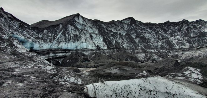
The Katla ice cave lies 20 km north of Vik, roughly 40 minutes’ drive through black sand plains. We drove on Ring Road for a couple of miles and then went off-road to drive on rough sandy terrain which led to the ice cave. In order to drive on such sandy roads, Hawk reduced the pressure of tires of his jeep. Usually this is done so that tires get a wider grip on sand and for the riders it is less bumpy. It was a fun 30 minutes jumpy ride leading up to roots of Kotlujokull. Kotlujokull is a glacier outlet of Mydalsjokull, which is the 4th largest glacier in Iceland. The dreadful volcano Katla sits beneath this glacier only. Since Vikings settled here way back in 9th century, Katla has erupted 20 times at an average interval of 40-50 years. The last time Katla erupted in 1918 bringing cataclysmic destruction with itself. Its eruption is due and that worries many people.
This place is entirely different from other glaciers that I have seen in past. The ice was black here. And it was black not because of some dirt settling on top, it was black because ash ruptures from volcanic eruptions hundreds of years ago had settled and frozen in ice here. Layers after layers of ice had formed on top of black ash particles embedding them deep within ice, giving it a characteristic black color.
We put on the crampons and helmet. Hawk also gave us flashlights as it is quite dark inside the cave. We climbed up for a bit before reaching the mouth of the ice cave.
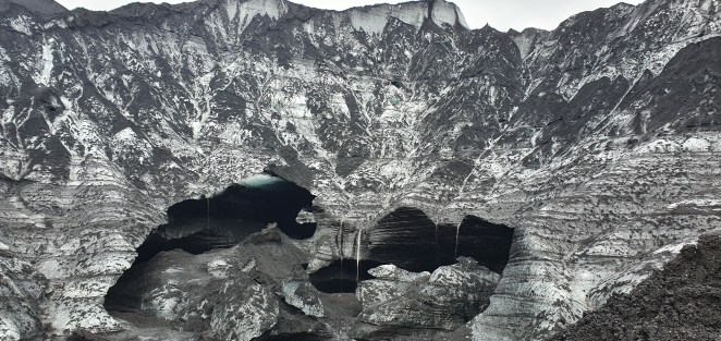
During summer, melt water from glacier surface forms a conduit and makes its way all the way to the base of the glacier through moulins. These natural drainage conduits can grow as big as 10 meters wide. So, quite powerful river of melted water flow through these moulins eroding the ice and forming the ice caves. These new ice caves then get hardened and stabilized during autumn and winters. Most of these ice caves have arch opening because it is the most stable architecture.
The Katla ice cave was phenomenal. Each black streak of tephra compressed tightly with ice narrated a story of past. In each trapped air bubble, a microcosm of yesteryears’ atmosphere existed. Each bend in the cave retraced the ancestral moulin. Each twist reiterated the whispers of air that flowed last summer. This dripping bluish-black cave was a stunning tapestry of nature.
Houkur, or Hawk in short, was the reason we enjoyed the ice cave tour even more. He explained a bunch of geological facts about ice caves. He was quite knowledgeable and gracefully took a lot of pictures and allowed us to do so as well. When you have a good guide, it makes the experience worthwhile. I wish Pablo (Skaftafell glacier hike guide) was this good. It would have made that more fun. I will remember his style of saying “Oooo …..yeah” to commemorate every mini stunt he used to perform while driving on that jolty terrain.
Kotlujokull, a glacier outlet of Mydalsjokull
Ash ruptures compressed tightly into ice layers for centuries
Entrance of ice cave
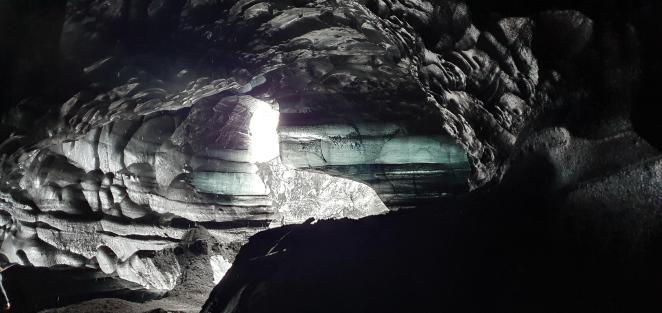
Water and air flowing through moulins erode ice creating such ice caves
Aye captain!
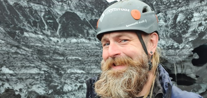
Hawk, our tour guide. He made the trip worth it.
After the ice cave tour, we had a nice lunch at nearby Ice Cave Café and headed to plane wreck location in Solheimasandur. In 1973, an airplane with 7 crew members while going to Keflavik airport had to crash land their plane here. That plane wreck still exists today. Visitors are supposed to park their vehicles much before the place and have to walk 3.5 km to reach that location. Alternatively, they can choose to pay 2500 ISK per person for roundtrip ticket to a bus that runs to and fro between the site and parking. The only reason we went there was because the entry shot of Gerua was shot here.
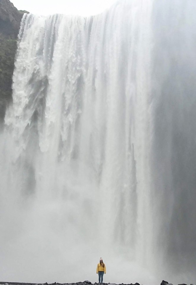
Next, we headed to Skogafoss. Again, a very popular spot in Iceland. A couple of scenes of Gerua was shot here as well. The uniqueness of this fall is that the land underneath the waterfall is very flat, allowing visitors to walk right up to the wall of water. The place was beautiful. There was a stairway to walk all the way to the top of waterfall. The cascade of water dropping a height 60 meters is enough to form almost persistent rainbow at this place. I just saw this waterfall from a distance and chose to stay and relax on a bench and read “Diary of a young girl”. Anshu and Sneh ventured near the foot of the waterfall for a few pics.
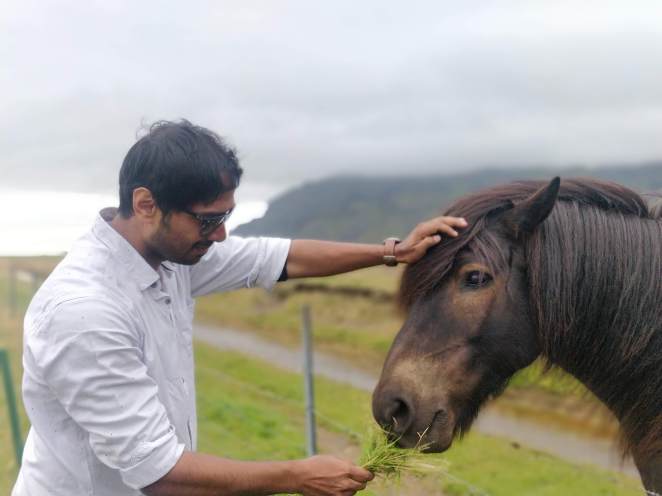
After a hectic day, we started driving back to our Airbnb. But we were destined for a surprise on our way back. A bunch of horses had come close to the fence near road and were obliging for photos with humans. We also stopped there. We plucked some grass, fed horses and clicked plenty of photos with them. Sneh slept early that day. Anshu and I prepared noodles for dinner. The dinner went with Carlsberg and Baileys and a couple of episodes of Sacred Games.
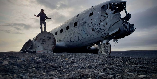
Solheimasandur plane wreck
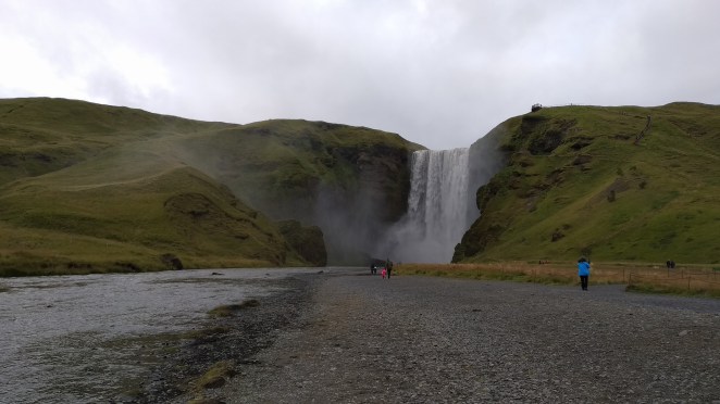
Skogafoss waterfall
Sneh standing beneath Skogafoss
Lovely!

Noodles with Baileys
Day 9: Golden Circle, 23rd August 2019
Last day in Iceland was also eventful. We had some fascinating stuffs left to see. Golden circle is one of the most popular tourist destinations in Iceland. It’s a circuit with 3 major spots- Gullfoss waterfall, Haukadalur geothermal area and Thingvellir National Park. Besides these there are a few other spots as well like Kerid crator, Faxi waterfall.
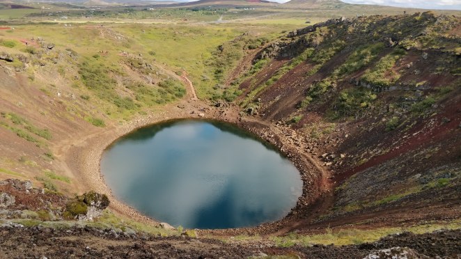
The first spot of the day was Kerid crater. This place lies in a privately-owned land, so all tourists have to pay 400 ISK to see the crater, similar to Vestrahorn mountains. Kerid crater was formed not due to outward explosion of rocks and other materials from a volcano, but due to inward explosion of a volcano’s magma chamber. To be precise, it is a caldera, not a crater. During certain types of explosive eruptions, a volcano’s magma chamber may empty enough for an area above it to subside, forming a type of larger depression known as a caldera. Craters are usually smaller features than caldera. I had to look up a few videos and read a bit to some rudimentary understanding. This video explains beautifully how a caldera, in this case Kerid Crater, was formed.
Most scientists believe that Kerid was once a cone-shaped volcano which subsequently erupted and exhausted its magma reserve. This made the foundation fall in on itself and thus resulting in the formation it has today. Gradually rainwater collected in the depression forming the aquamarine lake that we see today. The Kerid crater lake is not sourced by a glacier, but changes based on groundwater level. In a way, it is a window to the groundwater level. The crimson walls of the crater show the abundance of iron deposits in the rocks.
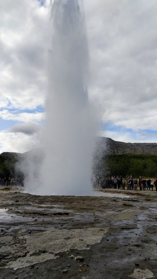
The next stop was Haukadalur geothermal field. This was similar to Namafjall geothermal area that we saw on Day 4, but with a welcome addition – geysers. Geysers are hot springs where water becomes so hot that it builds steam pressure and erupts in a jet above the surface of the Earth. Haukadalur geothermal field has 2 geysers – Geysir and Strokkur. Geysir is the elder brother. It is more powerful but has been quiet since past few years. When it last erupted in 2000, the water jet went as high as 120 meters. It has been highest recorded geyser blast of all time. Stokkur is its younger sibling. Lesser in might, but more forthcoming. It erupts every 8-10 minutes and is tourists’ darling.
I stood at a distance with mobile camera pointing towards the lone pool of gurgling water. The boiling water in the pool was doing its gymnastics, twisting and turning. Clock was ticking. “5 minutes have gone past since the last eruption”, someone told besides me. Pressure under the ground was building, and so was the anticipation within me. Any moment it could have happened. It was just a matter of seconds. And then it happened. A huge jet of water blasted its way out of earth’s crust going as high as 20-30 meters. I was in awe. One was not enough. I saw 3-4 eruptions of Strokkur. It was just mesmerizing.
Location-wise I like Namafjall more. It had more “outwordly” vibe with crimson mountains all around devoid of any vegetation. Haukadalur is a little bit greener. I don’t know if those plants grow organically there or have been planted. But Haukadalur had something that I saw for the first time and will always remember it for – geysers.
We had our lunch at a nearby café and started towards our next stop – Gullfoss. Gullfoss, or Golden Waterfall, is one of Iceland’s iconic waterfalls found in Hvita river canyon. The water here travels from the glacier Langjokull. Gullfoss gorge was formed by flash flood waters that forced their way through the cracks in basalt lava layers. These flash flood happen in Iceland when a volcano under glacier erupts melting a huge amount of ice within a matter of minutes. Gullfoss is a two-stage waterfall – height of upper one is 11 meters while that of lower one is 20 meters.
After Gullfoss, we started driving towards Thingvellir National Park. This was our last stop of the day. It is during this time Anshu got an email from Iceland traffic department that we got a speeding ticket. It said that we have to pay 5000 ISK to the rental agency as a service fee and the exact amount of fine will be sent later. The websites that we searched said it could be as high as 600 USD, which is a lot. Sort of an anti-climax to an amazing trip. After this mini jolt, Anshu and I drove extra cautiously. We kept a couple of dots below 90 on odometer. It was frustrating and funny at the same time to see cars after cars overtaking us. This had not happened in last 10 days. The roads in Iceland are so well made, but the speed limit is 90 kmph. Seriously?
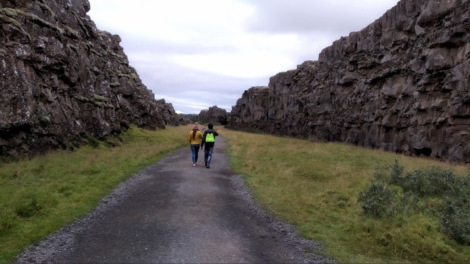
Thingvellir national park has something that is exclusive to Iceland. It is the place where one can see mid-Atlantic ridge (which usually in beneath Atlantic sea) rising 3000 meters above the sea floor. So, you can literally see a fissure separating North American and Eurasian tectonic plates. It was so cool walking between these two tectonic plates. A canyon-like thing wedged in between two menacing walls of rocks. By the way, this is place which shown as entrance to Eyrie in Game Of Thrones. It can be seen as the narrow path leading to the Eyrie, also when Littlefinger and Sansa Stark arrive at the Eyrie and when Catelyn Stark arrives in season 1 to her sister. We were here till about 7.30 PM.
With Thingvellir, our trip to Iceland came to an end. We drove from to Reykjavik first to drop the camping equipments. It was out of office hours, so we put the stuffs in the drop-off facility. This is something I liked a lot about Iceland Camping Equipment. It gives a lot of flexibility to the travelers. There was a Domino’s pizza nearby. We picked chicken wings and couple of beer from there and drove towards our stopover apartment near Keflavik airport. Three of us watched Sacred Games and had our final meal together.
Kerid crater
Faxi waterfall
Strokkur geyser
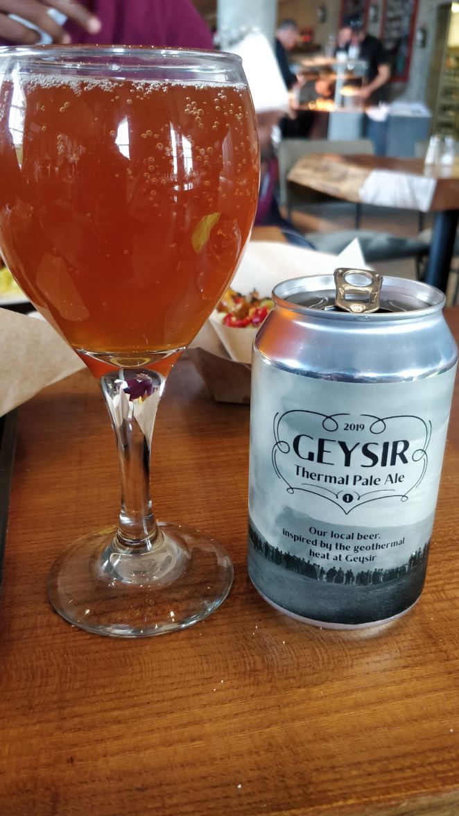
#BeersOfEurope
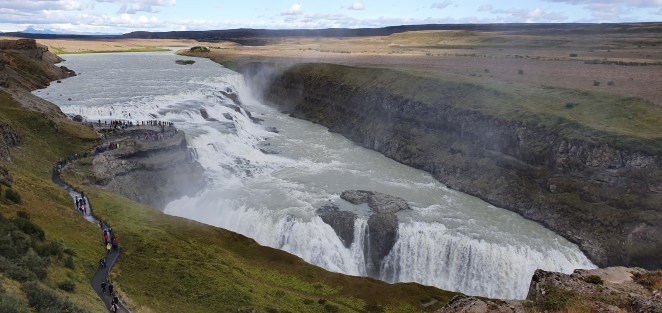
Gullfoss waterfall
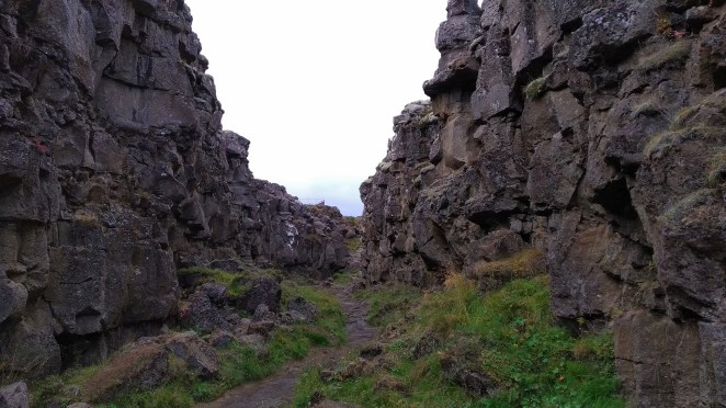
Mid-atlantic rift at Thingvellir National Park
Taking a leisurely walk between Eurasia and North America
Last Day: Vertu blessaður Iceland! 24th August 2019
Anshu and Sneh had their flight at 7.40 AM that day and my flight was at 5 PM. So, next morning I dropped them at the airport and then checked out of Airbnb at 12PM. I went to the car rental agency to drop the car. I got a good news and a bad news. Bad news first. I knew we didn’t pay tunnel toll while going from Akureyri towards Egilsstadir on Day 4. I thought we just had to pay additional 1000 ISK. That means instead of 1500 ISK we would pay 2500 ISK, as was written on www.tunnel.is. But the car rental agency charged additional 2490 ISK as the service fee for paying it on our behalf. And obviously another 5000 ISK for speeding ticket fee. So, I paid 9990 ISK to the car agency. Now the good news. We had rented a GPS device from them but didn’t use it all as it was not charging. I requested them to take it into consideration and reimburse the amount. They did. We got 10000 ISK back. Thank god! I spent a boring couple of hours on Keflavik airport before flying back to Seattle.
Final thoughts
Iceland is a wonderland. Within a span of just 10 days, I saw antediluvian glaciers, arid geo-thermal fields, black volcanic mountains, verdant meadows, moss-laden lava fields, sylvan campsites, deep burrowing fjords, mighty waterfalls, tranquil glacial lagoons, , black sand beaches, gorgeous canyons, ferocious volcanoes, ever-changing ice caves, , slurry mud pots and awe-inspiring geysers. Its splendor reminds puny humans of their insignificance in greater scheme of things. This place is a symphony of all elements. An orchestra with entire ambit of vocal ranges. A song of ice and fire indeed. Iceland is a magnum opus of mother nature.
